TopoQuest Logo
Do you find TopoQuest useful?
Help keep TopoQuest running and adding new maps/features by donating!
Bitcoin:  19c7KJd3qBynnjoSw5npx9KScwjBe4ifkT
Litecoin:  LXs6TkuXGGXo1vDsWCkWVdjQX94eUKd6ui
Home View Maps Find Maps Find Places Resources & Links


Kearny, Arizona Topographic Map

USGS Map Title: Kearny, AZ
USGS Map MRC: 33110A8
DRG (GeoTIFF) Download: o33110a8.tif


Neighboring USGS Topographic Map Quads:


  Teapot Mountain, AZ  
33111B1
 

  Hot Tamale Peak, AZ  
33110B8
 

  El Capitan Mountain, AZ  
33110B7
 

  Grayback, AZ  
33111A1
 

  Kearny, AZ  
33110A8
 

  Hayden, AZ  
33110A7
 

  Ninetysix Hills NE, AZ  
32111H1
 

  Crozier Peak, AZ  
32110H8
 

  Winkelman, AZ  
32110H7


Map MRC Location:

N34°
W111°
N34°
W110°
H8 H7 H6 H5 H4 H3 H2 H1
G8 G7 G6 G5 G4 G3 G2 G1
F8 F7 F6 F5 F4 F3 F2 F1
E8 E7 E6 E5 E4 E3 E2 E1
D8 D7 D6 D5 D4 D3 D2 D1
C8 C7 C6 C5 C4 C3 C2 C1
B8 B7 B6 B5 B4 B3 B2 B1
A8 A7 A6 A5 A4 A3 A2 A1
N33°
W111°
N33°
W110°

Kearny, AZ USGS 1:24K Topographic Map Preview:
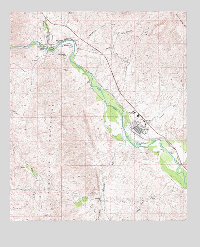
Kearny, AZ USGS Topographic Map
Click on map above to begin viewing in our Map Viewer.

This topographic map contains these locations and features:
Feature Name Type Latitude Longitude GNIS ID View Map
Arthur E Pomeroy Public LibraryBuildingN33.0545°W110.9142°2669391View Map
BranamanPopulated PlaceN33.0515°W110.9118°25332View Map
Breezeway Trailer ParkPopulated PlaceN33.0781°W110.9266°2670272View Map
Church of the Good ShepherdChurchN33.0598°W110.9127°2670771View Map
Fellowship Baptist ChurchChurchN33.0573°W110.9106°2670916View Map
Hackberry GulchValleyN33.1028°W110.9518°5474View Map
Hackberry MineMineN33.0117°W110.9362°5475View Map
Hackberry SpringSpringN33.0126°W110.9368°5482View Map
Hackberry WashStreamN33.0484°W110.9162°5495View Map
Indian Camp WashStreamN33.0259°W110.8857°6193View Map
Jim Thomas WashStreamN33.0081°W110.9340°6415View Map
Kane Spring CanyonValleyN33.1020°W110.9537°6611View Map
Kane SpringsSpringN33.1176°W110.9109°42800View Map
KearnyPopulated PlaceN33.0570°W110.9107°6633View Map
Kearny AirportAirportN33.0473°W110.9068°45377View Map
Kearny Church of ChristChurchN33.0584°W110.9025°2671191View Map
Kearny Fire DepartmentBuildingN33.0594°W110.9064°2672366View Map
Kearny Golf CourseLocaleN33.0495°W110.9110°2670119View Map
Kearny Mobile Home ParkPopulated PlaceN33.0521°W110.9144°2670392View Map
Kearny Municipal PoolLocaleN33.0545°W110.9146°43524View Map
Kearny Police DepartmentBuildingN33.0594°W110.9064°2672274View Map
Kearny Post OfficePost OfficeN33.0602°W110.9065°2669805View Map
Kearny Southern Baptist ChurchChurchN33.0545°W110.9068°2671192View Map
Kearny Water Reclamation FacilityLocaleN33.0555°W110.9186°2669600View Map
KelvinPopulated PlaceN33.1115°W110.9734°24477View Map
Kelvin CemeteryCemeteryN33.1089°W110.9582°6659View Map
Kennecott Cooper Corporation HospitalHospitalN33.0592°W110.9101°23726View Map
Mineral CreekStreamN33.1034°W110.9751°31905View Map
Old Ripsey MineMineN33.0031°W110.9759°8964View Map
Pinal County Sheriff's Office Kearny Region BBuildingN33.0593°W110.9055°2751658View Map
Ray Elementary SchoolSchoolN33.0633°W110.9116°23785View Map
Ray High SchoolSchoolN33.0647°W110.9125°9998View Map
Ray JunctionPopulated PlaceN33.1070°W110.9632°24576View Map
Ray Primary SchoolSchoolN33.0619°W110.9108°2545049View Map
Ripsey SpringSpringN33.0284°W110.9787°23790View Map
RiversidePopulated PlaceN33.1053°W110.9579°10330View Map
Saguaro Mobile Home ParkPopulated PlaceN33.0801°W110.9287°2670517View Map
Steamboat WashStreamN33.0478°W110.8984°11810View Map
Sultana-Arizona MineMineN33.0992°W110.9615°11945View Map
Town of KearnyCivilN33.0563°W110.9074°2412819View Map

Note: Coordinates in the location and feature list above are referenced to NAD83 datum.


Copyright (C) 2008-2025 Ryan Niemi / Sunset Dynamics ... All Rights Reserved