TopoQuest Logo
Do you find TopoQuest useful?
Help keep TopoQuest running and adding new maps/features by donating!
Bitcoin:  19c7KJd3qBynnjoSw5npx9KScwjBe4ifkT
Litecoin:  LXs6TkuXGGXo1vDsWCkWVdjQX94eUKd6ui
Home View Maps Find Maps Find Places Resources & Links


Bloomington West, Illinois Topographic Map

USGS Map Title: Bloomington West, IL
USGS Map MRC: 40089D1
DRG (GeoTIFF) Download: o40089d1.tif


Neighboring USGS Topographic Map Quads:


  Danvers, IL  
40089E2
 

  Normal West, IL  
40089E1
 

  Normal East, IL  
40088E8
 

  Stanford, IL  
40089D2
 

  Bloomington West, IL  
40089D1
 

  Bloomington East, IL  
40088D8
 

  McLean, IL  
40089C2
 

  Funks Grove, IL  
40089C1
 

  Heyworth, IL  
40088C8


Map MRC Location:

N41°
W90°
N41°
W89°
H8 H7 H6 H5 H4 H3 H2 H1
G8 G7 G6 G5 G4 G3 G2 G1
F8 F7 F6 F5 F4 F3 F2 F1
E8 E7 E6 E5 E4 E3 E2 E1
D8 D7 D6 D5 D4 D3 D2 D1
C8 C7 C6 C5 C4 C3 C2 C1
B8 B7 B6 B5 B4 B3 B2 B1
A8 A7 A6 A5 A4 A3 A2 A1
N40°
W90°
N40°
W89°

Bloomington West, IL USGS 1:24K Topographic Map Preview:
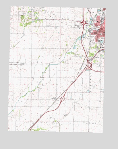
Bloomington West, IL USGS Topographic Map
Click on map above to begin viewing in our Map Viewer.

This topographic map contains these locations and features:
Feature Name Type Latitude Longitude GNIS ID View Map
Alexander School (historical)SchoolN40.4661°W89.0212°403403View Map
Bloomington Fire Department Station 4BuildingN40.4606°W89.0065°2681981View Map
Bloomington HeightsPopulated PlaceN40.4806°W89.0337°404580View Map
Bloomington Township Fire Protection District Station 2BuildingN40.4602°W89.0064°2682143View Map
Bloomington West Church of GodChurchN40.4839°W89.0015°1822418View Map
Buckmann ParkParkN40.4742°W89.0148°1747541View Map
California School (historical)SchoolN40.4292°W89.0629°405365View Map
Cottonwood AirportAirportN40.4220°W89.0206°427073View Map
County Farm CemeteryCemeteryN40.4153°W89.0011°406664View Map
CovellPopulated PlaceN40.4428°W89.1084°422585View Map
Dale Fire Protection District Shirley StationBuildingN40.4070°W89.0643°2682268View Map
Dale School (historical)SchoolN40.4581°W89.0673°406929View Map
Dale Township Fire Protection District Covell StationBuildingN40.4432°W89.1138°2682377View Map
East Twin Grove CemeteryCemeteryN40.4878°W89.0767°1747562View Map
Evergreen ParkParkN40.4911°W89.0081°1822460View Map
First Church of GodChurchN40.4773°W89.0026°1822470View Map
Forest ParkParkN40.4611°W89.0065°408517View Map
Goose CreekStreamN40.4728°W89.0276°409161View Map
Grassy Ridge CemeteryCemeteryN40.4067°W89.0029°409336View Map
Grassy Ridge School (historical)SchoolN40.4150°W89.0092°409337View Map
Highland Park Golf CourseLocaleN40.4611°W89.0015°1747584View Map
Interchange 134CrossingN40.4414°W89.0187°1822507View Map
Interchange 154CrossingN40.4084°W89.0542°1822512View Map
Interchange 157CrossingN40.4423°W89.0209°1822513View Map
Interchange 160CrossingN40.4848°W89.0284°1822514View Map
Jewish CemeteryCemeteryN40.4574°W89.0055°1747594View Map
Miller ParkParkN40.4678°W89.0029°413589View Map
Miller Park LakeReservoirN40.4665°W89.0042°1691290View Map
Miller Park Lake DamDamN40.4650°W89.0051°1691289View Map
Mobil-Land Trailer ParkPopulated PlaceN40.4645°W89.0187°1822552View Map
O'Neil ParkParkN40.4870°W89.0140°1747615View Map
Pannier Flying Club Airport (historical)AirportN40.4992°W89.0865°427072View Map
Park Hill CemeteryCemeteryN40.4681°W89.0081°1747616View Map
Park United Methodist ChurchChurchN40.4734°W89.0017°1822571View Map
Roy Burden RLA Airport (historical)AirportN40.3847°W89.0697°427809View Map
Saint Joseph's CemeteryCemeteryN40.4706°W89.0198°1747625View Map
Saint Josephs HospitalHospitalN40.4745°W89.0056°1747627View Map
Saint Mary's CemeteryCemeteryN40.4778°W89.0209°1747628View Map
Saint Marys SchoolSchoolN40.4756°W89.0009°1747629View Map
Saint Patricks SchoolSchoolN40.4845°W89.0070°1747630View Map
Sarah E Raymond School of Early EducationSchoolN40.4759°W89.0140°1747620View Map
Scogin Hill CemeteryCemeteryN40.4542°W89.0395°418157View Map
Sheridan Elementary SchoolSchoolN40.4870°W89.0104°1747631View Map
ShirleyPopulated PlaceN40.4073°W89.0626°418437View Map
Shirley CemeteryCemeteryN40.4038°W89.0666°1952878View Map
Shirley Post OfficePost OfficeN40.4078°W89.0641°1822593View Map
Sugar Creek School (historical)SchoolN40.4064°W89.1198°419297View Map
Sunny Point School (historical)SchoolN40.4478°W89.0154°419386View Map
Township of DaleCivilN40.4430°W89.0972°428869View Map
Twin GrovePopulated PlaceN40.4934°W89.0798°423261View Map
Twin Grove Census Designated PlaceCensusN40.4857°W89.0994°2628561View Map
WBNQ-FM (Bloomington)TowerN40.4589°W89.0106°428123View Map
West Side ChurchChurchN40.4453°W89.0529°1747646View Map
West Twin Grove CemeteryCemeteryN40.4911°W89.1137°1952836View Map
West Twin Grove ChurchChurchN40.4906°W89.1140°420930View Map
WGLT-FM (Normal)TowerN40.4795°W89.0534°428257View Map
WIHN-FM (Normal)TowerN40.4761°W89.0340°428259View Map
Willow Creek Trailer ParkPopulated PlaceN40.4670°W89.0187°1822623View Map
WJBC-AM (Bloomington)TowerN40.4589°W89.0106°427945View Map

Note: Coordinates in the location and feature list above are referenced to NAD83 datum.


Copyright (C) 2008-2024 Ryan Niemi / Sunset Dynamics ... All Rights Reserved