TopoQuest Logo
Do you find TopoQuest useful?
Help keep TopoQuest running and adding new maps/features by donating!
Bitcoin:  19c7KJd3qBynnjoSw5npx9KScwjBe4ifkT
Litecoin:  LXs6TkuXGGXo1vDsWCkWVdjQX94eUKd6ui
Home View Maps Find Maps Find Places Resources & Links


Tekonsha, Michigan Topographic Map

USGS Map Title: Tekonsha, MI
USGS Map MRC: 42084A8
DRG (GeoTIFF) Download: o42084a8.tif


Neighboring USGS Topographic Map Quads:


  Ellis Corners, MI  
42085B1
 

  Lyon Lake, MI  
42084B8
 

  Southwest Albion, MI  
42084B7
 

  Burlington, MI  
42085A1
 

  Tekonsha, MI  
42084A8
 

  Litchfield, MI  
42084A7
 

  Coldwater West, MI  
41085H1
 

  Coldwater East, MI  
41084H8
 

  Allen, MI  
41084H7


Map MRC Location:

N43°
W85°
N43°
W84°
H8 H7 H6 H5 H4 H3 H2 H1
G8 G7 G6 G5 G4 G3 G2 G1
F8 F7 F6 F5 F4 F3 F2 F1
E8 E7 E6 E5 E4 E3 E2 E1
D8 D7 D6 D5 D4 D3 D2 D1
C8 C7 C6 C5 C4 C3 C2 C1
B8 B7 B6 B5 B4 B3 B2 B1
A8 A7 A6 A5 A4 A3 A2 A1
N42°
W85°
N42°
W84°

Tekonsha, MI USGS 1:24K Topographic Map Preview:
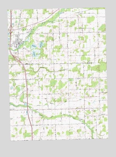
Tekonsha, MI USGS Topographic Map
Click on map above to begin viewing in our Map Viewer.

This topographic map contains these locations and features:
Feature Name Type Latitude Longitude GNIS ID View Map
Cheney ParkParkN42.0956°W84.9847°623149View Map
Clarks CemeteryCemeteryN42.0872°W84.8894°2630235View Map
Dayburg ChurchChurchN42.0153°W84.9066°624379View Map
East Shed LakeLakeN42.0910°W84.9581°625261View Map
Faxon Post Office (historical)Post OfficeN42.0006°W84.9047°2435379View Map
Harvey Randall House Historical MarkerParkN42.0942°W84.9860°2628146View Map
Interchange 23CrossingN42.0778°W84.9894°2628037View Map
Interchange 25CrossingN42.1058°W84.9958°2628038View Map
Juddville United Methodist ChurchChurchN42.0572°W84.9878°2576146View Map
Marshall Fire Fighters Ambulance Service TekonshaBuildingN42.0926°W84.9857°2662087View Map
Mount Hope CemeteryCemeteryN42.0195°W84.9072°632797View Map
Riverside CemeteryCemeteryN42.0881°W84.9822°635981View Map
South ButlerPopulated PlaceN42.0223°W84.8850°638327View Map
South Butler Post Office (historical)Post OfficeN42.0222°W84.8850°2435361View Map
South Shed LakeLakeN42.0820°W84.9670°638416View Map
Tamarack CreekStreamN42.0859°W84.9808°1614559View Map
TekonshaPopulated PlaceN42.0934°W84.9858°1614666View Map
Tekonsha CreekStreamN42.0862°W84.9908°1614667View Map
Tekonsha Fire DepartmentBuildingN42.0925°W84.9855°2630069View Map
Tekonsha High SchoolSchoolN42.0900°W84.9894°2630066View Map
Tekonsha Post OfficePost OfficeN42.0925°W84.9847°2630067View Map
Tekonsha Station (historical)LocaleN42.1014°W84.9861°2630065View Map
Tekonsha Township LibraryBuildingN42.0914°W84.9878°2630064View Map
Tekonsha Village Police DepartmentBuildingN42.0925°W84.9864°2630068View Map
Township of ButlerCivilN42.0291°W84.8842°1626013View Map
Township of ClarendonCivilN42.1159°W84.8845°1626087View Map
Village of TekonshaCivilN42.0959°W84.9881°2399959View Map
West Shed LakeLakeN42.0901°W84.9671°1616176View Map
WNWN-FM (Coldwater)TowerN42.0578°W84.9975°1625668View Map

Note: Coordinates in the location and feature list above are referenced to NAD83 datum.


Copyright (C) 2008-2024 Ryan Niemi / Sunset Dynamics ... All Rights Reserved