TopoQuest Logo
Do you find TopoQuest useful?
Help keep TopoQuest running and adding new maps/features by donating!
Bitcoin:  19c7KJd3qBynnjoSw5npx9KScwjBe4ifkT
Litecoin:  LXs6TkuXGGXo1vDsWCkWVdjQX94eUKd6ui
Home View Maps Find Maps Find Places Resources & Links


Tellico Plains, Tennessee Topographic Map

USGS Map Title: Tellico Plains, TN
USGS Map MRC: 35084C3
DRG (GeoTIFF) Download: o35084c3.tif


Neighboring USGS Topographic Map Quads:


  Englewood, TN  
35084D4
 

  Mount Vernon, TN  
35084D3
 

  Rafter, TN  
35084D2
 

  Mecca, TN  
35084C4
 

  Tellico Plains, TN  
35084C3
 

  Bald River Falls, TN  
35084C2
 

  McFarland, TN  
35084B4
 

  Farner, TN  
35084B3
 

  Unaka, NC  
35084B2


Map MRC Location:

N36°
W85°
N36°
W84°
H8 H7 H6 H5 H4 H3 H2 H1
G8 G7 G6 G5 G4 G3 G2 G1
F8 F7 F6 F5 F4 F3 F2 F1
E8 E7 E6 E5 E4 E3 E2 E1
D8 D7 D6 D5 D4 D3 D2 D1
C8 C7 C6 C5 C4 C3 C2 C1
B8 B7 B6 B5 B4 B3 B2 B1
A8 A7 A6 A5 A4 A3 A2 A1
N35°
W85°
N35°
W84°

Tellico Plains, TN USGS 1:24K Topographic Map Preview:
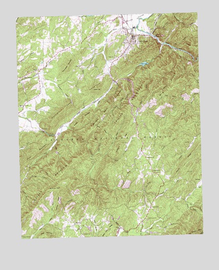
Tellico Plains, TN USGS Topographic Map
Click on map above to begin viewing in our Map Viewer.

This topographic map contains these locations and features:
Feature Name Type Latitude Longitude GNIS ID View Map
Aiken HollowValleyN35.3665°W84.2731°1304776View Map
Alvin Branch WorkingsMineN35.2509°W84.3230°1642721View Map
Annette WorkingsMineN35.2506°W84.2985°1642722View Map
Atkins School (historical)SchoolN35.3670°W84.2563°1308278View Map
Bakers Grave MountainSummitN35.3220°W84.3135°1276194View Map
Beaty ChapelChurchN35.3379°W84.3333°1640957View Map
Beck BranchStreamN35.2751°W84.2894°1641438View Map
Beck BranchStreamN35.2754°W84.2894°1276733View Map
Big BranchStreamN35.2681°W84.2610°1277253View Map
Big BranchStreamN35.3565°W84.2674°1277254View Map
Big Branch WorkingsMineN35.2684°W84.2580°1642724View Map
Big RidgeRidgeN35.3331°W84.2688°1277359View Map
Big RidgeRidgeN35.3381°W84.2663°1641409View Map
Big Surface WorkingsMineN35.2676°W84.2549°1642725View Map
Black Jack RidgeRidgeN35.2526°W84.3152°1305266View Map
Blackjack Ridge MineMineN35.2509°W84.3208°1642726View Map
Borin CemeteryCemeteryN35.3387°W84.3480°1640965View Map
Borin CemeteryCemeteryN35.3387°W84.3477°1278000View Map
Borin TopSummitN35.2783°W84.3499°1278001View Map
Brown Hill School (historical)SchoolN35.3456°W84.3552°1642731View Map
Calf Yoke MineMineN35.2634°W84.3124°1642732View Map
Calf Yoke WorkingsMineN35.2620°W84.3110°1642733View Map
Cannon RidgeRidgeN35.2700°W84.3487°1279613View Map
Cash RidgeRidgeN35.3106°W84.3166°1279849View Map
Cataska MountainSummitN35.2781°W84.3496°1305726View Map
Chormley BranchStreamN35.3551°W84.3146°1305912View Map
Chormley BranchStreamN35.3551°W84.3152°1640955View Map
Cindy Hole MineMineN35.2656°W84.3102°1642738View Map
Coker CreekPopulated PlaceN35.2656°W84.2858°1314869View Map
Coker Creek Baptist ChurchChurchN35.2662°W84.2858°1308288View Map
Coker Creek CemeteryCemeteryN35.2590°W84.2877°1640980View Map
Coker Creek CemeteryCemeteryN35.2592°W84.2877°1280877View Map
Coker Creek Elementary SchoolSchoolN35.2590°W84.2938°1652462View Map
Coker Creek Post OfficePost OfficeN35.2584°W84.2908°1649569View Map
Coker Creek SchoolSchoolN35.2590°W84.2938°1640982View Map
Coker Creek Volunteer Fire DepartmentBuildingN35.2629°W84.2963°2654295View Map
Conasauga Falls TrailTrailN35.2967°W84.3230°1647952View Map
Conasauga Falls TrailTrailN35.3051°W84.3285°1641415View Map
Conasauga MillPopulated PlaceN35.3104°W84.3569°1314875View Map
Consauga Valley Fire DepartmentBuildingN35.3340°W84.3598°2654993View Map
Coppenger CemeteryCemeteryN35.3656°W84.2816°1306105View Map
Coppenger CemeteryCemeteryN35.3653°W84.2819°1641557View Map
Criffitts BranchStreamN35.3023°W84.3460°1641422View Map
Cut-OffLocaleN35.2520°W84.2971°1642744View Map
Doc Rogers TrailTrailN35.2629°W84.2666°1647954View Map
Doc Rogers TrailTrailN35.2565°W84.2846°1640981View Map
East Fork Lyons CreekStreamN35.3281°W84.2630°1283355View Map
East Fork Lyons CreekStreamN35.3279°W84.2633°1641419View Map
El Tigre MineMineN35.2604°W84.2502°1642748View Map
Elbert Martin DamDamN35.3217°W84.2916°1301744View Map
Elbert Martin LakeReservoirN35.3213°W84.2923°1301745View Map
EppersonPopulated PlaceN35.2576°W84.3374°1315024View Map
Epperson School (historical)SchoolN35.2579°W84.3377°1317893View Map
Fall BranchStreamN35.3456°W84.2877°1284052View Map
Fall BranchStreamN35.3454°W84.2883°1640962View Map
Fern BranchStreamN35.2920°W84.3646°1284213View Map
Fern BranchStreamN35.2923°W84.3658°1641423View Map
First Baptist Church of Tellico PlainsChurchN35.3587°W84.2971°1317894View Map
Flemmings CreekStreamN35.2787°W84.3210°1641440View Map
Flemmings CreekStreamN35.2790°W84.3208°1284463View Map
Gear WorkingsMineN35.2695°W84.2546°1642753View Map
Green BranchStreamN35.2648°W84.3535°1641442View Map
Green BranchStreamN35.2648°W84.3530°1286064View Map
Griffitts BranchStreamN35.3026°W84.3516°1286291View Map
Grindstone RidgeRidgeN35.3017°W84.3044°1286317View Map
Groundhog MountainSummitN35.3479°W84.3385°1286349View Map
Hog BranchStreamN35.2959°W84.3252°1641424View Map
Hog BranchStreamN35.2967°W84.3152°1287974View Map
Holder CemeteryCemeteryN35.3020°W84.2571°1288030View Map
Holder CemeteryCemeteryN35.3020°W84.2569°1641421View Map
Hooper BranchStreamN35.2967°W84.3158°1641425View Map
Hooper BranchStreamN35.2962°W84.3249°1288243View Map
Hot Water BranchStreamN35.2545°W84.3063°1288478View Map
Hot Water BranchStreamN35.2542°W84.3066°1640979View Map
Hunt BranchStreamN35.3673°W84.2913°1288710View Map
Hurricane BranchStreamN35.2845°W84.3713°1641429View Map
Hurricane BranchStreamN35.2848°W84.3705°1288778View Map
JacktownPopulated PlaceN35.3626°W84.2796°1308305View Map
JalapaPopulated PlaceN35.3442°W84.3619°1289268View Map
Johnson BranchStreamN35.2698°W84.2619°1289524View Map
Johnson BranchStreamN35.2687°W84.2713°1642759View Map
Johnson Branch WorkingsMineN35.2654°W84.2660°1642760View Map
Johnson MineMineN35.2867°W84.2519°1642761View Map
Johnson ProspectMineN35.2851°W84.2524°1642762View Map
Kirkland HollowValleyN35.3364°W84.3484°1290302View Map
Lenderman MineMineN35.2879°W84.2544°1642764View Map
Lenderman ProspectMineN35.2870°W84.2549°1642765View Map
Leonards ChapelChurchN35.3451°W84.3608°1308309View Map
Long BranchStreamN35.2570°W84.2838°1291869View Map
Long Ridge ChurchChurchN35.2859°W84.2824°1641427View Map
Long Ridge ChurchChurchN35.2859°W84.2827°1292004View Map
Long Ridge Church (historical)ChurchN35.3020°W84.2841°1308312View Map
Lost River MineMineN35.2681°W84.2591°1642766View Map
Lower Johnson MineMineN35.2862°W84.2519°1642767View Map
Lyons CreekStreamN35.3556°W84.2671°1292377View Map
Lyons CreekStreamN35.3559°W84.2677°1641555View Map
Masingale CemeteryCemeteryN35.2517°W84.3321°1292875View Map
Masingale CemeteryCemeteryN35.2515°W84.3324°1640978View Map
McAllister BranchStreamN35.2598°W84.2755°1642770View Map
McAllister Branch WorkingsMineN35.2601°W84.2705°1642771View Map
Mocking Crow MountainSummitN35.3286°W84.3350°1294142View Map
Murphys Mill (historical)LocaleN35.2717°W84.2827°1308325View Map
Murr BranchStreamN35.3406°W84.2571°1328989View Map
Payne BranchStreamN35.2770°W84.3060°1641439View Map
Payne BranchStreamN35.2773°W84.3058°1297002View Map
Payne RidgeRidgeN35.2898°W84.2599°1297018View Map
Payne School (historical)SchoolN35.2954°W84.2885°1308327View Map
Payne Station SchoolSchoolN35.2809°W84.2758°1641437View Map
Payne Station School (historical)SchoolN35.2809°W84.2760°1642786View Map
Peaky TopSummitN35.3329°W84.3230°1297066View Map
Peels BranchStreamN35.2520°W84.2908°1641140View Map
Peels BranchStreamN35.2526°W84.2905°1297116View Map
Pine MountainSummitN35.2976°W84.3638°1297562View Map
Pole Bridge BranchStreamN35.3262°W84.2652°1298024View Map
Pole Bridge BranchStreamN35.3265°W84.2783°1641418View Map
Quarry CreekStreamN35.3579°W84.2741°1298746View Map
Queens MountainSummitN35.3190°W84.3271°1298760View Map
Queens MountainSummitN35.3165°W84.3580°1641413View Map
Rural ValePopulated PlaceN35.3117°W84.3596°1315849View Map
Rural Vale Elementary SchoolSchoolN35.3251°W84.3730°1648482View Map
Rural Vale SchoolSchoolN35.3251°W84.3735°1641414View Map
Sandy LanePopulated PlaceN35.2912°W84.2860°1641426View Map
Sandy LaneLocaleN35.2851°W84.2819°1300762View Map
Sandy Lane ChurchChurchN35.2940°W84.2877°1641428View Map
Sandy Lane ChurchChurchN35.2942°W84.2874°1300763View Map
Sanford Gray Lake Dam Number OneDamN35.2601°W84.3083°1301696View Map
Sanford Gray Lake Number OneReservoirN35.2604°W84.3080°1301697View Map
Sawmill BranchStreamN35.3090°W84.3369°1308330View Map
Shady Grove CemeteryCemeteryN35.3403°W84.3724°1317923View Map
Shady Grove ChurchChurchN35.3412°W84.3705°1301168View Map
Shady Grove ChurchChurchN35.3412°W84.3699°1640959View Map
SmithfieldPopulated PlaceN35.2792°W84.2521°1314304View Map
Smithfield School (historical)SchoolN35.2798°W84.2519°1308334View Map
Station School (historical)SchoolN35.2656°W84.2855°1308336View Map
Steer CreekStreamN35.3076°W84.3499°1271317View Map
Stillhouse CreekStreamN35.3540°W84.2663°1271404View Map
Stillhouse CreekStreamN35.3540°W84.2666°1640952View Map
Sugartree BranchStreamN35.2817°W84.3730°1308337View Map
Taylor CemeteryCemeteryN35.2853°W84.2596°1641434View Map
Taylor CemeteryCemeteryN35.3026°W84.3005°1272193View Map
Tellico BeachPopulated PlaceN35.3551°W84.2669°1640953View Map
Tellico BeachLocaleN35.3551°W84.2655°1272273View Map
Tellico City Volunteer Fire DepartmentBuildingN35.3694°W84.3007°2654363View Map
Tellico Iron Works (historical)LocaleN35.3654°W84.2902°1308346View Map
Tellico LakeReservoirN35.3469°W84.2876°1304036View Map
Tellico Lake DamDamN35.3476°W84.2869°1307105View Map
Tellico MountainSummitN35.3206°W84.3002°1272276View Map
Tellico MountainSummitN35.3323°W84.2902°1641408View Map
Tellico PlainsPopulated PlaceN35.3629°W84.2941°1304037View Map
Tellico Plains CemeteryCemeteryN35.3578°W84.2974°1317931View Map
Tellico Plains Division (historical)CensusN35.3542°W84.2841°1269260View Map
Tellico Plains Elementary SchoolSchoolN35.3598°W84.2930°1308347View Map
Tellico Plains Police DepartmentBuildingN35.3620°W84.2940°2765777View Map
Tellico Plains Post OfficePost OfficeN35.3717°W84.3020°1649607View Map
Towee Falls (historical)Populated PlaceN35.2526°W84.3735°1642804View Map
Towee Falls ChurchChurchN35.2515°W84.3738°1304142View Map
Towee Falls ChurchChurchN35.2512°W84.3744°1640986View Map
Town of Tellico PlainsCivilN35.3657°W84.2975°2406725View Map
Unaka ChurchChurchN35.3465°W84.3310°1640961View Map
Unaka ChurchChurchN35.3465°W84.3305°1304216View Map
Unicoi CemeteryCemeteryN35.3512°W84.3069°1317932View Map
Unicoi ChurchChurchN35.3512°W84.3077°1640956View Map
Unicoi ChurchChurchN35.3515°W84.3071°1304220View Map
Unicoi DamDamN35.2517°W84.2866°1301687View Map
Unicoi LakeReservoirN35.2517°W84.2858°1301686View Map
Upper Johnson MineMineN35.2856°W84.2519°1642806View Map
Watertrough HollowValleyN35.3376°W84.3091°1304412View Map
Whites Chapel (historical)ChurchN35.2951°W84.2977°1308354View Map
Wildcat Creek WorkingsMineN35.2965°W84.2610°1642812View Map
Williamson School (historical)SchoolN35.3273°W84.3210°1308355View Map
Wilson BranchStreamN35.2979°W84.3205°1641431View Map
Wilson BranchStreamN35.2979°W84.3199°1274788View Map
Witt BranchStreamN35.2562°W84.3296°1274919View Map
Witts Pond (historical)LakeN35.2709°W84.3383°1308356View Map
Yeller Nugget LakeReservoirN35.2550°W84.3282°1301688View Map
Yeller Nugget Lake DamDamN35.2534°W84.3266°1301689View Map

Note: Coordinates in the location and feature list above are referenced to NAD83 datum.


Copyright (C) 2008-2024 Ryan Niemi / Sunset Dynamics ... All Rights Reserved