TopoQuest Logo
Do you find TopoQuest useful?
Help keep TopoQuest running and adding new maps/features by donating!
Bitcoin:  19c7KJd3qBynnjoSw5npx9KScwjBe4ifkT
Litecoin:  LXs6TkuXGGXo1vDsWCkWVdjQX94eUKd6ui
Home View Maps Find Maps Find Places Resources & Links


Tenmile Hill, New Mexico Topographic Map

USGS Map Title: Tenmile Hill, NM
USGS Map MRC: 33107G3
DRG (GeoTIFF) Download: o33107g3.tif


Neighboring USGS Topographic Map Quads:


  Mount Withington, NM  
33107H4
 

  Squaw Peak, NM  
33107H3
 

  South Baldy, NM  
33107H2
 

  Grassy Lookout, NM  
33107G4
 

  Tenmile Hill, NM  
33107G3
 

  Puertecito Gap, NM  
33107G2
 

  Blue Mountain, NM  
33107F4
 

  San Juan Peak, NM  
33107F3
 

  Hickman Ranch, NM  
33107F2


Map MRC Location:

N34°
W108°
N34°
W107°
H8 H7 H6 H5 H4 H3 H2 H1
G8 G7 G6 G5 G4 G3 G2 G1
F8 F7 F6 F5 F4 F3 F2 F1
E8 E7 E6 E5 E4 E3 E2 E1
D8 D7 D6 D5 D4 D3 D2 D1
C8 C7 C6 C5 C4 C3 C2 C1
B8 B7 B6 B5 B4 B3 B2 B1
A8 A7 A6 A5 A4 A3 A2 A1
N33°
W108°
N33°
W107°

Tenmile Hill, NM USGS 1:24K Topographic Map Preview:
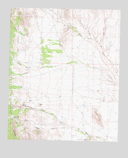
Tenmile Hill, NM USGS Topographic Map
Click on map above to begin viewing in our Map Viewer.

This topographic map contains these locations and features:
Feature Name Type Latitude Longitude GNIS ID View Map
Bald TankReservoirN33.8532°W107.3635°914203View Map
Big Rosa CanyonValleyN33.8440°W107.2798°903811View Map
Caliche TankReservoirN33.8480°W107.3629°914204View Map
Chavez CanyonValleyN33.8481°W107.3589°905050View Map
Deep WindmillLocaleN33.7998°W107.3603°937113View Map
Deer TankReservoirN33.7715°W107.3692°914197View Map
Hardy CanyonValleyN33.8412°W107.2756°906843View Map
Horse MountainSummitN33.7545°W107.3678°907101View Map
Horse Mountain CanyonValleyN33.7626°W107.3061°907103View Map
Horse Mountain TankReservoirN33.7713°W107.3702°907104View Map
Lane TankReservoirN33.8277°W107.3716°914200View Map
Little WellWellN33.8473°W107.2859°908065View Map
Melton RanchLocaleN33.7576°W107.2875°908566View Map
RG 30339 Water WellWellN33.8484°W107.3270°925744View Map
Road Well CorralLocaleN33.8006°W107.3603°914201View Map
Tenmile HillSummitN33.7748°W107.2773°911603View Map
Tigner Headquaters Water WellWellN33.7673°W107.3134°922035View Map
Tigner RanchLocaleN33.7673°W107.3145°911708View Map
Whitecap CanyonValleyN33.8167°W107.3464°912329View Map
Wilson HillSummitN33.7837°W107.3400°912430View Map
Wilson RanchLocaleN33.7612°W107.2875°1990060View Map
Wilson TankReservoirN33.7876°W107.3494°912441View Map
Woofter RanchLocaleN33.7615°W107.2964°912499View Map

Note: Coordinates in the location and feature list above are referenced to NAD83 datum.


Copyright (C) 2008-2024 Ryan Niemi / Sunset Dynamics ... All Rights Reserved