TopoQuest Logo
Do you find TopoQuest useful?
Help keep TopoQuest running and adding new maps/features by donating!
Bitcoin:  19c7KJd3qBynnjoSw5npx9KScwjBe4ifkT
Litecoin:  LXs6TkuXGGXo1vDsWCkWVdjQX94eUKd6ui
Home View Maps Find Maps Find Places Resources & Links


South Baldy, New Mexico Topographic Map

USGS Map Title: South Baldy, NM
USGS Map MRC: 33107H2
DRG (GeoTIFF) Download: o33107h2.tif


Neighboring USGS Topographic Map Quads:


  Arroyo Landavaso, NM  
34107A3
 

  Magdalena, NM  
34107A2
 

  Water Canyon, NM  
34107A1
 

  Squaw Peak, NM  
33107H3
 

  South Baldy, NM  
33107H2
 

  Molino Peak, NM  
33107H1
 

  Tenmile Hill, NM  
33107G3
 

  Puertecito Gap, NM  
33107G2
 

  Cienega Ranch, NM  
33107G1


Map MRC Location:

N34°
W108°
N34°
W107°
H8 H7 H6 H5 H4 H3 H2 H1
G8 G7 G6 G5 G4 G3 G2 G1
F8 F7 F6 F5 F4 F3 F2 F1
E8 E7 E6 E5 E4 E3 E2 E1
D8 D7 D6 D5 D4 D3 D2 D1
C8 C7 C6 C5 C4 C3 C2 C1
B8 B7 B6 B5 B4 B3 B2 B1
A8 A7 A6 A5 A4 A3 A2 A1
N33°
W108°
N33°
W107°

South Baldy, NM USGS 1:24K Topographic Map Preview:
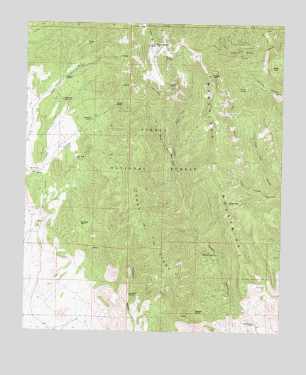
South Baldy, NM USGS Topographic Map
Click on map above to begin viewing in our Map Viewer.

This topographic map contains these locations and features:
Feature Name Type Latitude Longitude GNIS ID View Map
Arrowhead TankReservoirN33.9606°W107.2189°903285View Map
Baldy SpringSpringN33.9861°W107.1829°903521View Map
Bear Canyon SpringSpringN33.9851°W107.2159°913733View Map
Black GooseMineN33.9192°W107.2423°917474View Map
Black Goose GroupMineN33.9153°W107.2267°916453View Map
Buck PeakSummitN33.9820°W107.1306°904134View Map
Buttercup SpringSpringN33.9692°W107.2323°938805View Map
Deer Plot TankReservoirN33.9449°W107.2258°905703View Map
East Fork Sawmill CanyonValleyN33.9265°W107.1728°905970View Map
Gap TankReservoirN33.9199°W107.2436°913641View Map
Gap WellWellN33.9103°W107.2489°937067View Map
Hardy RidgeRidgeN33.9131°W107.1884°906844View Map
Hardy SpringSpringN33.9667°W107.2067°2025691View Map
Haunted SpringSpringN33.8828°W107.1667°906871View Map
Horseshoe TankReservoirN33.9186°W107.2232°907119View Map
Italian CanyonValleyN33.9326°W107.1270°907263View Map
Italian PeakSummitN33.9278°W107.1511°907266View Map
Italian SpringSpringN33.9311°W107.1337°907267View Map
Langmuir LaboratoryLocaleN33.9753°W107.1820°2013588View Map
Langmuir Research SiteParkN33.9420°W107.1706°2013587View Map
Martin SpringSpringN33.9583°W107.2107°913642View Map
Mill PlaceLocaleN33.9403°W107.2481°908745View Map
Muleshoe RanchLocaleN33.9778°W107.2309°908981View Map
Pipeline SpringSpringN33.8964°W107.1967°913639View Map
Puertecito Rim TankReservoirN33.8812°W107.2231°913640View Map
Puertecito SpringSpringN33.8900°W107.1991°909889View Map
Rock Slide SpringSpringN33.9467°W107.1488°913734View Map
Sawmill Canyon WindmillLocaleN33.8784°W107.1378°910843View Map
Sawmill SpringSpringN33.9068°W107.1574°910851View Map
SidewinderMineN33.9862°W107.1456°917469View Map
Sixmile SpringSpringN33.9739°W107.1468°911105View Map
South BaldySummitN33.9909°W107.1875°911216View Map
Timber PeakSummitN33.9790°W107.1598°911717View Map
Turkey TankReservoirN33.9922°W107.2213°911906View Map
West Fork Sawmill CanyonValleyN33.9265°W107.1728°912242View Map

Note: Coordinates in the location and feature list above are referenced to NAD83 datum.


Copyright (C) 2008-2025 Ryan Niemi / Sunset Dynamics ... All Rights Reserved