TopoQuest Logo
Do you find TopoQuest useful?
Help keep TopoQuest running and adding new maps/features by donating!
Bitcoin:  19c7KJd3qBynnjoSw5npx9KScwjBe4ifkT
Litecoin:  LXs6TkuXGGXo1vDsWCkWVdjQX94eUKd6ui
Home View Maps Find Maps Find Places Resources & Links


The Dalles North, Oregon Topographic Map

USGS Map Title: The Dalles North, OR
USGS Map MRC: 45121F2
DRG (GeoTIFF) Download: o45121f2.tif


Neighboring USGS Topographic Map Quads:


  Appleton, WA  
45121G3
 

  Klickitat, WA  
45121G2
 

  Wahkiacus, WA  
45121G1
 

  Lyle, WA  
45121F3
 

  The Dalles North, OR  
45121F2
 

  Stacker Butte, WA  
45121F1
 

  Brown Creek, OR  
45121E3
 

  The Dalles South, OR  
45121E2
 

  Petersburg, OR  
45121E1


Map MRC Location:

N46°
W122°
N46°
W121°
H8 H7 H6 H5 H4 H3 H2 H1
G8 G7 G6 G5 G4 G3 G2 G1
F8 F7 F6 F5 F4 F3 F2 F1
E8 E7 E6 E5 E4 E3 E2 E1
D8 D7 D6 D5 D4 D3 D2 D1
C8 C7 C6 C5 C4 C3 C2 C1
B8 B7 B6 B5 B4 B3 B2 B1
A8 A7 A6 A5 A4 A3 A2 A1
N45°
W122°
N45°
W121°

The Dalles North, OR USGS 1:24K Topographic Map Preview:
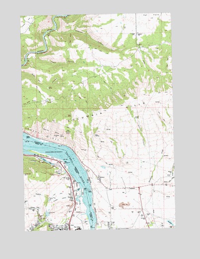
The Dalles North, OR USGS Topographic Map
Click on map above to begin viewing in our Map Viewer.

This topographic map contains these locations and features:
Feature Name Type Latitude Longitude GNIS ID View Map
Alder SpringSpringN45.7086°W121.2288°1515793View Map
Badger CreekStreamN45.6290°W121.2362°1117134View Map
ChenowethPopulated PlaceN45.6276°W121.2434°1129791View Map
Chenoweth CreekStreamN45.6340°W121.2003°1118845View Map
Chenoweth FlatFlatN45.6312°W121.2081°1129790View Map
Chenoweth Middle School (historical)SchoolN45.6279°W121.2309°1637900View Map
Chenoweth SubstationLocaleN45.6357°W121.2040°1638502View Map
Chenowith Elementary SchoolSchoolN45.6253°W121.2219°1161882View Map
Cold SpringSpringN45.6799°W121.2202°1517932View Map
Cold Spring FlatLocaleN45.6796°W121.2220°1517935View Map
Columbia GorgeValleyN45.6500°W121.2000°2572428View Map
Columbia Gorge Discovery CenterBuildingN45.6545°W121.2104°2699262View Map
CratesLocaleN45.6279°W121.2148°1136190View Map
Crates PointCapeN45.6579°W121.2309°1119517View Map
Crates Point LightLocaleN45.6487°W121.2020°1119518View Map
DallesdamLocaleN45.6282°W121.1384°1529961View Map
Dallesport Census Designated PlaceCensusN45.6316°W121.1749°2408639View Map
Devils HoleAreaN45.6832°W121.2273°1518711View Map
Dillacort CanyonValleyN45.7412°W121.2212°1518773View Map
Foley Lakes ReservoirReservoirN45.6357°W121.2312°1120862View Map
Frantz SpringSpringN45.6552°W121.2126°1120956View Map
Gooseberry CreekStreamN45.6432°W121.2081°1121250View Map
Gooseberry SpringSpringN45.6438°W121.2102°1121254View Map
Green CanyonValleyN45.7398°W121.2095°1520283View Map
HartlandLocaleN45.7379°W121.1553°1529968View Map
Hartland Lone Pine CemeteryCemeteryN45.7379°W121.1534°1520583View Map
Hidden ValleyValleyN45.6432°W121.2095°1121799View Map
High BridgeLocaleN45.6540°W121.2095°1160668View Map
Klickitat County Fire District 14 High PrairieBuildingN45.7183°W121.1751°2643377View Map
Klindt PointCapeN45.6265°W121.1967°1122799View Map
Knight CanyonValleyN45.7282°W121.2384°1521750View Map
Little Spearfish LakeLakeN45.6260°W121.1255°1522310View Map
Marsh SpringSpringN45.6439°W121.2307°1123787View Map
MurdockPopulated PlaceN45.6543°W121.1884°1523518View Map
Rocky IslandIslandN45.6465°W121.2026°1126242View Map
Rowena GapGapN45.6771°W121.2456°1132108View Map
Rowland SpringSpringN45.6823°W121.2151°1525259View Map
SmithvillePopulated PlaceN45.6487°W121.1640°1525990View Map
SpearfishLocaleN45.6423°W121.1306°1530084View Map
Spearfish LakeLakeN45.6280°W121.1307°1526337View Map
Squally PointCapeN45.6643°W121.2167°1127466View Map
Squaw IslandsIslandN45.6485°W121.1981°1526456View Map
Stanley CanyonValleyN45.6612°W121.1420°1526492View Map
Stanley SpringSpringN45.6896°W121.1578°1526494View Map
Taylor LakeLakeN45.6422°W121.2062°1127905View Map
Taylor SpringSpringN45.6474°W121.2084°1127912View Map
The Dalles Columbia Gorge Water SystemLocaleN45.6476°W121.2154°2697160View Map
The Dalles Country ClubLocaleN45.6535°W121.2150°2740139View Map
The Dalles-Wahtonka High School (historical)SchoolN45.6254°W121.2253°1128578View Map
Thornton SpringSpringN45.6323°W121.2361°1128056View Map
Threemile CreekStreamN45.6290°W121.1359°1527168View Map
Tooley LakeLakeN45.6656°W121.2323°1128163View Map
Windy PointCliffN45.6712°W121.1981°1528237View Map
Wish - Ulm CemeteryCemeteryN45.6312°W121.1506°1528266View Map

Note: Coordinates in the location and feature list above are referenced to NAD83 datum.


Copyright (C) 2008-2024 Ryan Niemi / Sunset Dynamics ... All Rights Reserved