TopoQuest Logo
Do you find TopoQuest useful?
Help keep TopoQuest running and adding new maps/features by donating!
Bitcoin:  19c7KJd3qBynnjoSw5npx9KScwjBe4ifkT
Litecoin:  LXs6TkuXGGXo1vDsWCkWVdjQX94eUKd6ui
Home View Maps Find Maps Find Places Resources & Links


Brown Creek, Oregon Topographic Map

USGS Map Title: Brown Creek, OR
USGS Map MRC: 45121E3
DRG (GeoTIFF) Download: o45121e3.tif


Neighboring USGS Topographic Map Quads:


  White Salmon, WA  
45121F4
 

  Lyle, WA  
45121F3
 

  The Dalles North, OR  
45121F2
 

  Ketchum Reservoir, OR  
45121E4
 

  Brown Creek, OR  
45121E3
 

  The Dalles South, OR  
45121E2
 

  Fivemile Butte, OR  
45121D4
 

  Wolf Run, OR  
45121D3
 

  Dufur West, OR  
45121D2


Map MRC Location:

N46°
W122°
N46°
W121°
H8 H7 H6 H5 H4 H3 H2 H1
G8 G7 G6 G5 G4 G3 G2 G1
F8 F7 F6 F5 F4 F3 F2 F1
E8 E7 E6 E5 E4 E3 E2 E1
D8 D7 D6 D5 D4 D3 D2 D1
C8 C7 C6 C5 C4 C3 C2 C1
B8 B7 B6 B5 B4 B3 B2 B1
A8 A7 A6 A5 A4 A3 A2 A1
N45°
W122°
N45°
W121°

Brown Creek, OR USGS 1:24K Topographic Map Preview:
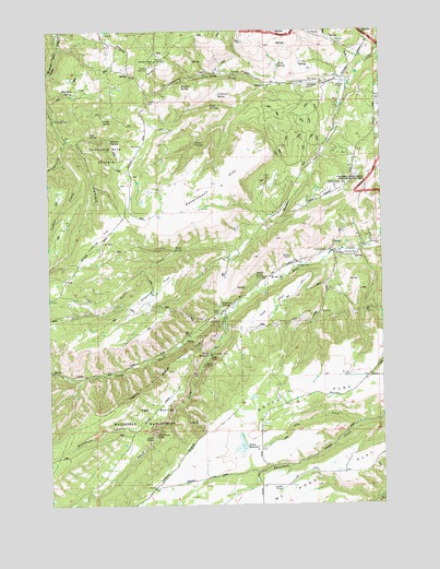
Brown Creek, OR USGS Topographic Map
Click on map above to begin viewing in our Map Viewer.

This topographic map contains these locations and features:
Feature Name Type Latitude Longitude GNIS ID View Map
Blackburn CanyonValleyN45.5201°W121.3381°1138226View Map
Brown CreekStreamN45.6121°W121.2606°1138670View Map
Chenoweth AirparkAirportN45.6109°W121.2818°2717237View Map
Chenoweth Airpark TerminalBuildingN45.6109°W121.2819°1158818View Map
Coon SpringSpringN45.5972°W121.3604°1119244View Map
Cotton SpringSpringN45.5953°W121.3208°1119311View Map
Dry ForkStreamN45.5212°W121.2601°1120152View Map
Dunnigan SpringSpringN45.6085°W121.3663°1120220View Map
Dutch FlatFlatN45.5298°W121.2767°1120232View Map
Evans DamDamN45.5148°W121.3029°1133526View Map
Evans ReservoirReservoirN45.5152°W121.3035°1120538View Map
Government FlatFlatN45.5846°W121.3126°1121270View Map
Indian HollowBasinN45.5176°W121.3370°1122233View Map
Ketchum PondLakeN45.5994°W121.2899°1129789View Map
Ladore CreekStreamN45.5907°W121.3712°1144737View Map
Leniger SpringSpringN45.6013°W121.3520°1123039View Map
Liechti PondLakeN45.5042°W121.2895°1123077View Map
Liechti Pond Number TwoLakeN45.5005°W121.3291°1129788View Map
Lubbing FlatFlatN45.5707°W121.3565°1123601View Map
Lucky CanyonValleyN45.5951°W121.3667°1145658View Map
Martin SpringSpringN45.5959°W121.3533°1123813View Map
Matney Post Office (historical)Post OfficeN45.5021°W121.3656°1164498View Map
Mill Creek FallsFallsN45.5189°W121.3377°1124168View Map
Mill Creek School (historical)SchoolN45.5657°W121.2684°1161881View Map
Miller SpringSpringN45.5597°W121.2982°1124209View Map
Mount Hood FlatFlatN45.5004°W121.2995°1158384View Map
Mount Hood Flat School (historical)SchoolN45.5193°W121.2981°1161880View Map
North Fork Mill CreekStreamN45.5507°W121.3081°1146983View Map
O'Connor SpringSpringN45.6080°W121.3122°1124881View Map
Oak FlatFlatN45.5521°W121.2937°1124905View Map
Obrist CemeteryCemeteryN45.5090°W121.2761°1130081View Map
Obrist GradeSlopeN45.5165°W121.2581°1156998View Map
Poe SpringSpringN45.6017°W121.3737°1125497View Map
Pointers AirportAirportN45.5837°W121.2680°1131686View Map
Pullens PondLakeN45.5776°W121.2870°1130080View Map
Scheuter SpringSpringN45.6101°W121.3261°1126640View Map
Seward FlatFlatN45.5562°W121.3351°1126769View Map
Sheep SpringSpringN45.5673°W121.3258°1126843View Map
Slegman SpringSpringN45.5528°W121.3116°1127069View Map
South Fork Mill CreekStreamN45.5507°W121.3081°1149993View Map
Suicide GradeSlopeN45.5418°W121.3209°1156999View Map
The Dalles DivisionCivilN45.5580°W121.3023°1938136View Map
The Dalles Wicks Water Treatment PlantLocaleN45.5396°W121.3159°2697161View Map
Thousand Acre PastureFlatN45.5923°W121.3531°1128057View Map
Trugg ReservoirReservoirN45.5828°W121.2749°1130079View Map
Twin SpringsSpringN45.6057°W121.3142°1128371View Map
Wasco ButteSummitN45.6168°W121.3359°1128685View Map
Wasco Guard StationLocaleN45.6171°W121.3359°1130078View Map
Wasco LookoutLocaleN45.6171°W121.3359°1162062View Map
Wassen PondLakeN45.5882°W121.2759°1130077View Map
Wetle SpringSpringN45.6157°W121.2893°1128926View Map
Wicks ReservoirReservoirN45.5396°W121.3164°1129035View Map

Note: Coordinates in the location and feature list above are referenced to NAD83 datum.


Copyright (C) 2008-2024 Ryan Niemi / Sunset Dynamics ... All Rights Reserved