TopoQuest Logo
Do you find TopoQuest useful?
Help keep TopoQuest running and adding new maps/features by donating!
Bitcoin:  19c7KJd3qBynnjoSw5npx9KScwjBe4ifkT
Litecoin:  LXs6TkuXGGXo1vDsWCkWVdjQX94eUKd6ui
Home View Maps Find Maps Find Places Resources & Links


Blue Buck Mountain, Washington Topographic Map

USGS Map Title: Blue Buck Mountain, WA
USGS Map MRC: 48120D1
DRG (GeoTIFF) Download: o48120d1.tif


Neighboring USGS Topographic Map Quads:


  Lewis Butte, WA  
48120E2
 

  Pearrygin Peak, WA  
48120E1
 

  Old Baldy, WA  
48119E8
 

  Winthrop, WA  
48120D2
 

  Blue Buck Mountain, WA  
48120D1
 

  Loup Loup Summit, WA  
48119D8
 

  Twisp West, WA  
48120C2
 

  Twisp East, WA  
48120C1
 

  Thrapp Mountain, WA  
48119C8


Map MRC Location:

N49°
W121°
N49°
W120°
H8 H7 H6 H5 H4 H3 H2 H1
G8 G7 G6 G5 G4 G3 G2 G1
F8 F7 F6 F5 F4 F3 F2 F1
E8 E7 E6 E5 E4 E3 E2 E1
D8 D7 D6 D5 D4 D3 D2 D1
C8 C7 C6 C5 C4 C3 C2 C1
B8 B7 B6 B5 B4 B3 B2 B1
A8 A7 A6 A5 A4 A3 A2 A1
N48°
W121°
N48°
W120°

Blue Buck Mountain, WA USGS 1:24K Topographic Map Preview:
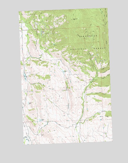
Blue Buck Mountain, WA USGS Topographic Map
Click on map above to begin viewing in our Map Viewer.

This topographic map contains these locations and features:
Feature Name Type Latitude Longitude GNIS ID View Map
Beaver CampgroundLocaleN48.4329°W120.0248°1529680View Map
Blue Buck CreekStreamN48.4860°W120.0054°1516666View Map
Blue Buck MountainSummitN48.4901°W120.0515°1516667View Map
Bonner LakeLakeN48.3972°W120.1015°1516791View Map
Bowen CreekStreamN48.4571°W120.1126°1516883View Map
Bowen MountainSummitN48.4676°W120.1054°1516885View Map
Burns CanyonValleyN48.4204°W120.0370°1517118View Map
Campbell LakeLakeN48.4420°W120.0669°1517328View Map
Cougar CreekStreamN48.4818°W120.1140°1518150View Map
Cougar FlatFlatN48.4663°W120.0954°1518170View Map
Cougar LakeLakeN48.4788°W120.0955°1518176View Map
Coyote RidgeRidgeN48.3979°W120.0073°1518253View Map
Davis CreekStreamN48.4113°W120.1223°1518502View Map
Davis LakeReservoirN48.4382°W120.1207°1532363View Map
Davis Lake DamDamN48.4415°W120.1229°1532362View Map
Fuzzy CanyonValleyN48.4332°W120.1159°1519859View Map
Johnson CreekStreamN48.4551°W120.1020°1521422View Map
Lamotte PondLakeN48.4138°W120.1173°1521881View Map
Methow Wildlife Recreation AreaParkN48.4254°W120.0531°1529175View Map
North Fork Beaver CreekStreamN48.4351°W120.0215°1533014View Map
Piper CreekStreamN48.4218°W120.0390°1524481View Map
Pipestone CanyonValleyN48.3935°W120.0534°1524482View Map
South Fork Beaver CreekStreamN48.4351°W120.0215°1526158View Map
Storer CreekStreamN48.3935°W120.0487°1529342View Map
Storer CreekStreamN48.3938°W120.0484°1530089View Map
Volstead CreekStreamN48.4410°W120.0184°1527735View Map
Wolf CanyonValleyN48.3935°W120.0465°1528276View Map

Note: Coordinates in the location and feature list above are referenced to NAD83 datum.


Copyright (C) 2008-2024 Ryan Niemi / Sunset Dynamics ... All Rights Reserved