TopoQuest Logo
Do you find TopoQuest useful?
Help keep TopoQuest running and adding new maps/features by donating!
Bitcoin:  19c7KJd3qBynnjoSw5npx9KScwjBe4ifkT
Litecoin:  LXs6TkuXGGXo1vDsWCkWVdjQX94eUKd6ui
Home View Maps Find Maps Find Places Resources & Links


Old Baldy, Washington Topographic Map

USGS Map Title: Old Baldy, WA
USGS Map MRC: 48119E8
DRG (GeoTIFF) Download: o48119e8.tif


Neighboring USGS Topographic Map Quads:


  Spur Peak, WA  
48120F1
 

  Tiffany Mountain, WA  
48119F8
 

  Coxit Mountain, WA  
48119F7
 

  Pearrygin Peak, WA  
48120E1
 

  Old Baldy, WA  
48119E8
 

  Conconully West, WA  
48119E7
 

  Blue Buck Mountain, WA  
48120D1
 

  Loup Loup Summit, WA  
48119D8
 

  Buck Mountain, WA  
48119D7


Map MRC Location:

N49°
W120°
N49°
W119°
H8 H7 H6 H5 H4 H3 H2 H1
G8 G7 G6 G5 G4 G3 G2 G1
F8 F7 F6 F5 F4 F3 F2 F1
E8 E7 E6 E5 E4 E3 E2 E1
D8 D7 D6 D5 D4 D3 D2 D1
C8 C7 C6 C5 C4 C3 C2 C1
B8 B7 B6 B5 B4 B3 B2 B1
A8 A7 A6 A5 A4 A3 A2 A1
N48°
W120°
N48°
W119°

Old Baldy, WA USGS 1:24K Topographic Map Preview:
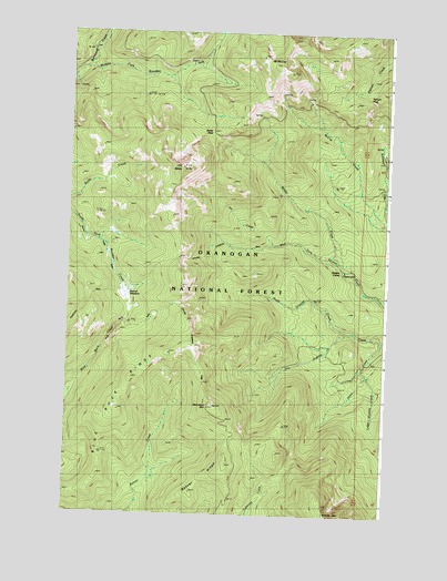
Old Baldy, WA USGS Topographic Map
Click on map above to begin viewing in our Map Viewer.

This topographic map contains these locations and features:
Feature Name Type Latitude Longitude GNIS ID View Map
Baldy PassGapN48.5985°W119.9440°1529343View Map
Beaver MeadowFlatN48.5554°W119.9767°1516342View Map
Bernhardt CreekStreamN48.6154°W119.9954°1516435View Map
Blue Buck RidgeRidgeN48.5265°W119.9798°1516668View Map
Blue Buck TrailTrailN48.5390°W119.9901°1529344View Map
Cathedral DrivewayTrailN48.5482°W119.9517°1517495View Map
Golden Stairway TrailTrailN48.5660°W119.9576°1520119View Map
Jim CreekStreamN48.5699°W119.9201°1521371View Map
Little Granite CreekStreamN48.5365°W119.8842°1522226View Map
McCay TrailTrailN48.5985°W119.8845°1522862View Map
Mount McCaySummitN48.6163°W119.9195°1522863View Map
North Granite CreekStreamN48.5479°W119.8906°1523887View Map
Old BaldySummitN48.5899°W119.9562°1523993View Map
Pearrygin TrailTrailN48.5693°W119.9923°1529346View Map
Pelican PassGapN48.6090°W119.8831°1524308View Map
Pretty Bird Trail (historical)TrailN48.5460°W119.8967°1524637View Map
Ryan Cabin (historical)LocaleN48.5865°W119.8765°1525312View Map
Shrew CreekStreamN48.5460°W119.8756°1525715View Map
Shrew Creek TrailTrailN48.5338°W119.9106°1525716View Map
South Fork TrailTrailN48.5665°W119.9845°1529345View Map
Starvation MountainSummitN48.5282°W119.9429°1526504View Map
Wagon CampLocaleN48.5635°W119.8920°1527751View Map
Wilder CreekStreamN48.5651°W119.8934°1528144View Map

Note: Coordinates in the location and feature list above are referenced to NAD83 datum.


Copyright (C) 2008-2025 Ryan Niemi / Sunset Dynamics ... All Rights Reserved