TopoQuest Logo
Do you find TopoQuest useful?
Help keep TopoQuest running and adding new maps/features by donating!
Bitcoin:  19c7KJd3qBynnjoSw5npx9KScwjBe4ifkT
Litecoin:  LXs6TkuXGGXo1vDsWCkWVdjQX94eUKd6ui
Home View Maps Find Maps Find Places Resources & Links


The Palisades, Texas Topographic Map

USGS Map Title: The Palisades, TX
USGS Map MRC: 35101A7
DRG (GeoTIFF) Download: o35101a7.tif


Neighboring USGS Topographic Map Quads:


  Amarillo West, TX  
35101B8
 

  Amarillo East, TX  
35101B7
 

  Pullman, TX  
35101B6
 

  Buffalo Stadium, TX  
35101A8
 

  The Palisades, TX  
35101A7
 

  Thomas Ranch, TX  
35101A6
 

  Canyon, TX  
34101H8
 

  Nance Ranch, TX  
34101H7
 

  Fortress Cliff, TX  
34101H6


Map MRC Location:

N36°
W102°
N36°
W101°
H8 H7 H6 H5 H4 H3 H2 H1
G8 G7 G6 G5 G4 G3 G2 G1
F8 F7 F6 F5 F4 F3 F2 F1
E8 E7 E6 E5 E4 E3 E2 E1
D8 D7 D6 D5 D4 D3 D2 D1
C8 C7 C6 C5 C4 C3 C2 C1
B8 B7 B6 B5 B4 B3 B2 B1
A8 A7 A6 A5 A4 A3 A2 A1
N35°
W102°
N35°
W101°

The Palisades, TX USGS 1:24K Topographic Map Preview:
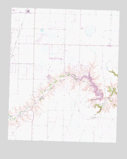
The Palisades, TX USGS Topographic Map
Click on map above to begin viewing in our Map Viewer.

This topographic map contains these locations and features:
Feature Name Type Latitude Longitude GNIS ID View Map
Blue Sky AirfieldAirportN35.0616°W101.8516°2675797View Map
Camp HarringtonLocaleN35.0403°W101.8399°1353638View Map
Cedar Way DrawValleyN35.0339°W101.7680°1354162View Map
Currie LakeReservoirN35.0351°W101.7664°1355484View Map
Currie RanchLocaleN35.0234°W101.7749°1355485View Map
Devils KitchenBasinN35.0426°W101.7621°1355973View Map
HaneyLocaleN35.0784°W101.8738°1358723View Map
KPUR-AM (Amarillo)TowerN35.1223°W101.8030°1385487View Map
Lake TanglewoodPopulated PlaceN35.0676°W101.7871°1388604View Map
Lake TanglewoodReservoirN35.0610°W101.7858°1369581View Map
Lake Tanglewood City HallBuildingN35.0721°W101.7900°2753739View Map
Lake Tanglewood DamDamN35.0398°W101.7710°1861321View Map
Lake Tanglewood Fire Department and Emergency Medical ServiceBuildingN35.0614°W101.7807°2551320View Map
PalisadesPopulated PlaceN35.0617°W101.8024°1699807View Map
Randall County Correctional CenterBuildingN35.1173°W101.8678°2738818View Map
Randall County Fire and Rescue Station 1BuildingN35.0918°W101.8510°2551365View Map
Randall County Sheriff's OfficeBuildingN35.1176°W101.8669°2750250View Map
River Falls AirportAirportN35.0774°W101.7598°1387330View Map
The PalisadesCliffN35.0642°W101.8046°1369805View Map
Timbercreek CanyonPopulated PlaceN35.0531°W101.8180°1388605View Map
Timbercreek Canyon Volunteer Fire DepartmentBuildingN35.0625°W101.8122°2551878View Map
Village of Lake TanglewoodCivilN35.0569°W101.7817°2413565View Map
Village of PalisadesCivilN35.0614°W101.8032°2413575View Map
Village of Timbercreek CanyonCivilN35.0538°W101.8186°2413594View Map
Youth Center of High PlainsSchoolN35.1195°W101.8663°2008068View Map

Note: Coordinates in the location and feature list above are referenced to NAD83 datum.


Copyright (C) 2008-2024 Ryan Niemi / Sunset Dynamics ... All Rights Reserved