TopoQuest Logo
Do you find TopoQuest useful?
Help keep TopoQuest running and adding new maps/features by donating!
Bitcoin:  19c7KJd3qBynnjoSw5npx9KScwjBe4ifkT
Litecoin:  LXs6TkuXGGXo1vDsWCkWVdjQX94eUKd6ui
Home View Maps Find Maps Find Places Resources & Links


Thomas Ranch, Texas Topographic Map

USGS Map Title: Thomas Ranch, TX
USGS Map MRC: 35101A6
DRG (GeoTIFF) Download: o35101a6.tif


Neighboring USGS Topographic Map Quads:


  Amarillo East, TX  
35101B7
 

  Pullman, TX  
35101B6
 

  Washburn, TX  
35101B5
 

  The Palisades, TX  
35101A7
 

  Thomas Ranch, TX  
35101A6
 

  Fairview, TX  
35101A5
 

  Nance Ranch, TX  
34101H7
 

  Fortress Cliff, TX  
34101H6
 

  Pony Flats, TX  
34101H5


Map MRC Location:

N36°
W102°
N36°
W101°
H8 H7 H6 H5 H4 H3 H2 H1
G8 G7 G6 G5 G4 G3 G2 G1
F8 F7 F6 F5 F4 F3 F2 F1
E8 E7 E6 E5 E4 E3 E2 E1
D8 D7 D6 D5 D4 D3 D2 D1
C8 C7 C6 C5 C4 C3 C2 C1
B8 B7 B6 B5 B4 B3 B2 B1
A8 A7 A6 A5 A4 A3 A2 A1
N35°
W102°
N35°
W101°

Thomas Ranch, TX USGS 1:24K Topographic Map Preview:
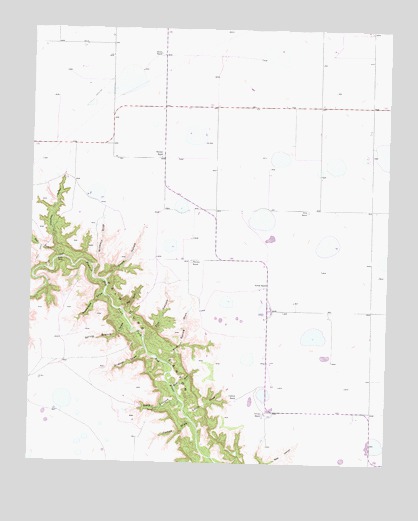
Thomas Ranch, TX USGS Topographic Map
Click on map above to begin viewing in our Map Viewer.

This topographic map contains these locations and features:
Feature Name Type Latitude Longitude GNIS ID View Map
Blue Spring DrawValleyN35.0287°W101.7018°1352494View Map
Chalk HollowValleyN35.0520°W101.7241°1354268View Map
Deep CanyonValleyN35.0177°W101.6973°1355802View Map
Dugout DrawValleyN35.0330°W101.7098°1356419View Map
Evans AerodromeAirportN35.0741°W101.6915°2770193View Map
Flat CanyonValleyN35.0363°W101.7105°1357424View Map
Forked DrawValleyN35.0116°W101.6928°1357572View Map
Irvin RanchLocaleN35.0726°W101.6532°1360035View Map
Little DrawValleyN35.0132°W101.6945°1361336View Map
Little FallsFallsN35.0584°W101.7405°1361351View Map
Nameless DrawValleyN35.0479°W101.7245°1363579View Map
Owens RanchLocaleN35.0145°W101.6677°1364633View Map
Post DrawValleyN35.0441°W101.7178°1365629View Map
Smoot RanchLocaleN35.1170°W101.7043°1368521View Map
Sorelle RanchLocaleN35.0506°W101.6671°1368609View Map
Spring BranchStreamN35.0381°W101.7149°1368941View Map
Stevens RanchLocaleN35.0584°W101.6946°1369183View Map
Stub DrawValleyN35.0218°W101.6988°1369295View Map
Thomas DrawValleyN35.0587°W101.7399°1369839View Map
Thomas RanchLocaleN35.0876°W101.7038°1369842View Map
Upshaw RanchLocaleN35.0184°W101.6774°1370535View Map
West Fork Prairie Dog Town Fork Red RiverStreamN35.0587°W101.7394°1371149View Map
Windmill DrawValleyN35.0548°W101.7281°1371751View Map

Note: Coordinates in the location and feature list above are referenced to NAD83 datum.


Copyright (C) 2008-2025 Ryan Niemi / Sunset Dynamics ... All Rights Reserved