TopoQuest Logo
Do you find TopoQuest useful?
Help keep TopoQuest running and adding new maps/features by donating!
Bitcoin:  19c7KJd3qBynnjoSw5npx9KScwjBe4ifkT
Litecoin:  LXs6TkuXGGXo1vDsWCkWVdjQX94eUKd6ui
Home View Maps Find Maps Find Places Resources & Links


Thorn Peak, Arizona Topographic Map

USGS Map Title: Thorn Peak, AZ
USGS Map MRC: 34113D2
DRG (GeoTIFF) Download: o34113d2.tif


Neighboring USGS Topographic Map Quads:


  Grayback Mountains, AZ  
34113E3
 

  Bagdad, AZ  
34113E2
 

  Big Shipp Mountain, AZ  
34113E1
 

  Arrastra Mountain NE, AZ  
34113D3
 

  Thorn Peak, AZ  
34113D2
 

  Malpais Mesa NE, AZ  
34113D1
 

  Arrastra Mountain SE, AZ  
34113C3
 

  Ives Peak, AZ  
34113C2
 

  Malpais Mesa, AZ  
34113C1


Map MRC Location:

N35°
W114°
N35°
W113°
H8 H7 H6 H5 H4 H3 H2 H1
G8 G7 G6 G5 G4 G3 G2 G1
F8 F7 F6 F5 F4 F3 F2 F1
E8 E7 E6 E5 E4 E3 E2 E1
D8 D7 D6 D5 D4 D3 D2 D1
C8 C7 C6 C5 C4 C3 C2 C1
B8 B7 B6 B5 B4 B3 B2 B1
A8 A7 A6 A5 A4 A3 A2 A1
N34°
W114°
N34°
W113°

Thorn Peak, AZ USGS 1:24K Topographic Map Preview:
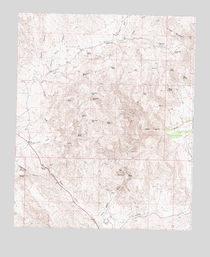
Thorn Peak, AZ USGS Topographic Map
Click on map above to begin viewing in our Map Viewer.

This topographic map contains these locations and features:
Feature Name Type Latitude Longitude GNIS ID View Map
Billy SpringSpringN34.4684°W113.1423°1426View Map
Bridle CreekStreamN34.3792°W113.1888°1958View Map
Cottonwood CanyonValleyN34.4028°W113.2213°3325View Map
Cottonwood SpringsSpringN34.4039°W113.2469°3396View Map
Cowboy WashStreamN34.4859°W113.1830°3467View Map
Crosby MountainSummitN34.4875°W113.1271°3583View Map
Crosby Mountain TankReservoirN34.4788°W113.1396°3584View Map
Deer SpringSpringN34.4642°W113.1329°3813View Map
Dry TankReservoirN34.4834°W113.1505°4166View Map
Fort Basin TankReservoirN34.4537°W113.1980°4745View Map
Hayes PeakSummitN34.4764°W113.1316°21283View Map
Highway SpringSpringN34.4095°W113.2280°5813View Map
Moonshine SpringSpringN34.4647°W113.2041°8263View Map
Mountain Spring WashStreamN34.4656°W113.2271°8333View Map
Pastore TankReservoirN34.4690°W113.1810°9239View Map
Placeritas CreekStreamN34.4297°W113.2224°9560View Map
Quail SpringSpringN34.4770°W113.2011°9844View Map
River TankReservoirN34.4542°W113.1613°10326View Map
Rock TankReservoirN34.4677°W113.1680°10432View Map
Santa Maria RanchLocaleN34.3781°W113.1838°10945View Map
Skunk CanyonValleyN34.4647°W113.2291°439View Map
Sultan MineMineN34.4475°W113.1474°11944View Map
Thorn PeakSummitN34.4367°W113.1830°12410View Map
Thorn Peak TankReservoirN34.4384°W113.1973°12411View Map
Tindsley SpringSpringN34.4407°W113.2038°12498View Map
Twin TanksReservoirN34.4495°W113.2152°12969View Map
Whitecap PeakSummitN34.4506°W113.1971°13696View Map
Willow SpringSpringN34.4287°W113.2064°13847View Map
Willow SpringSpringN34.4564°W113.1438°13848View Map

Note: Coordinates in the location and feature list above are referenced to NAD83 datum.


Copyright (C) 2008-2024 Ryan Niemi / Sunset Dynamics ... All Rights Reserved