TopoQuest Logo
Do you find TopoQuest useful?
Help keep TopoQuest running and adding new maps/features by donating!
Bitcoin:  19c7KJd3qBynnjoSw5npx9KScwjBe4ifkT
Litecoin:  LXs6TkuXGGXo1vDsWCkWVdjQX94eUKd6ui
Home View Maps Find Maps Find Places Resources & Links


Thornton, California Topographic Map

USGS Map Title: Thornton, CA
USGS Map MRC: 38121B4
DRG (GeoTIFF) Download: o38121b4.tif


Neighboring USGS Topographic Map Quads:


  Courtland, CA  
38121C5
 

  Bruceville, CA  
38121C4
 

  Galt, CA  
38121C3
 

  Isleton, CA  
38121B5
 

  Thornton, CA  
38121B4
 

  Lodi North, CA  
38121B3
 

  Bouldin Island, CA  
38121A5
 

  Terminous, CA  
38121A4
 

  Lodi South, CA  
38121A3


Map MRC Location:

N39°
W122°
N39°
W121°
H8 H7 H6 H5 H4 H3 H2 H1
G8 G7 G6 G5 G4 G3 G2 G1
F8 F7 F6 F5 F4 F3 F2 F1
E8 E7 E6 E5 E4 E3 E2 E1
D8 D7 D6 D5 D4 D3 D2 D1
C8 C7 C6 C5 C4 C3 C2 C1
B8 B7 B6 B5 B4 B3 B2 B1
A8 A7 A6 A5 A4 A3 A2 A1
N38°
W122°
N38°
W121°

Thornton, CA USGS 1:24K Topographic Map Preview:
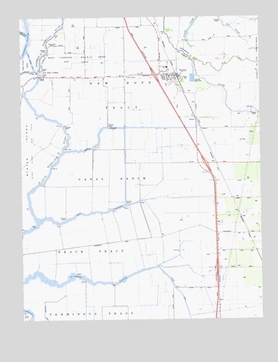
Thornton, CA USGS Topographic Map
Click on map above to begin viewing in our Map Viewer.

This topographic map contains these locations and features:
Feature Name Type Latitude Longitude GNIS ID View Map
Bear SloughGutN38.2452°W121.3900°218876View Map
Beaver SloughGutN38.2035°W121.4597°218950View Map
Brack TractCivilN38.1555°W121.4633°219753View Map
Canal RanchCivilN38.1841°W121.4547°220532View Map
De Snayer DairyLocaleN38.1956°W121.4164°2704801View Map
Dead Horse CutCanalN38.2327°W121.4958°222097View Map
Dry CreekStreamN38.2319°W121.4116°222621View Map
Four CornersLocaleN38.2255°W121.4475°223738View Map
Grizzly SloughGutN38.2457°W121.4125°253641View Map
Hog SloughGutN38.1691°W121.4602°225413View Map
KCSO-TV (Modesto)TowerN38.2388°W121.4822°1665156View Map
New HopePopulated PlaceN38.2263°W121.4238°1666005View Map
New Hope Elementary SchoolSchoolN38.2292°W121.4242°229496View Map
New Hope LandingPopulated PlaceN38.2280°W121.4908°1659215View Map
New Hope School (historical)SchoolN38.2257°W121.4516°1666006View Map
New Hope TractCivilN38.2321°W121.4536°229497View Map
Northwest Main CanalCanalN38.1846°W121.3969°229779View Map
River Island Gas FieldOilfieldN38.1955°W121.4955°277339View Map
Simones DairyLocaleN38.1367°W121.4086°2704980View Map
Sycamore SloughGutN38.1419°W121.4697°235931View Map
Taison (historical)Populated PlaceN38.2041°W121.4094°1666011View Map
ThorntonPopulated PlaceN38.2260°W121.4247°236291View Map
Thornton Branch Stockton-San Joaquin County Public LibraryBuildingN38.2260°W121.4247°1827330View Map
Thornton Census Designated PlaceCensusN38.2309°W121.4249°2628795View Map
Thornton DivisionCivilN38.1346°W121.4637°1935339View Map
Thornton Migratory Labor Camp (historical)LocaleN38.2241°W121.4388°1701257View Map
Thornton Post OfficePost OfficeN38.2243°W121.4219°1827331View Map
Thornton Rural Fire Protection DistrictBuildingN38.2230°W121.4213°2624595View Map
Upland CanalCanalN38.1308°W121.4161°236870View Map
Van Exel Dairy Number 1LocaleN38.1644°W121.3975°2704868View Map
West Thornton-Walnut Grove Gas FieldOilfieldN38.2324°W121.4722°277348View Map

Note: Coordinates in the location and feature list above are referenced to NAD83 datum.


Copyright (C) 2008-2024 Ryan Niemi / Sunset Dynamics ... All Rights Reserved