TopoQuest Logo
Do you find TopoQuest useful?
Help keep TopoQuest running and adding new maps/features by donating!
Bitcoin:  19c7KJd3qBynnjoSw5npx9KScwjBe4ifkT
Litecoin:  LXs6TkuXGGXo1vDsWCkWVdjQX94eUKd6ui
Home View Maps Find Maps Find Places Resources & Links


Bruceville, California Topographic Map

USGS Map Title: Bruceville, CA
USGS Map MRC: 38121C4
DRG (GeoTIFF) Download: o38121c4.tif


Neighboring USGS Topographic Map Quads:


  Clarksburg, CA  
38121D5
 

  Florin, CA  
38121D4
 

  Elk Grove, CA  
38121D3
 

  Courtland, CA  
38121C5
 

  Bruceville, CA  
38121C4
 

  Galt, CA  
38121C3
 

  Isleton, CA  
38121B5
 

  Thornton, CA  
38121B4
 

  Lodi North, CA  
38121B3


Map MRC Location:

N39°
W122°
N39°
W121°
H8 H7 H6 H5 H4 H3 H2 H1
G8 G7 G6 G5 G4 G3 G2 G1
F8 F7 F6 F5 F4 F3 F2 F1
E8 E7 E6 E5 E4 E3 E2 E1
D8 D7 D6 D5 D4 D3 D2 D1
C8 C7 C6 C5 C4 C3 C2 C1
B8 B7 B6 B5 B4 B3 B2 B1
A8 A7 A6 A5 A4 A3 A2 A1
N38°
W122°
N38°
W121°

Bruceville, CA USGS 1:24K Topographic Map Preview:
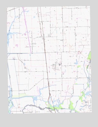
Bruceville, CA USGS Topographic Map
Click on map above to begin viewing in our Map Viewer.

This topographic map contains these locations and features:
Feature Name Type Latitude Longitude GNIS ID View Map
Bear Lake (historical)LakeN38.2846°W121.4677°1666255View Map
Bradford WineryLocaleN38.2955°W121.4177°1666260View Map
BrucevillePopulated PlaceN38.3357°W121.4172°252639View Map
Carroll School (historical)SchoolN38.3216°W121.4175°1701987View Map
Cosumnes RiverStreamN38.2555°W121.4391°254780View Map
Flying B RanchLocaleN38.3402°W121.4413°1827036View Map
Flying B Ranch AirportAirportN38.3403°W121.4371°1653461View Map
Franklin Census Designated PlaceCensusN38.3675°W121.4616°2583017View Map
Franklin FieldAirportN38.3023°W121.4246°1653462View Map
KCRA-TV (Sacramento)TowerN38.2644°W121.4905°1663193View Map
KRBK-TV (Sacramento)TowerN38.2644°W121.4905°1663194View Map
Kuhn RanchLocaleN38.3030°W121.4738°226693View Map
LagunaStreamN38.2846°W121.3788°255088View Map
Mokelumne CityPopulated PlaceN38.2530°W121.4391°1659154View Map
Point PleasantPopulated PlaceN38.3316°W121.4638°1659412View Map
Point Pleasant School (historical)SchoolN38.3391°W121.4455°1666337View Map
Point Pleasant United Methodist ChurchChurchN38.3313°W121.4641°1827050View Map
Rio Cosumnes Correctional CenterLocaleN38.3063°W121.4230°1827053View Map
Rio Cosumnes Correctional CenterBuildingN38.3064°W121.4217°2760166View Map
Sacramento Drainage CanalCanalN38.3719°W121.4891°1852145View Map
South Stone LakeLakeN38.3446°W121.4977°1828926View Map
Stone LakeLakeN38.3412°W121.4993°235525View Map
Tollenaar DairyLocaleN38.3419°W121.3972°2708025View Map

Note: Coordinates in the location and feature list above are referenced to NAD83 datum.


Copyright (C) 2008-2025 Ryan Niemi / Sunset Dynamics ... All Rights Reserved