TopoQuest Logo
Do you find TopoQuest useful?
Help keep TopoQuest running and adding new maps/features by donating!
Bitcoin:  19c7KJd3qBynnjoSw5npx9KScwjBe4ifkT
Litecoin:  LXs6TkuXGGXo1vDsWCkWVdjQX94eUKd6ui
Home View Maps Find Maps Find Places Resources & Links


Courtland, California Topographic Map

USGS Map Title: Courtland, CA
USGS Map MRC: 38121C5
DRG (GeoTIFF) Download: o38121c5.tif


Neighboring USGS Topographic Map Quads:


  Saxon, CA  
38121D6
 

  Clarksburg, CA  
38121D5
 

  Florin, CA  
38121D4
 

  Liberty Island, CA  
38121C6
 

  Courtland, CA  
38121C5
 

  Bruceville, CA  
38121C4
 

  Rio Vista, CA  
38121B6
 

  Isleton, CA  
38121B5
 

  Thornton, CA  
38121B4


Map MRC Location:

N39°
W122°
N39°
W121°
H8 H7 H6 H5 H4 H3 H2 H1
G8 G7 G6 G5 G4 G3 G2 G1
F8 F7 F6 F5 F4 F3 F2 F1
E8 E7 E6 E5 E4 E3 E2 E1
D8 D7 D6 D5 D4 D3 D2 D1
C8 C7 C6 C5 C4 C3 C2 C1
B8 B7 B6 B5 B4 B3 B2 B1
A8 A7 A6 A5 A4 A3 A2 A1
N38°
W122°
N38°
W121°

Courtland, CA USGS 1:24K Topographic Map Preview:
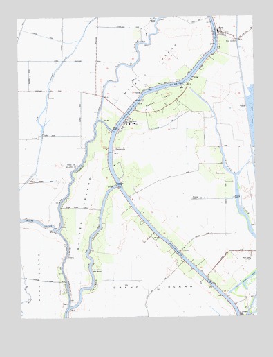
Courtland, CA USGS Topographic Map
Click on map above to begin viewing in our Map Viewer.

This topographic map contains these locations and features:
Feature Name Type Latitude Longitude GNIS ID View Map
Bates Elementary SchoolSchoolN38.3305°W121.5648°218728View Map
Clamshell Cut (historical)GutN38.3002°W121.6188°1666065View Map
Coggenshall LandingLocaleN38.2907°W121.5622°255986View Map
CourtlandPopulated PlaceN38.3310°W121.5686°1655931View Map
Courtland Branch LibraryBuildingN38.3313°W121.5691°1827031View Map
Courtland Census Designated PlaceCensusN38.3329°W121.5570°2582985View Map
Courtland Community Operated Neighborhood LibraryBuildingN38.3305°W121.5666°2061284View Map
Courtland Fire Protection District Station 91BuildingN38.3287°W121.5704°2061285View Map
Courtland Fire Protection District Station 92BuildingN38.3666°W121.5127°2061356View Map
Courtland Post OfficePost OfficeN38.3312°W121.5698°2061286View Map
Danady LandingLocaleN38.2930°W121.5608°255987View Map
De Back LandingLocaleN38.3074°W121.5755°255985View Map
Dean Landing Number B One Hundred TwelveLocaleN38.3430°W121.5547°255994View Map
Elk SloughStreamN38.3324°W121.5838°253726View Map
Elliott Landing Number B One Hundred TenLocaleN38.3396°W121.5608°255995View Map
Goldman LandingLocaleN38.2644°W121.5866°256005View Map
GreendalePopulated PlaceN38.3735°W121.5861°1656051View Map
Greens Landing Number B One Hundred Twelve and a HalfLocaleN38.3446°W121.5477°255998View Map
Hemp Landing Number Ninety-SevenLocaleN38.3377°W121.5666°255996View Map
Hollister Landing Number One Hundred SixteenLocaleN38.3491°W121.5333°256001View Map
HoodPopulated PlaceN38.3682°W121.5175°225528View Map
Hood Census Designated PlaceCensusN38.3693°W121.5155°2583037View Map
Hood JunctionPopulated PlaceN38.3635°W121.5097°1656075View Map
Hood Post OfficePost OfficeN38.3688°W121.5193°2061357View Map
KTXL-TV (Sacramento)TowerN38.2716°W121.5061°1665166View Map
KVIE-TV (Sacramento)TowerN38.2716°W121.5061°1665164View Map
KXJZ-FM (Sacramento)TowerN38.2735°W121.5041°1665086View Map
Lambert (historical)Populated PlaceN38.3205°W121.5025°1666299View Map
Landing Number One Hundred FourteenLocaleN38.3457°W121.5391°256002View Map
Landing Number One Hundred Twenty TwoLocaleN38.3610°W121.5191°256003View Map
LockePopulated PlaceN38.2505°W121.5094°1656136View Map
Locke Historic DistrictParkN38.2505°W121.5094°1827047View Map
McCollough LandingLocaleN38.2788°W121.5427°255990View Map
McFadden Landing Number One Hundred OneLocaleN38.3455°W121.5569°255999View Map
Merritt IslandIslandN38.3688°W121.5361°228530View Map
Mokelumne Continuation High SchoolSchoolN38.3302°W121.5688°2061393View Map
Morgans LandingPopulated PlaceN38.3282°W121.5758°252744View Map
Morse LandingLocaleN38.3227°W121.5872°255992View Map
OxfordPopulated PlaceN38.3071°W121.6208°1656202View Map
PaintersvillePopulated PlaceN38.3199°W121.5761°252759View Map
RandallPopulated PlaceN38.3449°W121.5352°255997View Map
Randall IslandIslandN38.3402°W121.5508°231232View Map
Reclamation District 551 Borrow CanalCanalN38.3274°W121.5211°1852146View Map
River Delta Continuation High School (historical)SchoolN38.3221°W121.5650°1827055View Map
River MansionBuildingN38.2694°W121.5875°231640View Map
Runyon LandingLocaleN38.2888°W121.5566°255988View Map
Simpson LandingNumber One Hundred TwentyLocaleN38.3577°W121.5244°256000View Map
SorrocaPopulated PlaceN38.3421°W121.6100°1656320View Map
Steamboat LandingLocaleN38.3055°W121.5741°1656331View Map
Sutter IslandIslandN38.2935°W121.5922°235846View Map
Sutter SloughStreamN38.2544°W121.6005°235852View Map
Talmadge LandingLocaleN38.2841°W121.5502°255989View Map
The Meadows SloughLakeN38.2661°W121.5048°236192View Map
Tye-A-Lee LandingLocaleN38.3324°W121.5852°255991View Map
ValdezPopulated PlaceN38.3260°W121.6133°1656381View Map
VordenPopulated PlaceN38.2771°W121.5411°1656394View Map
Wedley LandingLocaleN38.3132°W121.5755°255993View Map

Note: Coordinates in the location and feature list above are referenced to NAD83 datum.


Copyright (C) 2008-2025 Ryan Niemi / Sunset Dynamics ... All Rights Reserved