TopoQuest Logo
Do you find TopoQuest useful?
Help keep TopoQuest running and adding new maps/features by donating!
Bitcoin:  19c7KJd3qBynnjoSw5npx9KScwjBe4ifkT
Litecoin:  LXs6TkuXGGXo1vDsWCkWVdjQX94eUKd6ui
Home View Maps Find Maps Find Places Resources & Links


Thousand Springs, Oregon Topographic Map

USGS Map Title: Thousand Springs, OR
USGS Map MRC: 42122H3
DRG (GeoTIFF) Download: o42122h3.tif


Neighboring USGS Topographic Map Quads:


  Fish Mountain, OR  
43122A4
 

  Hamaker Butte, OR  
43122A3
 

  Pumice Desert West, OR  
43122A2
 

  Union Creek, OR  
42122H4
 

  Thousand Springs, OR  
42122H3
 

  Crater Lake West, OR  
42122H2
 

  Prospect North, OR  
42122G4
 

  Red Blanket Mountain, OR  
42122G3
 

  Union Peak, OR  
42122G2


Map MRC Location:

N43°
W123°
N43°
W122°
H8 H7 H6 H5 H4 H3 H2 H1
G8 G7 G6 G5 G4 G3 G2 G1
F8 F7 F6 F5 F4 F3 F2 F1
E8 E7 E6 E5 E4 E3 E2 E1
D8 D7 D6 D5 D4 D3 D2 D1
C8 C7 C6 C5 C4 C3 C2 C1
B8 B7 B6 B5 B4 B3 B2 B1
A8 A7 A6 A5 A4 A3 A2 A1
N42°
W123°
N42°
W122°

Thousand Springs, OR USGS 1:24K Topographic Map Preview:
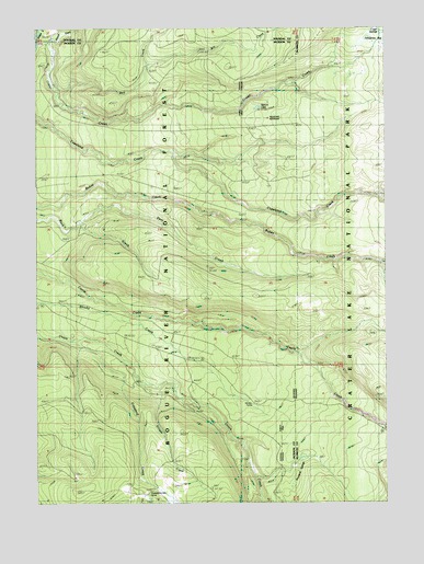
Thousand Springs, OR USGS Topographic Map
Click on map above to begin viewing in our Map Viewer.

This topographic map contains these locations and features:
Feature Name Type Latitude Longitude GNIS ID View Map
Bert CreekStreamN42.9846°W122.3723°1137952View Map
Bill CreekStreamN42.9896°W122.3381°1138109View Map
Copeland Creek TrailTrailN42.9712°W122.3289°1140094View Map
Crater CreekStreamN42.9965°W122.3742°1140392View Map
Crater SpringsSpringN42.9991°W122.2525°1140403View Map
Crawford CreekStreamN42.9185°W122.3625°1140411View Map
Deer CreekStreamN42.9462°W122.3673°1140822View Map
Grouse CreekStreamN42.9062°W122.3386°1143121View Map
Huckleberry Guard StationLocaleN42.8785°W122.3353°1143874View Map
Huckleberry Mountain Recreation SiteLocaleN42.8771°W122.3375°1155803View Map
Little Castle CreekStreamN42.8957°W122.2523°1145122View Map
North Fork Copeland CreekStreamN42.9560°W122.2553°1154311View Map
North Fork Little Copeland CreekStreamN42.9665°W122.3178°1155026View Map
Sphagnum BogSwampN42.9972°W122.2574°1150121View Map
Spruce LakeLakeN42.9789°W122.2967°1150209View Map
Sunday CampLocaleN42.9601°W122.3511°1155798View Map
Thousand SpringsSpringN42.8789°W122.2851°1151143View Map
Wagon CampLocaleN42.9060°W122.3256°1155799View Map
Whisky Camp (historical)LocaleN42.9010°W122.2989°1135024View Map

Note: Coordinates in the location and feature list above are referenced to NAD83 datum.


Copyright (C) 2008-2024 Ryan Niemi / Sunset Dynamics ... All Rights Reserved