TopoQuest Logo
Do you find TopoQuest useful?
Help keep TopoQuest running and adding new maps/features by donating!
Bitcoin:  19c7KJd3qBynnjoSw5npx9KScwjBe4ifkT
Litecoin:  LXs6TkuXGGXo1vDsWCkWVdjQX94eUKd6ui
Home View Maps Find Maps Find Places Resources & Links


Prospect North, Oregon Topographic Map

USGS Map Title: Prospect North, OR
USGS Map MRC: 42122G4
DRG (GeoTIFF) Download: o42122g4.tif


Neighboring USGS Topographic Map Quads:


  Abbott Butte, OR  
42122H5
 

  Union Creek, OR  
42122H4
 

  Thousand Springs, OR  
42122H3
 

  Whetstone Point, OR  
42122G5
 

  Prospect North, OR  
42122G4
 

  Red Blanket Mountain, OR  
42122G3
 

  Cascade Gorge, OR  
42122F5
 

  Prospect South, OR  
42122F4
 

  Imnaha Creek, OR  
42122F3


Map MRC Location:

N43°
W123°
N43°
W122°
H8 H7 H6 H5 H4 H3 H2 H1
G8 G7 G6 G5 G4 G3 G2 G1
F8 F7 F6 F5 F4 F3 F2 F1
E8 E7 E6 E5 E4 E3 E2 E1
D8 D7 D6 D5 D4 D3 D2 D1
C8 C7 C6 C5 C4 C3 C2 C1
B8 B7 B6 B5 B4 B3 B2 B1
A8 A7 A6 A5 A4 A3 A2 A1
N42°
W123°
N42°
W122°

Prospect North, OR USGS 1:24K Topographic Map Preview:
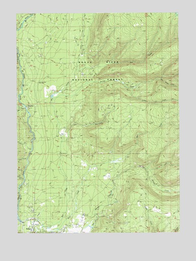
Prospect North, OR USGS Topographic Map
Click on map above to begin viewing in our Map Viewer.

This topographic map contains these locations and features:
Feature Name Type Latitude Longitude GNIS ID View Map
Aiken Family PlotCemeteryN42.7554°W122.4507°1157058View Map
Coffee CreekStreamN42.8318°W122.4123°1155029View Map
Dead Soldier CreekStreamN42.8373°W122.3942°1155028View Map
Deep CreekStreamN42.7918°W122.4934°1140798View Map
Ginkgo CreekStreamN42.8260°W122.4731°1142747View Map
Ginkgo TrailTrailN42.8021°W122.3831°1142748View Map
Graham CreekStreamN42.7821°W122.4964°1142899View Map
Kiter CreekStreamN42.8215°W122.4948°1144643View Map
Larson CreekStreamN42.7982°W122.4903°1144836View Map
Lick CreekStreamN42.7843°W122.4011°1144979View Map
Lund CreekStreamN42.7854°W122.4956°1145680View Map
Mammoth PinesWoodsN42.8357°W122.4850°1167401View Map
Mammoth Pines Picnic Area (historical)LocaleN42.8357°W122.4850°1157060View Map
Mill Creek Recreation SiteLocaleN42.7954°W122.4678°1155793View Map
Needle CreekStreamN42.8215°W122.4981°1146748View Map
North Fork Diversion DamDamN42.7748°W122.4995°1155627View Map
North Fork Diversion ReservoirReservoirN42.7569°W122.4989°1155628View Map
North Fork Mill CreekStreamN42.8443°W122.4539°1155025View Map
ProspectPopulated PlaceN42.7510°W122.4889°1148014View Map
Prospect Branch LibraryBuildingN42.7542°W122.4890°2699727View Map
Prospect Census Designated PlaceCensusN42.7526°W122.4757°2611775View Map
Prospect Fire DepartmentBuildingN42.7522°W122.4891°2576479View Map
Prospect Post OfficePost OfficeN42.7521°W122.4885°1165824View Map
Prospect Sanitary LandfillLocaleN42.7665°W122.4828°1638111View Map
Prospect SchoolSchoolN42.7535°W122.4896°2440213View Map
Red Blanket ReservoirReservoirN42.7568°W122.4400°1132696View Map
River Bridge Recreation SiteLocaleN42.8221°W122.4936°1157059View Map
Rogue River Siskiyou National Forest Law Enforcement High Cascades Ranger District ProspectBuildingN42.7628°W122.4889°1155785View Map
Sink CreekStreamN42.8021°W122.4667°1149537View Map
Skeeters CampLocaleN42.7693°W122.4748°1149584View Map
Takelma GorgeValleyN42.8448°W122.4981°1157061View Map
Union Rogue Church CampLocaleN42.8340°W122.4961°1167400View Map
United States Forest Service Prospect Ranger DistrictBuildingN42.7628°W122.4889°2576692View Map

Note: Coordinates in the location and feature list above are referenced to NAD83 datum.


Copyright (C) 2008-2024 Ryan Niemi / Sunset Dynamics ... All Rights Reserved