TopoQuest Logo
Do you find TopoQuest useful?
Help keep TopoQuest running and adding new maps/features by donating!
Bitcoin:  19c7KJd3qBynnjoSw5npx9KScwjBe4ifkT
Litecoin:  LXs6TkuXGGXo1vDsWCkWVdjQX94eUKd6ui
Home View Maps Find Maps Find Places Resources & Links


Wanderers Peak, Oregon Topographic Map

USGS Map Title: Wanderers Peak, OR
USGS Map MRC: 45122A2
DRG (GeoTIFF) Download: o45122a2.tif


Neighboring USGS Topographic Map Quads:


  Elwood, OR  
45122B3
 

  Bedford Point, OR  
45122B2
 

  Three Lynx, OR  
45122B1
 

  Soosap Peak, OR  
45122A3
 

  Wanderers Peak, OR  
45122A2
 

  Fish Creek Mountain, OR  
45122A1
 

  Rooster Rock, OR  
44122H3
 

  Bagby Hot Springs, OR  
44122H2
 

  Bull of the Woods, OR  
44122H1


Map MRC Location:

N46°
W123°
N46°
W122°
H8 H7 H6 H5 H4 H3 H2 H1
G8 G7 G6 G5 G4 G3 G2 G1
F8 F7 F6 F5 F4 F3 F2 F1
E8 E7 E6 E5 E4 E3 E2 E1
D8 D7 D6 D5 D4 D3 D2 D1
C8 C7 C6 C5 C4 C3 C2 C1
B8 B7 B6 B5 B4 B3 B2 B1
A8 A7 A6 A5 A4 A3 A2 A1
N45°
W123°
N45°
W122°

Wanderers Peak, OR USGS 1:24K Topographic Map Preview:
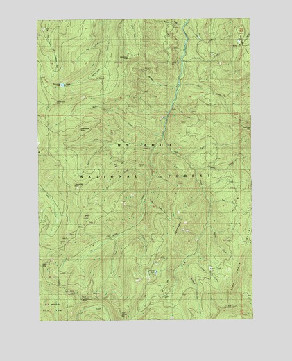
Wanderers Peak, OR USGS Topographic Map
Click on map above to begin viewing in our Map Viewer.

This topographic map contains these locations and features:
Feature Name Type Latitude Longitude GNIS ID View Map
Big Meadow QuarryMineN45.0210°W122.1509°2754405View Map
Bracket MountainSummitN45.0026°W122.2034°1138552View Map
Bracket Mountain QuarryMineN45.0172°W122.1923°2754404View Map
Button CreekStreamN45.1235°W122.1631°1133946View Map
Calico CreekStreamN45.0673°W122.1648°1139155View Map
Calico QuarryMineN45.1100°W122.1487°2754400View Map
CamelsbackRidgeN45.0407°W122.1681°1139186View Map
Cedar CreekStreamN45.0387°W122.1959°1135483View Map
Coffee CreekStreamN45.0601°W122.1845°1135481View Map
Cotton CreekStreamN45.0546°W122.1551°1135493View Map
Dead Horse ButteRidgeN45.0768°W122.2323°1140689View Map
Deadhorse QuarryMineN45.1070°W122.2032°2754399View Map
Divide ButteSummitN45.0240°W122.2495°1141062View Map
Dunharrow QuarryMineN45.0401°W122.2213°2754403View Map
East MountainSummitN45.0048°W122.1384°1141630View Map
Fall CreekStreamN45.0576°W122.1859°1141971View Map
First CreekStreamN45.1226°W122.1637°1135485View Map
Fish Creek Saddle QuarryMineN45.0326°W122.1416°2754402View Map
Flannel CreekStreamN45.0401°W122.1526°1135760View Map
Gingham CreekStreamN45.0632°W122.1595°1135492View Map
Lunch CreekStreamN45.0518°W122.1809°1135482View Map
Memaloose LakeLakeN45.0978°W122.2366°1146092View Map
Miners ButteSummitN45.0423°W122.2242°1146319View Map
Music CreekStreamN45.0762°W122.1770°1146691View Map
Oasis CreekStreamN45.1165°W122.2095°1135484View Map
Pick CreekStreamN45.0710°W122.1823°1147644View Map
Round MountainSummitN45.0557°W122.2295°1148787View Map
Second CreekStreamN45.1073°W122.1662°1135487View Map
Shovel CreekStreamN45.0729°W122.2092°1135489View Map
Silk CreekStreamN45.0898°W122.1720°1135491View Map
South Fork MountainSummitN45.0915°W122.2404°1135488View Map
Surprise LakeLakeN45.0197°W122.1829°1150697View Map
Third CreekStreamN45.0982°W122.1676°1135486View Map
Trout Creek QuarryMineN45.0098°W122.1292°2754406View Map
Tweed CreekStreamN45.0282°W122.1587°1135495View Map
Wanderers CreekStreamN45.0985°W122.1684°1135490View Map
Wanderers PeakSummitN45.1087°W122.1970°1151874View Map
Wash CreekStreamN45.0748°W122.1776°1151920View Map
Wash Creek ButteSummitN45.0093°W122.2256°1151921View Map
Wear CreekStreamN45.0354°W122.2040°1155784View Map
Whalehead QuarryMineN45.1152°W122.1325°2754401View Map
Wool CreekStreamN45.0485°W122.1504°1135494View Map
Worsted CreekStreamN45.0229°W122.1684°1157881View Map

Note: Coordinates in the location and feature list above are referenced to NAD83 datum.


Copyright (C) 2008-2025 Ryan Niemi / Sunset Dynamics ... All Rights Reserved