TopoQuest Logo
Do you find TopoQuest useful?
Help keep TopoQuest running and adding new maps/features by donating!
Bitcoin:  19c7KJd3qBynnjoSw5npx9KScwjBe4ifkT
Litecoin:  LXs6TkuXGGXo1vDsWCkWVdjQX94eUKd6ui
Home View Maps Find Maps Find Places Resources & Links


Three Oaks, Michigan Topographic Map

USGS Map Title: Three Oaks, MI
USGS Map MRC: 41086G5
DRG (GeoTIFF) Download: o41086g5.tif


Neighboring USGS Topographic Map Quads:


  Bridgman, MI  
41086H5
 

  Baroda, MI  
41086H4
 

  New Buffalo East, MI  
41086G6
 

  Three Oaks, MI  
41086G5
 

  Galien, MI  
41086G4
 

  Springville, IN  
41086F6
 

  New Carlisle, IN  
41086F5
 

  Lydick, IN  
41086F4


Map MRC Location:

N42°
W87°
N42°
W86°
H8 H7 H6 H5 H4 H3 H2 H1
G8 G7 G6 G5 G4 G3 G2 G1
F8 F7 F6 F5 F4 F3 F2 F1
E8 E7 E6 E5 E4 E3 E2 E1
D8 D7 D6 D5 D4 D3 D2 D1
C8 C7 C6 C5 C4 C3 C2 C1
B8 B7 B6 B5 B4 B3 B2 B1
A8 A7 A6 A5 A4 A3 A2 A1
N41°
W87°
N41°
W86°

Three Oaks, MI USGS 1:24K Topographic Map Preview:
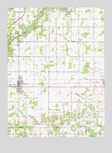
Three Oaks, MI USGS Topographic Map
Click on map above to begin viewing in our Map Viewer.

This topographic map contains these locations and features:
Feature Name Type Latitude Longitude GNIS ID View Map
AveryPopulated PlaceN41.8000°W86.5714°2376506View Map
Avery StationLocaleN41.8011°W86.5714°2401326View Map
Beaverdam CreekStreamN41.8056°W86.5525°620958View Map
Benedick AirportAirportN41.8576°W86.6118°2650900View Map
Berrien County CourthouseBuildingN41.8017°W86.6106°2376334View Map
Blue Jay CreekStreamN41.8425°W86.5492°621628View Map
Calvary Tabernacle ChurchChurchN41.8075°W86.6100°2376319View Map
Chikaming SchoolSchoolN41.8703°W86.6109°623192View Map
Chikaming Township Fire DepartmentBuildingN41.8727°W86.6249°2636097View Map
Chikaming Township Police DepartmentBuildingN41.8728°W86.6249°2377545View Map
Davidson LakeLakeN41.7604°W86.5322°624331View Map
Davidson LakeLakeN41.7500°W86.5320°433338View Map
Dowling CreekStreamN41.8303°W86.5489°452582View Map
East Branch Galien RiverStreamN41.8703°W86.5470°1618900View Map
Elm ValleyValleyN41.8541°W86.5464°625513View Map
First Congregational ChurchChurchN41.7986°W86.6083°2376321View Map
First Reformed ChurchChurchN41.8039°W86.6106°2376317View Map
Forest Lawn CemeteryCemeteryN41.7792°W86.6197°626275View Map
Free Methodist ChurchChurchN41.7939°W86.6097°2376323View Map
Galien Township Fire DepartmentBuildingN41.7993°W86.5030°2373996View Map
Germinder and Ward GravesCemeteryN41.7986°W86.5028°2374154View Map
Harbert ChurchChurchN41.8706°W86.6084°627749View Map
Harbert Community ParkParkN41.8731°W86.6244°2373985View Map
Klutes LakesLakeN41.7689°W86.5951°629799View Map
Lake LouiseLakeN41.8550°W86.6070°631133View Map
Lancaster LakeLakeN41.7501°W86.5180°452660View Map
Oakview Estates Mobile Home ParkPopulated PlaceN41.7986°W86.6228°2376327View Map
Olive Branch ChurchChurchN41.7695°W86.5081°634028View Map
Real Life Community ChurchChurchN41.8017°W86.6100°2376316View Map
River Valley High SchoolSchoolN41.8395°W86.6114°635972View Map
Riverside CemeteryCemeteryN41.8448°W86.6089°635978View Map
Saint John United Church of ChristChurchN41.7997°W86.6108°2376322View Map
Saint Mary Catholic ChurchChurchN41.7992°W86.6119°2376320View Map
Shedd CemeteryCemeteryN41.7628°W86.5914°637705View Map
Spicer LakeLakeN41.7573°W86.5221°452805View Map
Swem GraveCemeteryN41.7761°W86.5131°2374162View Map
The Dewey Cannon Historical MarkerParkN41.8003°W86.6097°2374116View Map
Three OaksPopulated PlaceN41.7987°W86.6106°1614822View Map
Three Oaks Church of ChristChurchN41.8044°W86.6106°2376318View Map
Three Oaks Elementary SchoolSchoolN41.7994°W86.6164°2376336View Map
Three Oaks Emergency Vehicle AssociationBuildingN41.7999°W86.6099°2661958View Map
Three Oaks Fire DepartmentBuildingN41.7995°W86.6097°2376329View Map
Three Oaks Fire DepartmentBuildingN41.8017°W86.6092°2376332View Map
Three Oaks Police DepartmentBuildingN41.8018°W86.6089°2376331View Map
Three Oaks Post OfficePost OfficeN41.8033°W86.6106°2376330View Map
Three Oaks StationLocaleN41.8008°W86.6092°2376338View Map
Three Oaks Township HallBuildingN41.7994°W86.6103°2376328View Map
Three Oaks Township Library and MuseumBuildingN41.8011°W86.6106°2376333View Map
Three Oaks United Methodist ChurchChurchN41.8028°W86.6100°2376324View Map
Township of ChikamingCivilN41.8575°W86.6178°1626076View Map
Township of GalienCivilN41.7861°W86.5137°1626331View Map
Township of Three OaksCivilN41.7937°W86.6202°1627163View Map
Township of WeesawCivilN41.8559°W86.5131°1627238View Map
Village of Three OaksCivilN41.7989°W86.6124°2399977View Map
Warren Woods State ParkParkN41.8334°W86.6222°1615792View Map
Watkins Memorial ParkParkN41.7958°W86.6186°2376337View Map
Weesaw Township Ambulance ServiceBuildingN41.8744°W86.5486°2661970View Map
Weesaw Township Fire DepartmentBuildingN41.8744°W86.5486°2636087View Map

Note: Coordinates in the location and feature list above are referenced to NAD83 datum.


Copyright (C) 2008-2025 Ryan Niemi / Sunset Dynamics ... All Rights Reserved