TopoQuest Logo
Do you find TopoQuest useful?
Help keep TopoQuest running and adding new maps/features by donating!
Bitcoin:  19c7KJd3qBynnjoSw5npx9KScwjBe4ifkT
Litecoin:  LXs6TkuXGGXo1vDsWCkWVdjQX94eUKd6ui
Home View Maps Find Maps Find Places Resources & Links


Blue Hole, New Mexico Topographic Map

USGS Map Title: Blue Hole, NM
USGS Map MRC: 35103C2
DRG (GeoTIFF) Download: o35103c2.tif


Neighboring USGS Topographic Map Quads:


  Logan NE, NM  
35103D3
 

  Cammak Camp, NM  
35103D2
 

  Sanchez Springs, TX  
35103D1
 

  Tuscocoillo Canyon, NM  
35103C3
 

  Blue Hole, NM  
35103C2
 

  Martin Draw, NM  
35103C1
 

  Porter, NM  
35103B3
 

  Bard, NM  
35103B2
 

  Glenrio, NM  
35103B1


Map MRC Location:

N36°
W104°
N36°
W103°
H8 H7 H6 H5 H4 H3 H2 H1
G8 G7 G6 G5 G4 G3 G2 G1
F8 F7 F6 F5 F4 F3 F2 F1
E8 E7 E6 E5 E4 E3 E2 E1
D8 D7 D6 D5 D4 D3 D2 D1
C8 C7 C6 C5 C4 C3 C2 C1
B8 B7 B6 B5 B4 B3 B2 B1
A8 A7 A6 A5 A4 A3 A2 A1
N35°
W104°
N35°
W103°

Blue Hole, NM USGS 1:24K Topographic Map Preview:
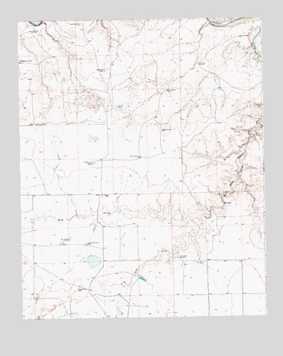
Blue Hole, NM USGS Topographic Map
Click on map above to begin viewing in our Map Viewer.

This topographic map contains these locations and features:
Feature Name Type Latitude Longitude GNIS ID View Map
05407 Water WellWellN35.3003°W103.2050°928227View Map
05411 Water WellWellN35.2723°W103.2416°927799View Map
05412 Water WellWellN35.2798°W103.2133°927802View Map
05413 Water WellWellN35.2745°W103.1950°927801View Map
05426 Water WellWellN35.2728°W103.1672°927800View Map
05427 Water WellWellN35.2803°W103.1361°927803View Map
05428 Water WellWellN35.2839°W103.1294°927804View Map
05433 Water WellWellN35.2670°W103.1538°927423View Map
05516 Water WellWellN35.3687°W103.2400°927807View Map
05517 Water WellWellN35.3717°W103.2158°927808View Map
05519 Water WellWellN35.3434°W103.1713°927417View Map
05520 Water WellWellN35.3267°W103.1744°927414View Map
05523 Water WellWellN35.3656°W103.1344°927806View Map
05525 Water WellWellN35.3537°W103.1549°927805View Map
05527 Water WellWellN35.3287°W103.1455°927415View Map
05528 Water WellWellN35.3287°W103.1455°927416View Map
05529 Water WellWellN35.3267°W103.1744°928228View Map
Blue HoleSpringN35.2973°W103.1461°886515View Map
Collins RanchLocaleN35.3014°W103.2077°887746View Map
Cooper-Trew RanchLocaleN35.2628°W103.2208°887820View Map
DourghertyLocaleN35.2751°W103.1344°930448View Map
East Side TankReservoirN35.3539°W103.2059°888697View Map
Frost CreekStreamN35.2903°W103.1625°889250View Map
Granny WindmillLocaleN35.3317°W103.2416°889552View Map
Ivory WindmillLocaleN35.3734°W103.2186°890368View Map
Johnson WindmillLocaleN35.2834°W103.2277°890531View Map
Lackey WindmillLocaleN35.2814°W103.2155°890854View Map
Long Place WindmillLocaleN35.3706°W103.2430°923497View Map
Mesquital TankReservoirN35.3579°W103.2494°891905View Map
Middle WindmillLocaleN35.3284°W103.1769°892018View Map
New WindmillLocaleN35.3451°W103.1741°892523View Map
Northwest WindmillLocaleN35.3559°W103.1577°892750View Map
PharisLocaleN35.2770°W103.1533°930428View Map
Sand WindmillLocaleN35.3670°W103.1363°894543View Map
Second Trap WindmillLocaleN35.3156°W103.2155°894690View Map
Shaffer WindmillLocaleN35.3173°W103.1883°894745View Map
Southwest WindmillLocaleN35.2751°W103.1691°895211View Map

Note: Coordinates in the location and feature list above are referenced to NAD83 datum.


Copyright (C) 2008-2025 Ryan Niemi / Sunset Dynamics ... All Rights Reserved