TopoQuest Logo
Do you find TopoQuest useful?
Help keep TopoQuest running and adding new maps/features by donating!
Bitcoin:  19c7KJd3qBynnjoSw5npx9KScwjBe4ifkT
Litecoin:  LXs6TkuXGGXo1vDsWCkWVdjQX94eUKd6ui
Home View Maps Find Maps Find Places Resources & Links


Tuscocoillo Canyon, New Mexico Topographic Map

USGS Map Title: Tuscocoillo Canyon, NM
USGS Map MRC: 35103C3
DRG (GeoTIFF) Download: o35103c3.tif


Neighboring USGS Topographic Map Quads:


  Logan North, NM  
35103D4
 

  Logan NE, NM  
35103D3
 

  Cammak Camp, NM  
35103D2
 

  Logan South, NM  
35103C4
 

  Tuscocoillo Canyon, NM  
35103C3
 

  Blue Hole, NM  
35103C2
 

  San Jon NW, NM  
35103B4
 

  Porter, NM  
35103B3
 

  Bard, NM  
35103B2


Map MRC Location:

N36°
W104°
N36°
W103°
H8 H7 H6 H5 H4 H3 H2 H1
G8 G7 G6 G5 G4 G3 G2 G1
F8 F7 F6 F5 F4 F3 F2 F1
E8 E7 E6 E5 E4 E3 E2 E1
D8 D7 D6 D5 D4 D3 D2 D1
C8 C7 C6 C5 C4 C3 C2 C1
B8 B7 B6 B5 B4 B3 B2 B1
A8 A7 A6 A5 A4 A3 A2 A1
N35°
W104°
N35°
W103°

Tuscocoillo Canyon, NM USGS 1:24K Topographic Map Preview:
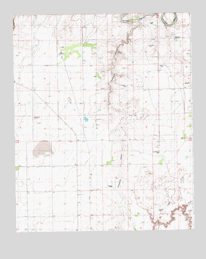
Tuscocoillo Canyon, NM USGS Topographic Map
Click on map above to begin viewing in our Map Viewer.

This topographic map contains these locations and features:
Feature Name Type Latitude Longitude GNIS ID View Map
05386 Water WellWellN35.3003°W103.2988°927587View Map
05387 Water WellWellN35.2878°W103.3066°928629View Map
05388 Water WellWellN35.2937°W103.2708°928631View Map
05391 Water WellWellN35.2867°W103.3716°928628View Map
05392 Water WellWellN35.2814°W103.3463°928626View Map
05393 Water WellWellN35.2859°W103.3000°928627View Map
05394 Water WellWellN35.2723°W103.3508°927584View Map
05395 Water WellWellN35.2723°W103.3508°927583View Map
05396 Water WellWellN35.2578°W103.3508°927582View Map
05397 Water WellWellN35.2506°W103.3327°927581View Map
05408 Water WellWellN35.2937°W103.2708°928630View Map
05409 Water WellWellN35.2723°W103.2625°927585View Map
05410 Water WellWellN35.2792°W103.2625°927586View Map
05511 Water WellWellN35.3553°W103.2777°928620View Map
05512 Water WellWellN35.3517°W103.3405°927592View Map
05513 Water WellWellN35.3323°W103.2938°927591View Map
05514 Water WellWellN35.3151°W103.3594°927590View Map
05515 Water WellWellN35.3142°W103.2972°927589View Map
05518 Water WellWellN35.3576°W103.2575°928621View Map
05521 Water WellWellN35.3014°W103.2541°927588View Map
Anniston (historical)Populated PlaceN35.3739°W103.3225°934280View Map
Anniston CemeteryCemeteryN35.2575°W103.3225°885767View Map
BrownLocaleN35.2501°W103.2933°930447View Map
Collins TankReservoirN35.3691°W103.2793°887747View Map
Cottonwood TankReservoirN35.3597°W103.2614°887944View Map
Cox RanchLocaleN35.3292°W103.3625°888001View Map
Ealen WindmillLocaleN35.3523°W103.3425°888627View Map
Hard Bottom TankReservoirN35.2949°W103.2736°889758View Map
Molyneaux RanchLocaleN35.2753°W103.3069°892149View Map
Red Hill TankReservoirN35.2617°W103.2748°893743View Map
Salt WellLocaleN35.3023°W103.2569°894368View Map
Smith WellLocaleN35.3328°W103.2958°894949View Map
South Woods WindmillLocaleN35.3156°W103.3608°895195View Map
Tuscocoillo CanyonValleyN35.3698°W103.2863°915910View Map
Wallin WellLocaleN35.3442°W103.2697°896220View Map
West WellLocaleN35.3556°W103.2800°896424View Map
Woods PlaceLocaleN35.3617°W103.3602°898614View Map

Note: Coordinates in the location and feature list above are referenced to NAD83 datum.


Copyright (C) 2008-2025 Ryan Niemi / Sunset Dynamics ... All Rights Reserved