TopoQuest Logo
Do you find TopoQuest useful?
Help keep TopoQuest running and adding new maps/features by donating!
Bitcoin:  19c7KJd3qBynnjoSw5npx9KScwjBe4ifkT
Litecoin:  LXs6TkuXGGXo1vDsWCkWVdjQX94eUKd6ui
Home View Maps Find Maps Find Places Resources & Links


Logan NE, New Mexico Topographic Map

USGS Map Title: Logan NE, NM
USGS Map MRC: 35103D3
DRG (GeoTIFF) Download: o35103d3.tif


Neighboring USGS Topographic Map Quads:


  McCarty Ranch, NM  
35103E4
 

  Lockney, NM  
35103E3
 

  Obar, NM  
35103E2
 

  Logan North, NM  
35103D4
 

  Logan NE, NM  
35103D3
 

  Cammak Camp, NM  
35103D2
 

  Logan South, NM  
35103C4
 

  Tuscocoillo Canyon, NM  
35103C3
 

  Blue Hole, NM  
35103C2


Map MRC Location:

N36°
W104°
N36°
W103°
H8 H7 H6 H5 H4 H3 H2 H1
G8 G7 G6 G5 G4 G3 G2 G1
F8 F7 F6 F5 F4 F3 F2 F1
E8 E7 E6 E5 E4 E3 E2 E1
D8 D7 D6 D5 D4 D3 D2 D1
C8 C7 C6 C5 C4 C3 C2 C1
B8 B7 B6 B5 B4 B3 B2 B1
A8 A7 A6 A5 A4 A3 A2 A1
N35°
W104°
N35°
W103°

Logan NE, NM USGS 1:24K Topographic Map Preview:
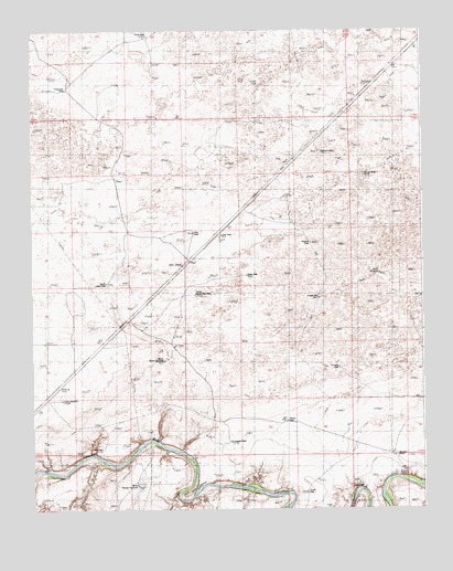
Logan NE, NM USGS Topographic Map
Click on map above to begin viewing in our Map Viewer.

This topographic map contains these locations and features:
Feature Name Type Latitude Longitude GNIS ID View Map
05235 Water WellWellN35.4664°W103.2800°935135View Map
05236 Water WellWellN35.4745°W103.3100°935136View Map
05237 Water WellWellN35.4587°W103.3163°935132View Map
05238 Water WellWellN35.4550°W103.2919°935131View Map
05239 Water WellWellN35.4123°W103.2863°935140View Map
05242 Water WellWellN35.3898°W103.3513°934650View Map
05244 Water WellWellN35.4342°W103.2619°934654View Map
05262 Water WellWellN35.4962°W103.3344°934658View Map
05263 Water WellWellN35.4862°W103.3452°934657View Map
05475 Water WellWellN35.4989°W103.3727°934659View Map
05488 Water WellWellN35.4662°W103.2661°935134View Map
05489 Water WellWellN35.4428°W103.2841°934656View Map
05490 Water WellWellN35.4345°W103.3044°934655View Map
05491 Water WellWellN35.4206°W103.3386°934651View Map
05492 Water WellWellN35.4295°W103.3208°934653View Map
05493 Water WellWellN35.4287°W103.2813°934652View Map
05494 Water WellWellN35.4125°W103.3311°935141View Map
05495 Water WellWellN35.3917°W103.3094°935137View Map
05497 Water WellWellN35.4595°W103.2661°935133View Map
Barnes WellLocaleN35.4623°W103.2680°923452View Map
Bunk Clay PlaceLocaleN35.4134°W103.3319°923455View Map
Canode (historical)Populated PlaceN35.4408°W103.3439°932839View Map
Canode Post Office (historical)Post OfficeN35.4408°W103.3439°937498View Map
Chalk WellLocaleN35.4356°W103.3055°923458View Map
Claer WellLocaleN35.3912°W103.3525°923459View Map
Clay WindmillLocaleN35.4037°W103.3644°923460View Map
Congdon WellLocaleN35.3923°W103.3113°923461View Map
East WellLocaleN35.4467°W103.3227°923471View Map
Garrison WellLocaleN35.4678°W103.2813°923478View Map
Hadden RanchLocaleN35.3756°W103.3169°923481View Map
Hughes WellLocaleN35.4442°W103.2855°923490View Map
Jones WellLocaleN35.3795°W103.2877°923491View Map
Knapp WellLocaleN35.4300°W103.2830°923492View Map
Litton WellWellN35.4467°W103.3147°923495View Map
MeeksLocaleN35.4200°W103.3625°930453View Map
Meeks RanchLocaleN35.4189°W103.3613°923503View Map
Morris WellLocaleN35.3975°W103.2933°923505View Map
North Bunk Clay WellLocaleN35.4306°W103.3216°923508View Map
North Woods WindmillLocaleN35.3812°W103.3413°923510View Map
PyleLocaleN35.3870°W103.2563°930426View Map
Pyle RanchLocaleN35.3889°W103.2600°923516View Map
RodewaldLocaleN35.4609°W103.3644°930418View Map
Rodewald RanchLocaleN35.4606°W103.3633°923522View Map
Rodewald WellLocaleN35.4850°W103.3619°923523View Map
Sand SpringsSpringN35.4387°W103.3266°920853View Map
Sand SpringsPopulated PlaceN35.4723°W103.2833°923525View Map
Sand Springs RanchLocaleN35.4989°W103.3738°894525View Map
Schneider RanchLocaleN35.4531°W103.2855°923526View Map
Shallow Well DrawValleyN35.4970°W103.3491°923527View Map
South Bunk Clay WellLocaleN35.4137°W103.3322°923530View Map
South Litton WellWellN35.4339°W103.3502°923531View Map
South WellLocaleN35.4987°W103.3363°923533View Map
South WindmillLocaleN35.4362°W103.2636°923534View Map
Stringer WellLocaleN35.4134°W103.2880°923536View Map

Note: Coordinates in the location and feature list above are referenced to NAD83 datum.


Copyright (C) 2008-2024 Ryan Niemi / Sunset Dynamics ... All Rights Reserved