TopoQuest Logo
Do you find TopoQuest useful?
Help keep TopoQuest running and adding new maps/features by donating!
Bitcoin:  19c7KJd3qBynnjoSw5npx9KScwjBe4ifkT
Litecoin:  LXs6TkuXGGXo1vDsWCkWVdjQX94eUKd6ui
Home View Maps Find Maps Find Places Resources & Links


Tiffin, Missouri Topographic Map

USGS Map Title: Tiffin, MO
USGS Map MRC: 37093H8
DRG (GeoTIFF) Download: o37093h8.tif


Neighboring USGS Topographic Map Quads:


  Rockville, MO  
38094A1
 

  Taberville, MO  
38093A8
 

  Monegaw Springs, MO  
38093A7
 

  El Dorado Springs North, MO  
37094H1
 

  Tiffin, MO  
37093H8
 

  Roscoe, MO  
37093H7
 

  El Dorado Springs South, MO  
37094G1
 

  Filley, MO  
37093G8
 

  Caplinger Mills, MO  
37093G7


Map MRC Location:

N38°
W94°
N38°
W93°
H8 H7 H6 H5 H4 H3 H2 H1
G8 G7 G6 G5 G4 G3 G2 G1
F8 F7 F6 F5 F4 F3 F2 F1
E8 E7 E6 E5 E4 E3 E2 E1
D8 D7 D6 D5 D4 D3 D2 D1
C8 C7 C6 C5 C4 C3 C2 C1
B8 B7 B6 B5 B4 B3 B2 B1
A8 A7 A6 A5 A4 A3 A2 A1
N37°
W94°
N37°
W93°

Tiffin, MO USGS 1:24K Topographic Map Preview:
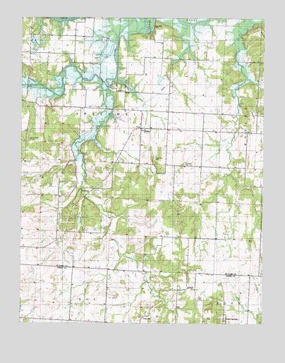
Tiffin, MO USGS Topographic Map
Click on map above to begin viewing in our Map Viewer.

This topographic map contains these locations and features:
Feature Name Type Latitude Longitude GNIS ID View Map
Arrarat School (historical)SchoolN37.9100°W93.9266°755698View Map
Blue Ridge School (historical)SchoolN37.9211°W93.9813°755791View Map
Bowling Green School (historical)SchoolN37.9164°W93.8763°755807View Map
Cedar Springs School (historical)SchoolN37.8792°W93.8938°746211View Map
Clear CreekStreamN37.9956°W93.9366°755899View Map
Coal HillPopulated PlaceN37.8784°W93.9335°740753View Map
Ebb (historical)Populated PlaceN37.9311°W93.8763°758129View Map
Ebb Post OfficePost OfficeN37.9311°W93.8763°759587View Map
Glendale School (historical)SchoolN37.9550°W93.8966°756108View Map
Graham School (historical)SchoolN37.9759°W93.9238°757203View Map
Horseshoe LakeLakeN37.9846°W93.9556°756192View Map
Kennerly CemeteryCemeteryN37.9400°W93.9155°756242View Map
Landers CemeteryCemeteryN37.9822°W93.9616°756280View Map
LebeckPopulated PlaceN37.8898°W93.9133°729917View Map
Light and Life Church CampLocaleN37.9509°W93.9961°758177View Map
Little Clear CreekStreamN37.9711°W93.9558°756307View Map
Oyer HillSummitN37.9606°W93.8816°756492View Map
PapePopulated PlaceN37.9711°W93.9508°757202View Map
Pape ChurchChurchN37.9703°W93.9505°756500View Map
Preston CemeteryCemeteryN37.8850°W93.9063°724918View Map
Rock House BluffCliffN37.9961°W93.9322°756601View Map
Ruark School (historical)SchoolN37.9928°W93.9769°756618View Map
Snyder School (historical)SchoolN37.9628°W93.9741°756738View Map
Speedwell ChurchChurchN37.9289°W93.9655°758176View Map
TiffinPopulated PlaceN37.9550°W93.9383°756795View Map
Township of East Speedwell (historical)CivilN37.9509°W93.9463°767593View Map
Township of SpeedwellCivilN37.9525°W93.9821°767321View Map
Union Point CemeteryCemeteryN37.9425°W93.9313°756823View Map
Union Point School (historical)SchoolN37.9395°W93.9258°756824View Map

Note: Coordinates in the location and feature list above are referenced to NAD83 datum.


Copyright (C) 2008-2025 Ryan Niemi / Sunset Dynamics ... All Rights Reserved