TopoQuest Logo
Do you find TopoQuest useful?
Help keep TopoQuest running and adding new maps/features by donating!
Bitcoin:  19c7KJd3qBynnjoSw5npx9KScwjBe4ifkT
Litecoin:  LXs6TkuXGGXo1vDsWCkWVdjQX94eUKd6ui
Home View Maps Find Maps Find Places Resources & Links


El Dorado Springs South, Missouri Topographic Map

USGS Map Title: El Dorado Springs South, MO
USGS Map MRC: 37094G1
DRG (GeoTIFF) Download: o37094g1.tif


Neighboring USGS Topographic Map Quads:


  Harwood, MO  
37094H2
 

  El Dorado Springs North, MO  
37094H1
 

  Tiffin, MO  
37093H8
 

  Dederick, MO  
37094G2
 

  El Dorado Springs South, MO  
37094G1
 

  Filley, MO  
37093G8
 

  Bellamy, MO  
37094F2
 

  Montevallo, MO  
37094F1
 

  Wagoner, MO  
37093F8


Map MRC Location:

N38°
W95°
N38°
W94°
H8 H7 H6 H5 H4 H3 H2 H1
G8 G7 G6 G5 G4 G3 G2 G1
F8 F7 F6 F5 F4 F3 F2 F1
E8 E7 E6 E5 E4 E3 E2 E1
D8 D7 D6 D5 D4 D3 D2 D1
C8 C7 C6 C5 C4 C3 C2 C1
B8 B7 B6 B5 B4 B3 B2 B1
A8 A7 A6 A5 A4 A3 A2 A1
N37°
W95°
N37°
W94°

El Dorado Springs South, MO USGS 1:24K Topographic Map Preview:
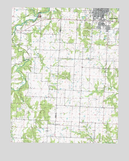
El Dorado Springs South, MO USGS Topographic Map
Click on map above to begin viewing in our Map Viewer.

This topographic map contains these locations and features:
Feature Name Type Latitude Longitude GNIS ID View Map
Assembly of God ChurchChurchN37.8603°W94.0202°748278View Map
Baker CreekStreamN37.7575°W94.0338°748494View Map
Bethel Free Will Baptist ChurchChurchN37.8617°W94.0166°748279View Map
Cedar County Memorial HospitalHospitalN37.8603°W94.0174°748281View Map
City of El Dorado SpringsCivilN37.8694°W94.0196°2394631View Map
Clintonville CemeteryCemeteryN37.8492°W94.0133°748496View Map
Clintonville School (historical)SchoolN37.8556°W94.0077°748497View Map
El Dorado Springs Elementary SchoolSchoolN37.8665°W94.0190°748287View Map
El Dorado Springs High SchoolSchoolN37.8686°W94.0188°748288View Map
El Dorado Springs Middle SchoolSchoolN37.8674°W94.0189°2710755View Map
El Dorado Springs Police DepartmentBuildingN37.8642°W94.0219°2752178View Map
El Dorado Springs Post OfficePost OfficeN37.8746°W94.0214°2779438View Map
El Dorado Springs Volunteer Fire DepartmentBuildingN37.8643°W94.0219°2620386View Map
El Dorado Springs Volunteer Fire Department Rural StationBuildingN37.8709°W94.0309°2621591View Map
First Baptist ChurchChurchN37.8731°W94.0230°748282View Map
Fly Creek School (historical)SchoolN37.8584°W94.0917°748502View Map
Holiness Church of GodChurchN37.8570°W94.0186°748277View Map
Keck School (historical)SchoolN37.8320°W94.0899°748505View Map
Kelley BridgeBridgeN37.8256°W94.1091°755246View Map
KESM-AM (Eldorado Springs)TowerN37.8642°W94.0152°759281View Map
KESM-FM (Eldorado Springs)TowerN37.8642°W94.0152°754252View Map
Land O'Lakes FairgroundParkN37.8445°W94.0066°748283View Map
Liberty Hall School (historical)SchoolN37.7978°W94.0436°748508View Map
Melton CreekStreamN37.8692°W94.0941°748514View Map
Missouri Department of Conservation Forestry Kansas City Regional Field Fire Office Eldorado SpringsBuildingN37.8650°W94.0218°2620700View Map
Mount Pleasant CemeteryCemeteryN37.8503°W94.1083°748517View Map
Mulberry CreekStreamN37.7984°W94.1172°748519View Map
Nine Wonders School (historical)SchoolN37.8606°W94.0480°748520View Map
Number 636 DamDamN37.8617°W94.1086°763185View Map
Oak Grove School (historical)SchoolN37.7720°W94.1183°748522View Map
Park Street Christian ChurchChurchN37.8609°W94.0177°748280View Map
Pashaw (historical)Populated PlaceN37.8398°W94.0927°748539View Map
Pleasant Valley School (historical)SchoolN37.8069°W94.0900°748525View Map
Reece CemeteryCemeteryN37.8009°W94.0194°748528View Map
Sulphur Springs Baptist ChurchChurchN37.8536°W94.1105°758450View Map
Union ChurchChurchN37.7673°W94.0727°748285View Map
Union Hall ChurchChurchN37.8273°W94.0344°748531View Map
Union Hall School (historical)SchoolN37.8270°W94.0413°748532View Map
Virgil CityPopulated PlaceN37.7664°W94.0727°748534View Map
Virgil City CemeteryCemeteryN37.7609°W94.0830°748286View Map
Virgil City School (historical)SchoolN37.7675°W94.0741°748540View Map
Warkins CemeteryCemeteryN37.8148°W94.1045°2572611View Map
West Fork Clear CreekStreamN37.8523°W94.1222°748492View Map
White Hall Church (historical)ChurchN37.7684°W94.0263°748536View Map
White Hall School (historical)SchoolN37.7695°W94.0413°748537View Map
Whitehall CemeteryCemeteryN37.7686°W94.0408°748284View Map

Note: Coordinates in the location and feature list above are referenced to NAD83 datum.


Copyright (C) 2008-2024 Ryan Niemi / Sunset Dynamics ... All Rights Reserved