TopoQuest Logo
Do you find TopoQuest useful?
Help keep TopoQuest running and adding new maps/features by donating!
Bitcoin:  19c7KJd3qBynnjoSw5npx9KScwjBe4ifkT
Litecoin:  LXs6TkuXGGXo1vDsWCkWVdjQX94eUKd6ui
Home View Maps Find Maps Find Places Resources & Links


Tilton, Arkansas Topographic Map

USGS Map Title: Tilton, AR
USGS Map MRC: 35091C1
DRG (GeoTIFF) Download: o35091c1.tif


Neighboring USGS Topographic Map Quads:


  Tupelo, AR  
35091D2
 

  Beedeville, AR  
35091D1
 

  Hickory Ridge, AR  
35090D8
 

  McCrory, AR  
35091C2
 

  Tilton, AR  
35091C1
 

  Central, AR  
35090C8
 

  Grays, AR  
35091B2
 

  Fair Oaks, AR  
35091B1
 

  Hamlin, AR  
35090B8


Map MRC Location:

N36°
W92°
N36°
W91°
H8 H7 H6 H5 H4 H3 H2 H1
G8 G7 G6 G5 G4 G3 G2 G1
F8 F7 F6 F5 F4 F3 F2 F1
E8 E7 E6 E5 E4 E3 E2 E1
D8 D7 D6 D5 D4 D3 D2 D1
C8 C7 C6 C5 C4 C3 C2 C1
B8 B7 B6 B5 B4 B3 B2 B1
A8 A7 A6 A5 A4 A3 A2 A1
N35°
W92°
N35°
W91°

Tilton, AR USGS 1:24K Topographic Map Preview:
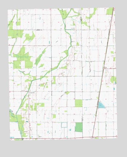
Tilton, AR USGS Topographic Map
Click on map above to begin viewing in our Map Viewer.

This topographic map contains these locations and features:
Feature Name Type Latitude Longitude GNIS ID View Map
Aberdeen (historical)Populated PlaceN35.3612°W91.0048°61625View Map
Ball ChurchChurchN35.2959°W91.1073°46055View Map
Church of GodChurchN35.2968°W91.1107°78117View Map
Duffy School (historical)SchoolN35.3401°W91.0848°82772View Map
MortonPopulated PlaceN35.2512°W91.0935°77696View Map
Morton CemeteryCemeteryN35.2590°W91.1062°52228View Map
Mount Carmel ChurchChurchN35.3437°W91.0757°52279View Map
Pea RidgeRidgeN35.2648°W91.1043°53241View Map
Pumpkin BendPopulated PlaceN35.2965°W91.1023°59326View Map
Pumpkin Bend CemeteryCemeteryN35.2970°W91.1007°53840View Map
Pumpkin Bend SchoolSchoolN35.2973°W91.1090°53841View Map
Sailor Harris RidgeRidgeN35.3459°W91.0885°54305View Map
Straight LakeLakeN35.3320°W91.1110°59327View Map
TiltonPopulated PlaceN35.3173°W91.0140°78558View Map
Tilton Methodist ChurchChurchN35.3165°W91.0093°61668View Map
Township of Pumpkin BendCivilN35.2985°W91.0857°69866View Map
Wrape (historical)Populated PlaceN35.2718°W91.0248°61676View Map
Wrapes Spur (historical)LocaleN35.2879°W91.0210°82790View Map

Note: Coordinates in the location and feature list above are referenced to NAD83 datum.


Copyright (C) 2008-2024 Ryan Niemi / Sunset Dynamics ... All Rights Reserved