TopoQuest Logo
Do you find TopoQuest useful?
Help keep TopoQuest running and adding new maps/features by donating!
Bitcoin:  19c7KJd3qBynnjoSw5npx9KScwjBe4ifkT
Litecoin:  LXs6TkuXGGXo1vDsWCkWVdjQX94eUKd6ui
Home View Maps Find Maps Find Places Resources & Links


Beedeville, Arkansas Topographic Map

USGS Map Title: Beedeville, AR
USGS Map MRC: 35091D1
DRG (GeoTIFF) Download: o35091d1.tif


Neighboring USGS Topographic Map Quads:


  Auvergne, AR  
35091E2
 

  Amagon, AR  
35091E1
 

  Weiner, AR  
35090E8
 

  Tupelo, AR  
35091D2
 

  Beedeville, AR  
35091D1
 

  Hickory Ridge, AR  
35090D8
 

  McCrory, AR  
35091C2
 

  Tilton, AR  
35091C1
 

  Central, AR  
35090C8


Map MRC Location:

N36°
W92°
N36°
W91°
H8 H7 H6 H5 H4 H3 H2 H1
G8 G7 G6 G5 G4 G3 G2 G1
F8 F7 F6 F5 F4 F3 F2 F1
E8 E7 E6 E5 E4 E3 E2 E1
D8 D7 D6 D5 D4 D3 D2 D1
C8 C7 C6 C5 C4 C3 C2 C1
B8 B7 B6 B5 B4 B3 B2 B1
A8 A7 A6 A5 A4 A3 A2 A1
N35°
W92°
N35°
W91°

Beedeville, AR USGS 1:24K Topographic Map Preview:
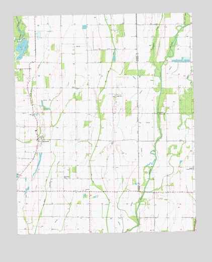
Beedeville, AR USGS Topographic Map
Click on map above to begin viewing in our Map Viewer.

This topographic map contains these locations and features:
Feature Name Type Latitude Longitude GNIS ID View Map
BeedevillePopulated PlaceN35.4290°W91.1098°46335View Map
Beedeville Church (historical)ChurchN35.4437°W91.1121°59257View Map
Beedeville Post OfficePost OfficeN35.4288°W91.1100°2781834View Map
Citizenship ChurchChurchN35.3990°W91.0768°47790View Map
Citizenship School (historical)SchoolN35.3990°W91.0746°82729View Map
Cow Lake (historical)Populated PlaceN35.4579°W91.0571°61810View Map
Cow Lake Church (historical)ChurchN35.4584°W91.0571°59260View Map
Cow Lake DitchCanalN35.4706°W91.0576°48120View Map
Dale CemeteryCemeteryN35.4465°W91.0566°59261View Map
Eight Mile CemeteryCemeteryN35.4435°W91.1116°48828View Map
Eight Mile Fire Department StationBuildingN35.4259°W91.1096°2116393View Map
Eight Mile Fire Department Station - Storage GarageBuildingN35.4273°W91.1094°2116394View Map
Eightmile (historical)Populated PlaceN35.4492°W91.1132°82831View Map
Givens CemeteryCemeteryN35.4154°W91.0445°59264View Map
Jones CemeteryCemeteryN35.4270°W91.0571°50727View Map
Love Chapel (historical)ChurchN35.4273°W91.0560°59266View Map
May Branch LateralCanalN35.3804°W91.1112°51752View Map
McFaddenPopulated PlaceN35.4065°W91.0921°57109View Map
Old Forked SloughStreamN35.4351°W91.0096°52996View Map
Proctor School (historical)SchoolN35.4062°W91.0751°82732View Map
Threemile CreekStreamN35.4670°W91.0226°78554View Map
Town of BeedevilleCivilN35.4285°W91.1113°2405227View Map
Township of Cow LakeCivilN35.4167°W91.0970°66723View Map
Walker CemeteryCemeteryN35.4534°W91.0546°55955View Map

Note: Coordinates in the location and feature list above are referenced to NAD83 datum.


Copyright (C) 2008-2024 Ryan Niemi / Sunset Dynamics ... All Rights Reserved