TopoQuest Logo
Do you find TopoQuest useful?
Help keep TopoQuest running and adding new maps/features by donating!
Bitcoin:  19c7KJd3qBynnjoSw5npx9KScwjBe4ifkT
Litecoin:  LXs6TkuXGGXo1vDsWCkWVdjQX94eUKd6ui
Home View Maps Find Maps Find Places Resources & Links


Hickory Ridge, Arkansas Topographic Map

USGS Map Title: Hickory Ridge, AR
USGS Map MRC: 35090D8
DRG (GeoTIFF) Download: o35090d8.tif


Neighboring USGS Topographic Map Quads:


  Amagon, AR  
35091E1
 

  Weiner, AR  
35090E8
 

  Powers Slough, AR  
35090E7
 

  Beedeville, AR  
35091D1
 

  Hickory Ridge, AR  
35090D8
 

  Cherry Valley West, AR  
35090D7
 

  Tilton, AR  
35091C1
 

  Central, AR  
35090C8
 

  Vanndale, AR  
35090C7


Map MRC Location:

N36°
W91°
N36°
W90°
H8 H7 H6 H5 H4 H3 H2 H1
G8 G7 G6 G5 G4 G3 G2 G1
F8 F7 F6 F5 F4 F3 F2 F1
E8 E7 E6 E5 E4 E3 E2 E1
D8 D7 D6 D5 D4 D3 D2 D1
C8 C7 C6 C5 C4 C3 C2 C1
B8 B7 B6 B5 B4 B3 B2 B1
A8 A7 A6 A5 A4 A3 A2 A1
N35°
W91°
N35°
W90°

Hickory Ridge, AR USGS 1:24K Topographic Map Preview:
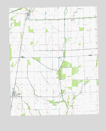
Hickory Ridge, AR USGS Topographic Map
Click on map above to begin viewing in our Map Viewer.

This topographic map contains these locations and features:
Feature Name Type Latitude Longitude GNIS ID View Map
Bale Brown BranchStreamN35.4906°W90.9221°46052View Map
Brushey LakePopulated PlaceN35.4859°W90.9135°57454View Map
Bushy Creek DitchCanalN35.4251°W90.9293°47068View Map
Caney CreekStreamN35.3848°W90.9162°47414View Map
City of FisherCivilN35.4913°W90.9726°2403611View Map
City of Hickory RidgeCivilN35.4026°W90.9943°2404695View Map
Cooper PondReservoirN35.4037°W90.9798°74757View Map
Ditch Number 15CanalN35.4876°W90.8873°82091View Map
FisherPopulated PlaceN35.4915°W90.9743°57752View Map
Fisher Volunteer Fire DepartmentBuildingN35.4919°W90.9735°2116430View Map
Gum SloughStreamN35.3904°W90.9401°49725View Map
Hickory RidgePopulated PlaceN35.3973°W90.9965°77174View Map
Hickory Ridge Elementary SchoolSchoolN35.3993°W90.9937°61655View Map
Hickory Ridge High School (historical)SchoolN35.3993°W90.9937°61656View Map
Hickory Ridge Post OfficePost OfficeN35.4017°W90.9952°2781860View Map
Hickory Ridge Volunteer Fire StationBuildingN35.4020°W90.9963°2116561View Map
McCoy DitchCanalN35.4506°W90.9043°51807View Map
One Mile BranchStreamN35.4417°W90.9023°53051View Map
Overcup CreekStreamN35.3923°W90.9251°53097View Map
PittingerPopulated PlaceN35.4423°W90.9865°58395View Map
Township of Hickory RidgeCivilN35.3985°W90.9593°66476View Map
Twomile CreekStreamN35.4187°W90.9298°78607View Map
Wyatts CemeteryCemeteryN35.4784°W90.9187°56568View Map

Note: Coordinates in the location and feature list above are referenced to NAD83 datum.


Copyright (C) 2008-2025 Ryan Niemi / Sunset Dynamics ... All Rights Reserved