TopoQuest Logo
Do you find TopoQuest useful?
Help keep TopoQuest running and adding new maps/features by donating!
Bitcoin:  19c7KJd3qBynnjoSw5npx9KScwjBe4ifkT
Litecoin:  LXs6TkuXGGXo1vDsWCkWVdjQX94eUKd6ui
Home View Maps Find Maps Find Places Resources & Links


Timothy Lake, Oregon Topographic Map

USGS Map Title: Timothy Lake, OR
USGS Map MRC: 45121A7
DRG (GeoTIFF) Download: o45121a7.tif


Neighboring USGS Topographic Map Quads:


  High Rock, OR  
45121B8
 

  Wolf Peak, OR  
45121B7
 

  Wapinitia Pass, OR  
45121B6
 

  Mount Mitchell, OR  
45121A8
 

  Timothy Lake, OR  
45121A7
 

  Mount Wilson, OR  
45121A6
 

  Mount Lowe, OR  
44121H8
 

  Pinhead Buttes, OR  
44121H7
 

  Fort Butte, OR  
44121H6


Map MRC Location:

N46°
W122°
N46°
W121°
H8 H7 H6 H5 H4 H3 H2 H1
G8 G7 G6 G5 G4 G3 G2 G1
F8 F7 F6 F5 F4 F3 F2 F1
E8 E7 E6 E5 E4 E3 E2 E1
D8 D7 D6 D5 D4 D3 D2 D1
C8 C7 C6 C5 C4 C3 C2 C1
B8 B7 B6 B5 B4 B3 B2 B1
A8 A7 A6 A5 A4 A3 A2 A1
N45°
W122°
N45°
W121°

Timothy Lake, OR USGS 1:24K Topographic Map Preview:
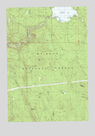
Timothy Lake, OR USGS Topographic Map
Click on map above to begin viewing in our Map Viewer.

This topographic map contains these locations and features:
Feature Name Type Latitude Longitude GNIS ID View Map
Alligator QuarryMineN45.1059°W121.8240°2754424View Map
Anvil CreekStreamN45.1126°W121.8151°1137268View Map
Aquarius SpringSpringN45.1096°W121.8095°1154935View Map
Buck CreekStreamN45.1010°W121.8420°1138777View Map
Buck Creek QuarryMineN45.0960°W121.8682°2754426View Map
Buck LakeLakeN45.1108°W121.8722°1138796View Map
Chief CreekStreamN45.0610°W121.8642°1135104View Map
Cove Recreation SiteLocaleN45.1082°W121.7829°1926231View Map
Dinger CreekStreamN45.1226°W121.8076°1141035View Map
Dry Creek SpringSpringN45.0262°W121.7574°1141322View Map
Fire SpringSpringN45.0073°W121.8632°1142127View Map
Gemini QuarriesMineN45.0999°W121.8428°2754423View Map
Gone Creek Boat LaunchLocaleN45.1133°W121.7756°2699397View Map
Gone Creek Recreation SiteLocaleN45.1129°W121.7776°1142843View Map
Hood View Recreation SiteLocaleN45.1115°W121.8017°1143709View Map
Hoodview Campground Boat LaunchLocaleN45.1081°W121.7914°2699464View Map
Oak Fork Boat LaunchLocaleN45.1160°W121.7715°2699657View Map
Oak Fork Recreation SiteLocaleN45.1151°W121.7706°1156858View Map
Peavine MountainSummitN45.0140°W121.8365°1147543View Map
Peavine SpringSpringN45.0299°W121.8271°1147546View Map
Pine Point Boat LaunchLocaleN45.1141°W121.8023°2699713View Map
Pine Point Recreation SiteLocaleN45.1123°W121.8067°1156859View Map
Rimtie QuarryMineN45.0797°W121.8547°2754425View Map
Rock ButteSummitN45.0671°W121.8254°1148561View Map
Rock SpringSpringN45.0313°W121.8149°1148639View Map
Rock Springs TrailTrailN45.0565°W121.7992°1148640View Map
Sheep SpringSpringN45.0277°W121.8252°1149360View Map
Skyline Alternate TrailTrailN45.0773°W121.7851°1149651View Map
Snive CreekStreamN45.0590°W121.8534°1135103View Map
Stone CreekStreamN45.1062°W121.8184°1150445View Map
Stone Creek Gravel PitMineN45.0567°W121.8017°2754427View Map
Summit LakeLakeN45.0315°W121.7880°1150623View Map
Summit Lake Recreation SiteLocaleN45.0318°W121.7901°1156510View Map
Summit Lake TrailTrailN45.0151°W121.7817°1150625View Map
Timothy LakeReservoirN45.1210°W121.7857°1151253View Map
Timothy Lake DamDamN45.1137°W121.8063°1155665View Map
Timothy Meadows (historical)FlatN45.1165°W121.7845°1159035View Map
Warm Springs Meadow TrailTrailN45.0223°W121.8237°1151901View Map

Note: Coordinates in the location and feature list above are referenced to NAD83 datum.


Copyright (C) 2008-2025 Ryan Niemi / Sunset Dynamics ... All Rights Reserved