TopoQuest Logo
Do you find TopoQuest useful?
Help keep TopoQuest running and adding new maps/features by donating!
Bitcoin:  19c7KJd3qBynnjoSw5npx9KScwjBe4ifkT
Litecoin:  LXs6TkuXGGXo1vDsWCkWVdjQX94eUKd6ui
Home View Maps Find Maps Find Places Resources & Links


Mount Lowe, Oregon Topographic Map

USGS Map Title: Mount Lowe, OR
USGS Map MRC: 44121H8
DRG (GeoTIFF) Download: o44121h8.tif


Neighboring USGS Topographic Map Quads:


  Fish Creek Mountain, OR  
45122A1
 

  Mount Mitchell, OR  
45121A8
 

  Timothy Lake, OR  
45121A7
 

  Bull of the Woods, OR  
44122H1
 

  Mount Lowe, OR  
44121H8
 

  Pinhead Buttes, OR  
44121H7
 

  Mother Lode Mountain, OR  
44122G1
 

  Breitenbush Hot Springs, OR  
44121G8
 

  Olallie Butte, OR  
44121G7


Map MRC Location:

N45°
W122°
N45°
W121°
H8 H7 H6 H5 H4 H3 H2 H1
G8 G7 G6 G5 G4 G3 G2 G1
F8 F7 F6 F5 F4 F3 F2 F1
E8 E7 E6 E5 E4 E3 E2 E1
D8 D7 D6 D5 D4 D3 D2 D1
C8 C7 C6 C5 C4 C3 C2 C1
B8 B7 B6 B5 B4 B3 B2 B1
A8 A7 A6 A5 A4 A3 A2 A1
N44°
W122°
N44°
W121°

Mount Lowe, OR USGS 1:24K Topographic Map Preview:
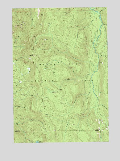
Mount Lowe, OR USGS Topographic Map
Click on map above to begin viewing in our Map Viewer.

This topographic map contains these locations and features:
Feature Name Type Latitude Longitude GNIS ID View Map
Beaver Dam QuarryMineN44.9190°W121.9876°2754442View Map
Bob MeadowFlatN44.9429°W121.9790°1138368View Map
Bonner CreekStreamN44.9821°W121.8798°1138421View Map
Burnt GraniteSummitN44.9929°W121.9587°1138993View Map
Campbell CreekStreamN44.9945°W121.8867°1154273View Map
Cub CreekStreamN44.9057°W121.8915°1140524View Map
Cul de sac QuarryMineN44.9635°W121.9973°2754437View Map
Eds MeadowFlatN44.8921°W121.9215°1141685View Map
Fadeaway SpringSpringN44.9247°W121.9425°1120552View Map
Fawn CreekStreamN44.9321°W121.8967°1142039View Map
Fawn MeadowFlatN44.9007°W121.9562°1142047View Map
Fawn Meadow PitMineN44.9040°W121.9668°2754441View Map
Graham PassGapN44.9157°W121.9584°1142902View Map
Hunter Camp WayTrailN44.8757°W121.9270°1143927View Map
Hunter CreekStreamN44.9148°W121.8884°1143932View Map
Hunter Creek TrailTrailN44.8804°W121.9040°1143934View Map
Hunter PitMineN44.9200°W121.9066°2754439View Map
Jim MeadowFlatN44.9460°W121.9592°1144278View Map
June Creek PitMineN44.9950°W121.9301°2754435View Map
Kansas CreekStreamN44.9979°W121.8951°1144485View Map
Lacy PitMineN44.9007°W121.9097°2754440View Map
Last CreekStreamN44.9715°W121.8762°1144851View Map
Lowe CreekStreamN44.9451°W121.8879°1145595View Map
Lowe Creek PitMineN44.9704°W121.9585°2754436View Map
Lowe Creek TrailTrailN44.9410°W121.9290°1158340View Map
Marion QuarryMineN44.8861°W121.9471°2754443View Map
Mount LoweSummitN44.9560°W121.9729°1145597View Map
Ochre CreekStreamN44.9215°W121.9967°1147152View Map
Pinhead CreekStreamN44.9835°W121.8806°1147740View Map
Rho Ridge ShelterLocaleN44.9226°W121.9590°1155897View Map
Rhododendron CreekStreamN44.9373°W121.8942°1148409View Map
Rhododendron MeadowFlatN44.9187°W121.9456°1148410View Map
Rhododendron RidgeRidgeN44.9079°W121.9556°1148411View Map
Rhododendron Ridge ShelterLocaleN44.9237°W121.9562°1148401View Map
Rhododendron Ridge TrailTrailN44.9507°W121.9715°1148402View Map
Round CreekStreamN44.8787°W121.9854°1148764View Map
Round LakeLakeN44.8754°W121.9703°1148769View Map
Round Lake Recreation SiteLocaleN44.8762°W121.9690°1167380View Map
Saddle SpringsSpringN44.9730°W121.9739°1148916View Map
Sisi CreekStreamN44.9118°W121.8887°1149543View Map
Squirrel QuarryMineN44.8945°W121.8851°2754444View Map
Tarzan SpringsSpringN44.9847°W121.9519°1150901View Map
Tumble CreekStreamN44.9351°W121.9156°1151500View Map
Wall CreekStreamN44.9551°W121.8859°1151845View Map
Wall QuarryMineN44.9479°W121.8833°2754438View Map

Note: Coordinates in the location and feature list above are referenced to NAD83 datum.


Copyright (C) 2008-2024 Ryan Niemi / Sunset Dynamics ... All Rights Reserved