TopoQuest Logo
Do you find TopoQuest useful?
Help keep TopoQuest running and adding new maps/features by donating!
Bitcoin:  19c7KJd3qBynnjoSw5npx9KScwjBe4ifkT
Litecoin:  LXs6TkuXGGXo1vDsWCkWVdjQX94eUKd6ui
Home View Maps Find Maps Find Places Resources & Links


Blue Lake, Washington Topographic Map

USGS Map Title: Blue Lake, WA
USGS Map MRC: 46121D6
DRG (GeoTIFF) Download: o46121d6.tif


Neighboring USGS Topographic Map Quads:


  Purcell Mountain, WA  
46121E7
 

  Packwood, WA  
46121E6
 

  Packwood Lake, WA  
46121E5
 

  Tower Rock, WA  
46121D7
 

  Blue Lake, WA  
46121D6
 

  Hamilton Buttes, WA  
46121D5
 

  McCoy Peak, WA  
46121C7
 

  East Canyon Ridge, WA  
46121C6
 

  Green Mountain, WA  
46121C5


Map MRC Location:

N47°
W122°
N47°
W121°
H8 H7 H6 H5 H4 H3 H2 H1
G8 G7 G6 G5 G4 G3 G2 G1
F8 F7 F6 F5 F4 F3 F2 F1
E8 E7 E6 E5 E4 E3 E2 E1
D8 D7 D6 D5 D4 D3 D2 D1
C8 C7 C6 C5 C4 C3 C2 C1
B8 B7 B6 B5 B4 B3 B2 B1
A8 A7 A6 A5 A4 A3 A2 A1
N46°
W122°
N46°
W121°

Blue Lake, WA USGS 1:24K Topographic Map Preview:
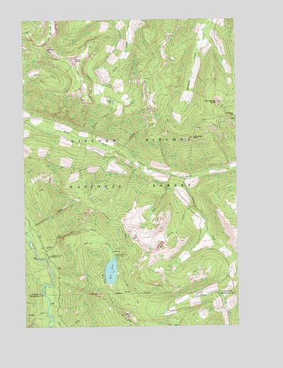
Blue Lake, WA USGS Topographic Map
Click on map above to begin viewing in our Map Viewer.

This topographic map contains these locations and features:
Feature Name Type Latitude Longitude GNIS ID View Map
Blue LakeLakeN46.3974°W121.7006°1516691View Map
Blue Lake Camp Picnic AreaLocaleN46.4040°W121.6981°1516702View Map
Blue Lake CreekStreamN46.4040°W121.7443°1516703View Map
Blue Lake Creek CampgroundLocaleN46.4037°W121.7359°1516704View Map
Blue Lake RidgeRidgeN46.3787°W121.6920°1516705View Map
Castle ButteSummitN46.4840°W121.7206°1517464View Map
Cold Springs ButteSummitN46.4659°W121.6365°1517938View Map
Cozy RidgeRidgeN46.4142°W121.6265°2090070View Map
Grouse CreekStreamN46.4237°W121.6515°1520381View Map
Horseshoe PointSummitN46.4515°W121.6515°1520968View Map
Jackpot CreekStreamN46.4509°W121.7109°1521305View Map
Jackpot LakeLakeN46.4666°W121.6984°1521306View Map
Juniper CreekStreamN46.3807°W121.7384°1521529View Map
Klickitat TrailTrailN46.4826°W121.7481°1521729View Map
Preacher CreekStreamN46.4403°W121.6828°2516399View Map
Robber CreekStreamN46.4133°W121.6439°2516401View Map
Saint Michael LakeLakeN46.4612°W121.6253°1525372View Map
Siwash CreekStreamN46.4462°W121.6945°1525835View Map
Timonium CreekStreamN46.4351°W121.6562°1527240View Map
Twin CreekStreamN46.3779°W121.7348°1527523View Map
Twin SistersSummitN46.4871°W121.7359°1527558View Map
Yozoo CreekStreamN46.4371°W121.6643°1528372View Map

Note: Coordinates in the location and feature list above are referenced to NAD83 datum.


Copyright (C) 2008-2025 Ryan Niemi / Sunset Dynamics ... All Rights Reserved