TopoQuest Logo
Do you find TopoQuest useful?
Help keep TopoQuest running and adding new maps/features by donating!
Bitcoin:  19c7KJd3qBynnjoSw5npx9KScwjBe4ifkT
Litecoin:  LXs6TkuXGGXo1vDsWCkWVdjQX94eUKd6ui
Home View Maps Find Maps Find Places Resources & Links


Green Mountain, Washington Topographic Map

USGS Map Title: Green Mountain, WA
USGS Map MRC: 46121C5
DRG (GeoTIFF) Download: o46121c5.tif


Neighboring USGS Topographic Map Quads:


  Blue Lake, WA  
46121D6
 

  Hamilton Buttes, WA  
46121D5
 

  Walupt Lake, WA  
46121D4
 

  East Canyon Ridge, WA  
46121C6
 

  Green Mountain, WA  
46121C5
 

  Glaciate Butte, WA  
46121C4
 

  Steamboat Mountain, WA  
46121B6
 

  Mount Adams West, WA  
46121B5
 

  Mount Adams East, WA  
46121B4


Map MRC Location:

N47°
W122°
N47°
W121°
H8 H7 H6 H5 H4 H3 H2 H1
G8 G7 G6 G5 G4 G3 G2 G1
F8 F7 F6 F5 F4 F3 F2 F1
E8 E7 E6 E5 E4 E3 E2 E1
D8 D7 D6 D5 D4 D3 D2 D1
C8 C7 C6 C5 C4 C3 C2 C1
B8 B7 B6 B5 B4 B3 B2 B1
A8 A7 A6 A5 A4 A3 A2 A1
N46°
W122°
N46°
W121°

Green Mountain, WA USGS 1:24K Topographic Map Preview:
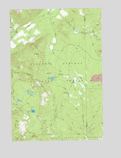
Green Mountain, WA USGS Topographic Map
Click on map above to begin viewing in our Map Viewer.

This topographic map contains these locations and features:
Feature Name Type Latitude Longitude GNIS ID View Map
Babyshoe RidgeRidgeN46.2690°W121.6193°1516012View Map
Cat CreekStreamN46.3493°W121.6243°1517482View Map
Cat Creek CampgroundLocaleN46.3484°W121.6248°1517484View Map
Cat Creek Guard StationLocaleN46.3537°W121.6181°1517485View Map
Chain of LakesLakeN46.2941°W121.6000°1517609View Map
Chain of Lakes CampgroundLocaleN46.2943°W121.5943°1529588View Map
Chambers CreekStreamN46.3707°W121.5743°1517615View Map
Divide Camp TrailTrailN46.2562°W121.5659°1518809View Map
East Fork Adams CreekStreamN46.2751°W121.5654°1519084View Map
Green MountainSummitN46.3326°W121.5918°1520305View Map
Green Mountain LakeLakeN46.3137°W121.5765°1520317View Map
Horseshoe LakeLakeN46.3087°W121.5695°1520952View Map
Horseshoe Lake Forest CampLocaleN46.3098°W121.5668°1534079View Map
Keenes Horse CampLocaleN46.3104°W121.5448°1529289View Map
Killen CreekStreamN46.3048°W121.5837°1521663View Map
Killen Creek CampgroundLocaleN46.2948°W121.5490°1521664View Map
Midway CreekStreamN46.3743°W121.5568°1523115View Map
Midway Guard StationLocaleN46.3510°W121.5231°1523117View Map
Midway MeadowsFlatN46.3537°W121.5337°1523118View Map
Mouse CreekStreamN46.3573°W121.6215°1523449View Map
Muddy ForkStreamN46.3701°W121.5687°1523495View Map
Muddy MeadowsFlatN46.3051°W121.5373°1523496View Map
Olallie LakeLakeN46.2889°W121.6165°1523989View Map
Olallie Lake CampgroundLocaleN46.2893°W121.6193°1529593View Map
Pimlico CreekStreamN46.3707°W121.5743°1524430View Map
Potato HillSummitN46.3332°W121.5012°1524600View Map
Sheep CreekStreamN46.3221°W121.6234°1525631View Map
South Fork Spring CreekStreamN46.3101°W121.5501°1526259View Map
Spring CreekStreamN46.3354°W121.5668°1526404View Map
Spring Creek CampgroundLocaleN46.3123°W121.5543°1526416View Map
Takh Takh MeadowFlatN46.2698°W121.5873°1526905View Map
Takhlakh Forest CampLocaleN46.2785°W121.6001°1534078View Map
Takhlakh LakeLakeN46.2782°W121.5965°1526906View Map
West Fork Adams CreekStreamN46.2957°W121.5701°1527927View Map

Note: Coordinates in the location and feature list above are referenced to NAD83 datum.


Copyright (C) 2008-2025 Ryan Niemi / Sunset Dynamics ... All Rights Reserved