TopoQuest Logo
Do you find TopoQuest useful?
Help keep TopoQuest running and adding new maps/features by donating!
Bitcoin:  19c7KJd3qBynnjoSw5npx9KScwjBe4ifkT
Litecoin:  LXs6TkuXGGXo1vDsWCkWVdjQX94eUKd6ui
Home View Maps Find Maps Find Places Resources & Links


Tinkerville, New Hampshire Topographic Map

USGS Map Title: Tinkerville, NH
USGS Map MRC: 44071G5
DRG (GeoTIFF) Download: o44071g5.tif


Neighboring USGS Topographic Map Quads:


  Averill, VT  
44071H6
 

  Monadnock Mountain, VT  
44071H5
 

  Lovering Mountain, NH  
44071H4
 

  Bloomfield, VT  
44071G6
 

  Tinkerville, NH  
44071G5
 

  Bunnell Mountain, NH  
44071G4
 

  Maidstone Lake, VT  
44071F6
 

  Stratford, NH  
44071F5
 

  Percy Peaks, NH  
44071F4


Map MRC Location:

N45°
W72°
N45°
W71°
H8 H7 H6 H5 H4 H3 H2 H1
G8 G7 G6 G5 G4 G3 G2 G1
F8 F7 F6 F5 F4 F3 F2 F1
E8 E7 E6 E5 E4 E3 E2 E1
D8 D7 D6 D5 D4 D3 D2 D1
C8 C7 C6 C5 C4 C3 C2 C1
B8 B7 B6 B5 B4 B3 B2 B1
A8 A7 A6 A5 A4 A3 A2 A1
N44°
W72°
N44°
W71°

Tinkerville, NH USGS 1:24K Topographic Map Preview:
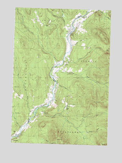
Tinkerville, NH USGS Topographic Map
Click on map above to begin viewing in our Map Viewer.

This topographic map contains these locations and features:
Feature Name Type Latitude Longitude GNIS ID View Map
Basin HoleBasinN44.7606°W71.6234°1456292View Map
Beaver BrookStreamN44.8312°W71.5584°865477View Map
Blodgett BrookStreamN44.8598°W71.5504°1456475View Map
Blodgett CemeteryCemeteryN44.8563°W71.5501°1919294View Map
Bloomfield CemeteryCemeteryN44.7878°W71.5814°1456484View Map
Buzzell HillSummitN44.8145°W71.6006°1456709View Map
Camp Number 5LocaleN44.7664°W71.5073°865942View Map
Camp Number 6LocaleN44.7806°W71.5084°865943View Map
Clough BrookStreamN44.8248°W71.5679°1456926View Map
ColumbiaPopulated PlaceN44.8520°W71.5518°871045View Map
Columbia BridgeBridgeN44.8531°W71.5518°866292View Map
Columbia BridgeBridgeN44.8531°W71.5518°1919318View Map
Cone BrookStreamN44.8120°W71.5740°866301View Map
Cone SchoolSchoolN44.8220°W71.5606°866302View Map
ConesPopulated PlaceN44.8198°W71.5659°866303View Map
Cree NotchGapN44.8375°W71.5037°866394View Map
Daley BrookStreamN44.7656°W71.6131°1457091View Map
GeorgesPopulated PlaceN44.7834°W71.5806°871046View Map
Gore BranchStreamN44.7664°W71.5420°867130View Map
Harvey BrookStreamN44.8417°W71.5512°867398View Map
Healey CemeteryCemeteryN44.8064°W71.5708°1919348View Map
Hymmel BranchStreamN44.7617°W71.5340°871047View Map
Jordan HillSummitN44.8431°W71.5273°867812View Map
Ledge MountainSummitN44.7531°W71.5062°867979View Map
LenningtonPopulated PlaceN44.8581°W71.5509°1460430View Map
Lightning MountainSummitN44.7573°W71.5673°868003View Map
Lyman BrookStreamN44.7837°W71.5881°868217View Map
Lyman CemeteryCemeteryN44.7773°W71.5880°868218View Map
Meriden HillPopulated PlaceN44.7823°W71.5543°868390View Map
Mill BrookStreamN44.7742°W71.6020°1458459View Map
Mill BrookStreamN44.8678°W71.5637°1460382View Map
Mount PleasantSummitN44.7914°W71.5212°869262View Map
O'Neil CemeteryCemeteryN44.8559°W71.5504°1919387View Map
Schoolhouse BrookStreamN44.7778°W71.5620°869814View Map
Simms HillSummitN44.8648°W71.5870°1919404View Map
Simms HillPopulated PlaceN44.8603°W71.5881°1460452View Map
Snow HillSummitN44.8012°W71.6229°1459555View Map
South Branch Lyman BrookStreamN44.7662°W71.5420°870020View Map
South Columbia SchoolSchoolN44.7898°W71.5726°870028View Map
Sweatt BrookStreamN44.8067°W71.5684°870309View Map
TinkervillePopulated PlaceN44.7806°W71.5834°870445View Map
Wallace PondLakeN44.8681°W71.5328°870651View Map

Note: Coordinates in the location and feature list above are referenced to NAD83 datum.


Copyright (C) 2008-2025 Ryan Niemi / Sunset Dynamics ... All Rights Reserved