TopoQuest Logo
Do you find TopoQuest useful?
Help keep TopoQuest running and adding new maps/features by donating!
Bitcoin:  19c7KJd3qBynnjoSw5npx9KScwjBe4ifkT
Litecoin:  LXs6TkuXGGXo1vDsWCkWVdjQX94eUKd6ui
Home View Maps Find Maps Find Places Resources & Links


Benton, Mississippi Topographic Map

USGS Map Title: Benton, MS
USGS Map MRC: 32090G3
DRG (GeoTIFF) Download: o32090g3.tif


Neighboring USGS Topographic Map Quads:


  Carter, MS  
32090H4
 

  Eden, MS  
32090H3
 

  Zeiglerville, MS  
32090H2
 

  Yazoo City, MS  
32090G4
 

  Benton, MS  
32090G3
 

  Linwood, MS  
32090G2
 

  Tinsley, MS  
32090F4
 

  Bentonia, MS  
32090F3
 

  Berryville, MS  
32090F2


Map MRC Location:

N33°
W91°
N33°
W90°
H8 H7 H6 H5 H4 H3 H2 H1
G8 G7 G6 G5 G4 G3 G2 G1
F8 F7 F6 F5 F4 F3 F2 F1
E8 E7 E6 E5 E4 E3 E2 E1
D8 D7 D6 D5 D4 D3 D2 D1
C8 C7 C6 C5 C4 C3 C2 C1
B8 B7 B6 B5 B4 B3 B2 B1
A8 A7 A6 A5 A4 A3 A2 A1
N32°
W91°
N32°
W90°

Benton, MS USGS 1:24K Topographic Map Preview:
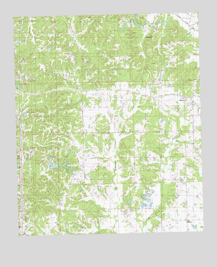
Benton, MS USGS Topographic Map
Click on map above to begin viewing in our Map Viewer.

This topographic map contains these locations and features:
Feature Name Type Latitude Longitude GNIS ID View Map
Anderson Catfish Pond DamDamN32.7885°W90.3334°681654View Map
Anderson Lake DamDamN32.7885°W90.3451°681655View Map
Bells ChapelChurchN32.7899°W90.2948°666797View Map
BentonPopulated PlaceN32.8265°W90.2595°666835View Map
Benton Post OfficePost OfficeN32.8270°W90.2612°2768699View Map
Benton Volunteer Fire DepartmentBuildingN32.8215°W90.2598°2665826View Map
Bethesda (historical)Populated PlaceN32.8307°W90.3251°686654View Map
Boylan ChurchChurchN32.7557°W90.2609°667500View Map
Captain Simmons ChurchChurchN32.8226°W90.2826°668055View Map
Castles ChapelChurchN32.7612°W90.3476°668145View Map
Cedar Hill (historical)Populated PlaceN32.8724°W90.2918°686658View Map
Coopers CemeteryCemeteryN32.8696°W90.2890°668813View Map
Edinburg High SchoolSchoolN32.8085°W90.3406°690999View Map
Fletchers ChapelChurchN32.7857°W90.3348°670039View Map
Forest Park Club Lake DamDamN32.8268°W90.3668°681682View Map
Fouche Lake DamDamN32.8685°W90.2884°681710View Map
Galilee ChurchChurchN32.8071°W90.3301°670296View Map
Hilton (historical)Populated PlaceN32.8362°W90.3334°686671View Map
Lear Lake DamDamN32.8735°W90.2784°681715View Map
McGraw Lake DamDamN32.7685°W90.2801°681636View Map
Peters Chapel ChurchChurchN32.8724°W90.3009°675649View Map
Piney Creek Watershed Y-38-26 DamDamN32.8735°W90.2718°681714View Map
RoadsidePopulated PlaceN32.7890°W90.3320°686685View Map
Saint Pauls ChurchChurchN32.7826°W90.3251°677211View Map
Silver Mountain ChurchChurchN32.8710°W90.3509°677803View Map
Silver Mountain SchoolSchoolN32.8704°W90.3490°677804View Map
Smith's CemeteryCemeteryN32.7879°W90.3251°677938View Map
Wesley ChapelChurchN32.8276°W90.2793°679450View Map
Williams Lake DamDamN32.8168°W90.2884°681674View Map
WoodlawnPopulated PlaceN32.8610°W90.2806°679850View Map

Note: Coordinates in the location and feature list above are referenced to NAD83 datum.


Copyright (C) 2008-2024 Ryan Niemi / Sunset Dynamics ... All Rights Reserved