TopoQuest Logo
Do you find TopoQuest useful?
Help keep TopoQuest running and adding new maps/features by donating!
Bitcoin:  19c7KJd3qBynnjoSw5npx9KScwjBe4ifkT
Litecoin:  LXs6TkuXGGXo1vDsWCkWVdjQX94eUKd6ui
Home View Maps Find Maps Find Places Resources & Links


Todd Lakes, Montana Topographic Map

USGS Map Title: Todd Lakes, MT
USGS Map MRC: 48105C8
DRG (GeoTIFF) Download: o48105c8.tif


Neighboring USGS Topographic Map Quads:


  Spring Valley East, MT  
48106D1
 

  Lustre, MT  
48105D8
 

  Todd Lakes NE, MT  
48105D7
 

  Hauck Coulee, MT  
48106C1
 

  Todd Lakes, MT  
48105C8
 

  Todd Lakes SE, MT  
48105C7
 

  Dubbe Reservoir, MT  
48106B1
 

  Oswego NW, MT  
48105B8
 

  Flynn Creek North, MT  
48105B7


Map MRC Location:

N49°
W106°
N49°
W105°
H8 H7 H6 H5 H4 H3 H2 H1
G8 G7 G6 G5 G4 G3 G2 G1
F8 F7 F6 F5 F4 F3 F2 F1
E8 E7 E6 E5 E4 E3 E2 E1
D8 D7 D6 D5 D4 D3 D2 D1
C8 C7 C6 C5 C4 C3 C2 C1
B8 B7 B6 B5 B4 B3 B2 B1
A8 A7 A6 A5 A4 A3 A2 A1
N48°
W106°
N48°
W105°

Todd Lakes, MT USGS 1:24K Topographic Map Preview:
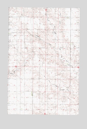
Todd Lakes, MT USGS Topographic Map
Click on map above to begin viewing in our Map Viewer.

This topographic map contains these locations and features:
Feature Name Type Latitude Longitude GNIS ID View Map
29N44E03BBCA01 WellWellN48.3039°W105.9983°1634740View Map
29N44E03BBCD01 WellWellN48.3025°W105.9983°1634724View Map
29N44E14ADAB01 WellWellN48.2728°W105.9578°1634556View Map
29N44E23BCCA01 WellWellN48.2567°W105.9758°1634445View Map
29N44E23BCCD01 WellWellN48.2561°W105.9756°1634434View Map
29N44E24ABBA01 WellWellN48.2522°W105.9514°1634420View Map
29N45E18CCBB01 WellWellN48.2656°W105.9336°1634502View Map
30N44E11CCAB01 WellWellN48.3667°W105.9747°1635145View Map
30N44E22BCBC01 WellWellN48.3445°W105.9992°1635019View Map
30N45E16ACBD01 WellWellN48.3586°W105.8792°1635094View Map
30N45E17AABB01 WellWellN48.3628°W105.8967°1635121View Map
30N45E28BBDA02 WellWellN48.3320°W105.8870°1634929View Map
30N45E28BBDB01 WellWellN48.3325°W105.8886°1634934View Map
Baker School (historical)SchoolN48.3206°W105.8867°1819542View Map
Bakers (historical)Populated PlaceN48.3209°W105.8878°1688563View Map
Cavens Church (historical)ChurchN48.2620°W105.9992°1677306View Map
Grand Prairie School (historical)SchoolN48.2620°W105.9992°1677275View Map
Koslowski School (historical)SchoolN48.3745°W105.9570°1819546View Map
Oswego DistrictCivilN48.3265°W105.8970°2419044View Map
South Fork School (historical)SchoolN48.3631°W105.9770°1819545View Map
Thiessen CouleeValleyN48.3275°W105.9106°799957View Map
Todd Lake DamDamN48.3034°W105.9792°795527View Map
Todd LakesLakeN48.3110°W105.9709°795528View Map
Tree CouleeValleyN48.3486°W105.9222°799956View Map
Wolf Creek School (historical)SchoolN48.3350°W105.8900°1819543View Map
Zerbe AirportAirportN48.2724°W105.9584°806417View Map

Note: Coordinates in the location and feature list above are referenced to NAD83 datum.


Copyright (C) 2008-2025 Ryan Niemi / Sunset Dynamics ... All Rights Reserved