TopoQuest Logo
Do you find TopoQuest useful?
Help keep TopoQuest running and adding new maps/features by donating!
Bitcoin:  19c7KJd3qBynnjoSw5npx9KScwjBe4ifkT
Litecoin:  LXs6TkuXGGXo1vDsWCkWVdjQX94eUKd6ui
Home View Maps Find Maps Find Places Resources & Links


Lakewood, Illinois Topographic Map

USGS Map Title: Lakewood, IL
USGS Map MRC: 39088C8
DRG (GeoTIFF) Download: o39088c8.tif


Neighboring USGS Topographic Map Quads:


  Pana, IL  
39089D1
 

  Tower Hill, IL  
39088D8
 

  Shelbyville, IL  
39088D7
 

  Oconee, IL  
39089C1
 

  Lakewood, IL  
39088C8
 

  Fancher, IL  
39088C7
 

  Ramsey, IL  
39089B1
 

  Herrick, IL  
39088B8
 

  Beecher City, IL  
39088B7


Map MRC Location:

N40°
W89°
N40°
W88°
H8 H7 H6 H5 H4 H3 H2 H1
G8 G7 G6 G5 G4 G3 G2 G1
F8 F7 F6 F5 F4 F3 F2 F1
E8 E7 E6 E5 E4 E3 E2 E1
D8 D7 D6 D5 D4 D3 D2 D1
C8 C7 C6 C5 C4 C3 C2 C1
B8 B7 B6 B5 B4 B3 B2 B1
A8 A7 A6 A5 A4 A3 A2 A1
N39°
W89°
N39°
W88°

Lakewood, IL USGS 1:24K Topographic Map Preview:
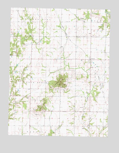
Lakewood, IL USGS Topographic Map
Click on map above to begin viewing in our Map Viewer.

This topographic map contains these locations and features:
Feature Name Type Latitude Longitude GNIS ID View Map
Bateman CemeteryCemeteryN39.2867°W88.9773°1725292View Map
Center School (historical)SchoolN39.3059°W88.9734°405805View Map
Champion School (historical)SchoolN39.2739°W88.8981°405938View Map
Cold Spring TownhallBuildingN39.2956°W88.9737°1725250View Map
Corley CemeteryCemeteryN39.2706°W88.9664°406589View Map
Corley RidgeRidgeN39.2792°W88.9617°406590View Map
Corley School (historical)SchoolN39.2745°W88.9740°406591View Map
Eiler CemeteryCemeteryN39.3721°W88.9849°407821View Map
Greenleaf School (historical)SchoolN39.3023°W88.8998°409436View Map
Horsman CemeteryCemeteryN39.2978°W88.9363°1725270View Map
Hudson CemeteryCemeteryN39.2781°W88.9070°410649View Map
LakewoodPopulated PlaceN39.3250°W88.8995°411767View Map
Lakewood Post OfficePost OfficeN39.3256°W88.8987°1821176View Map
Liston CemeteryCemeteryN39.3481°W88.9745°1725276View Map
Lockwood School (historical)SchoolN39.3314°W88.9723°412478View Map
McCoy CemeteryCemeteryN39.3148°W88.9808°413232View Map
Moore CemeteryCemeteryN39.2584°W88.9056°1725291View Map
Mound CemeteryCemeteryN39.2867°W88.9770°1966067View Map
Mount Olive CemeteryCemeteryN39.2742°W88.9277°1725296View Map
New Hope CemeteryCemeteryN39.3293°W88.9897°1821187View Map
Palestine School (historical)SchoolN39.3606°W88.9720°415307View Map
Red Bank CemeteryCemeteryN39.2931°W88.8991°416446View Map
Rhodes CemeteryCemeteryN39.2537°W88.9437°1725312View Map
Ridge CemeteryCemeteryN39.3006°W88.9326°1725314View Map
Rocky BranchStreamN39.3706°W88.8795°416871View Map
Rocky Branch School (historical)SchoolN39.3634°W88.8998°416873View Map
Standard School (historical)SchoolN39.3606°W88.9370°419031View Map
Stark School (historical)SchoolN39.2753°W88.9353°419053View Map
Summit School (historical)SchoolN39.3039°W88.9376°419355View Map
Town HouseLocaleN39.2956°W88.9734°419807View Map
Township of Cold SpringCivilN39.3032°W88.9713°428829View Map
West New Hope ChurchChurchN39.3275°W88.9929°414426View Map
Westminster (historical)Populated PlaceN39.3598°W88.9892°2014008View Map
Williamsburg (historical)Populated PlaceN39.2953°W88.9376°1821208View Map
Williamsburg HillPopulated PlaceN39.3003°W88.9348°423314View Map
Zion ChurchChurchN39.3245°W88.9606°421653View Map

Note: Coordinates in the location and feature list above are referenced to NAD83 datum.


Copyright (C) 2008-2024 Ryan Niemi / Sunset Dynamics ... All Rights Reserved