TopoQuest Logo
Do you find TopoQuest useful?
Help keep TopoQuest running and adding new maps/features by donating!
Bitcoin:  19c7KJd3qBynnjoSw5npx9KScwjBe4ifkT
Litecoin:  LXs6TkuXGGXo1vDsWCkWVdjQX94eUKd6ui
Home View Maps Find Maps Find Places Resources & Links


Townsville, North Carolina Topographic Map

USGS Map Title: Townsville, NC
USGS Map MRC: 36078D4
DRG (GeoTIFF) Download: o36078d4.tif


Neighboring USGS Topographic Map Quads:


  Clarksville South, VA  
36078E5
 

  Tungsten, NC  
36078E4
 

  John H Kerr Dam, VA  
36078E3
 

  Stovall, NC  
36078D5
 

  Townsville, NC  
36078D4
 

  Middleburg, NC  
36078D3
 

  Oxford, NC  
36078C5
 

  Henderson, NC  
36078C4
 

  Vicksboro, NC  
36078C3


Map MRC Location:

N37°
W79°
N37°
W78°
H8 H7 H6 H5 H4 H3 H2 H1
G8 G7 G6 G5 G4 G3 G2 G1
F8 F7 F6 F5 F4 F3 F2 F1
E8 E7 E6 E5 E4 E3 E2 E1
D8 D7 D6 D5 D4 D3 D2 D1
C8 C7 C6 C5 C4 C3 C2 C1
B8 B7 B6 B5 B4 B3 B2 B1
A8 A7 A6 A5 A4 A3 A2 A1
N36°
W79°
N36°
W78°

Townsville, NC USGS 1:24K Topographic Map Preview:
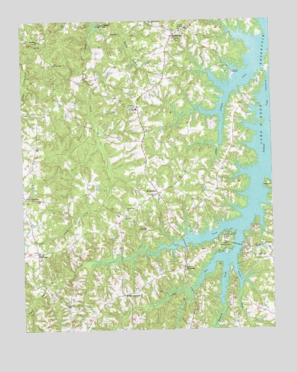
Townsville, NC USGS Topographic Map
Click on map above to begin viewing in our Map Viewer.

This topographic map contains these locations and features:
Feature Name Type Latitude Longitude GNIS ID View Map
Ashley Grove ChurchChurchN36.4090°W78.3792°980333View Map
Cedar WalkBuildingN36.4293°W78.4319°1965085View Map
Crooked RunStreamN36.4038°W78.3992°983774View Map
Flat CreekStreamN36.4171°W78.3922°985163View Map
Flat Creek ChurchChurchN36.4210°W78.4483°985167View Map
Hargrove EstatesPopulated PlaceN36.4790°W78.4264°1006100View Map
Harris CrossroadsPopulated PlaceN36.4004°W78.4189°986449View Map
Hicks CrossroadsPopulated PlaceN36.4288°W78.4983°1020722View Map
Hope PlaceBuildingN36.4296°W78.4322°1965084View Map
Indian CreekStreamN36.4029°W78.3944°987353View Map
Island Creek ChurchChurchN36.4235°W78.4472°987426View Map
Island Creek EstatesPopulated PlaceN36.4585°W78.4381°1006101View Map
Kellys CrossroadsPopulated PlaceN36.3893°W78.4489°1006266View Map
Kerr Lake Country ClubLocaleN36.4046°W78.3839°1007975View Map
Kerr Lake SchoolSchoolN36.4971°W78.4164°1007988View Map
Kerr Lake State Recreation AreaParkN36.3792°W78.3958°2374756View Map
Knotts CrossroadsPopulated PlaceN36.4065°W78.4925°1006267View Map
Marrows ChapelChurchN36.4832°W78.4833°989357View Map
Montpelier Airport (historical)AirportN36.4168°W78.4417°998069View Map
Mount Calvary ChurchChurchN36.4993°W78.4333°990339View Map
Mount Zion ChurchChurchN36.4557°W78.4378°990678View Map
New Hope SchoolSchoolN36.4646°W78.4422°991043View Map
Nutbush Bridge CampgroundLocaleN36.4126°W78.3978°991330View Map
Nutbush ChurchChurchN36.4921°W78.4225°991332View Map
Philadelphia ChurchChurchN36.4915°W78.4917°992131View Map
Poplar Spring BranchStreamN36.4990°W78.4628°992701View Map
Saint Beulahs ChurchChurchN36.4651°W78.4431°993875View Map
Saint Johns ChurchChurchN36.4296°W78.4342°993968View Map
Thomas Satterwhite HouseBuildingN36.4299°W78.4317°1965083View Map
Township of WilliamsboroCivilN36.4258°W78.4472°1027257View Map
TownsvillePopulated PlaceN36.4946°W78.4236°1022975View Map
Townsville LandingLocaleN36.4793°W78.3936°1022976View Map
Townsville Post OfficePost OfficeN36.4938°W78.4241°2774368View Map
Townsville Rural Volunteer Fire DepartmentBuildingN36.4951°W78.4223°2639816View Map
WilliamsboroPopulated PlaceN36.4304°W78.4317°997393View Map
Williamsboro WaysideParkN36.3954°W78.4164°1007974View Map

Note: Coordinates in the location and feature list above are referenced to NAD83 datum.


Copyright (C) 2008-2024 Ryan Niemi / Sunset Dynamics ... All Rights Reserved