TopoQuest Logo
Do you find TopoQuest useful?
Help keep TopoQuest running and adding new maps/features by donating!
Bitcoin:  19c7KJd3qBynnjoSw5npx9KScwjBe4ifkT
Litecoin:  LXs6TkuXGGXo1vDsWCkWVdjQX94eUKd6ui
Home View Maps Find Maps Find Places Resources & Links


Trapper Creek, Idaho Topographic Map

USGS Map Title: Trapper Creek, ID
USGS Map MRC: 45115F3
DRG (GeoTIFF) Download: o45115f3.tif


Neighboring USGS Topographic Map Quads:


  Elk City, ID  
45115G4
 

  Black Hawk Mountain, ID  
45115G3
 

  Sable Hill, ID  
45115G2
 

  Moose Butte, ID  
45115F4
 

  Trapper Creek, ID  
45115F3
 

  Boston Mountain, ID  
45115F2
 

  Dixie, ID  
45115E4
 

  Whitewater Ranch, ID  
45115E3
 

  Hida Point, ID  
45115E2


Map MRC Location:

N46°
W116°
N46°
W115°
H8 H7 H6 H5 H4 H3 H2 H1
G8 G7 G6 G5 G4 G3 G2 G1
F8 F7 F6 F5 F4 F3 F2 F1
E8 E7 E6 E5 E4 E3 E2 E1
D8 D7 D6 D5 D4 D3 D2 D1
C8 C7 C6 C5 C4 C3 C2 C1
B8 B7 B6 B5 B4 B3 B2 B1
A8 A7 A6 A5 A4 A3 A2 A1
N45°
W116°
N45°
W115°

Trapper Creek, ID USGS 1:24K Topographic Map Preview:
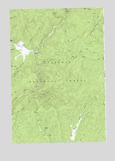
Trapper Creek, ID USGS Topographic Map
Click on map above to begin viewing in our Map Viewer.

This topographic map contains these locations and features:
Feature Name Type Latitude Longitude GNIS ID View Map
Blanco CreekStreamN45.7121°W115.3565°377846View Map
Cook RanchLocaleN45.6380°W115.2932°379643View Map
Deer CreekStreamN45.6713°W115.3626°380445View Map
Ditch CreekStreamN45.7469°W115.2990°380628View Map
Ditch Creek CampgroundLocaleN45.7471°W115.2973°395309View Map
Jack Creek SummitGapN45.6535°W115.3454°383808View Map
Jungle CreekStreamN45.7385°W115.3068°384066View Map
LightfootPopulated PlaceN45.7185°W115.3610°400546View Map
Little Moose CreekStreamN45.7160°W115.3685°384899View Map
Moose Butte CreekStreamN45.7096°W115.3540°387165View Map
Mullins Airstrip (historical)AirportN45.7146°W115.3626°400563View Map
Pat Brennan CreekStreamN45.6721°W115.3432°388257View Map
Red River CampgroundLocaleN45.7485°W115.2721°400547View Map
Red River Ranger StationLocaleN45.7088°W115.3440°389232View Map
Ryan CreekStreamN45.6955°W115.3657°389752View Map
Schooner CreekStreamN45.6974°W115.3410°390030View Map
Slide CreekStreamN45.6719°W115.2518°390615View Map
South Fork Big Mallard CreekStreamN45.6630°W115.2537°390883View Map
South Fork Red RiverStreamN45.7107°W115.3457°391002View Map
Steckner CreekStreamN45.7399°W115.3054°391395View Map
Steckner MineMineN45.7460°W115.3171°391396View Map
Trapper CreekStreamN45.6735°W115.3451°392351View Map

Note: Coordinates in the location and feature list above are referenced to NAD83 datum.


Copyright (C) 2008-2025 Ryan Niemi / Sunset Dynamics ... All Rights Reserved