TopoQuest Logo
Do you find TopoQuest useful?
Help keep TopoQuest running and adding new maps/features by donating!
Bitcoin:  19c7KJd3qBynnjoSw5npx9KScwjBe4ifkT
Litecoin:  LXs6TkuXGGXo1vDsWCkWVdjQX94eUKd6ui
Home View Maps Find Maps Find Places Resources & Links


Trent Creek, Wyoming Topographic Map

USGS Map Title: Trent Creek, WY
USGS Map MRC: 41106A5
DRG (GeoTIFF) Download: o41106a5.tif


Neighboring USGS Topographic Map Quads:


  Gunst Reservoir, WY  
41106B6
 

  Barcus Peak, WY  
41106B5
 

  Overlook Hill, WY  
41106B4
 

  Blackhall Mountain, WY  
41106A6
 

  Trent Creek, WY  
41106A5
 

  Elkhorn Point, WY  
41106A4
 

  Davis Peak, CO  
40106H6
 

  Pearl, CO  
40106H5
 

  Independence Mountain, CO  
40106H4


Map MRC Location:

N42°
W107°
N42°
W106°
H8 H7 H6 H5 H4 H3 H2 H1
G8 G7 G6 G5 G4 G3 G2 G1
F8 F7 F6 F5 F4 F3 F2 F1
E8 E7 E6 E5 E4 E3 E2 E1
D8 D7 D6 D5 D4 D3 D2 D1
C8 C7 C6 C5 C4 C3 C2 C1
B8 B7 B6 B5 B4 B3 B2 B1
A8 A7 A6 A5 A4 A3 A2 A1
N41°
W107°
N41°
W106°

Trent Creek, WY USGS 1:24K Topographic Map Preview:
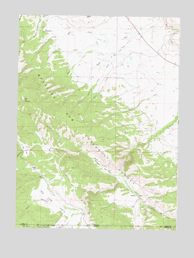
Trent Creek, WY USGS Topographic Map
Click on map above to begin viewing in our Map Viewer.

This topographic map contains these locations and features:
Feature Name Type Latitude Longitude GNIS ID View Map
Bear MountainSummitN41.0750°W106.6198°1598020View Map
Beaver CreekStreamN41.0077°W106.5731°169931View Map
Big Creek Guard StationLocaleN41.0516°W106.5248°1598138View Map
Big Creek MineMineN41.1105°W106.5025°1726169View Map
Big Creek ParkFlatN41.0125°W106.5875°1598139View Map
Casteel CreekStreamN41.0122°W106.5878°169929View Map
Casteel CreekStreamN41.0122°W106.5875°1598658View Map
Casteel DitchCanalN41.0672°W106.5175°1598659View Map
Casteel DitchCanalN41.1002°W106.5598°1598660View Map
Casteel ParkFlatN41.0350°W106.6128°1598661View Map
Continental DitchCanalN41.0055°W106.5906°1598879View Map
Continental DitchCanalN41.0041°W106.5923°201884View Map
Cunningham ParkFlatN41.0364°W106.5592°1599079View Map
Deer CreekStreamN41.1005°W106.5464°1599189View Map
East Trent CreekStreamN41.1069°W106.5439°1599527View Map
Holroyd CreekStreamN41.0146°W106.5245°169982View Map
Holroyd CreekStreamN41.0147°W106.5239°1600366View Map
Holroyd ParkFlatN41.0200°W106.5317°1600367View Map
Jerry ParkFlatN41.0469°W106.6209°1600610View Map
King Claims MineMineN41.0522°W106.5220°1726168View Map
Line CreekStreamN41.0091°W106.5742°169930View Map
Line CreekStreamN41.0091°W106.5739°1600928View Map
Little Bear CreekStreamN41.1094°W106.5548°1600941View Map
McAnulty CreekStreamN41.0472°W106.6148°1601293View Map
McNulty CreekStreamN41.0464°W106.5920°1601316View Map
Middle Fork Big CreekStreamN41.0322°W106.5445°1601387View Map
North Bear CreekStreamN41.1133°W106.5356°1601715View Map
North Fork Big CreekStreamN41.0322°W106.5448°1601745View Map
Platt MineMineN41.1152°W106.5053°1602210View Map
Quimby ParkFlatN41.0461°W106.6025°1602344View Map
Skyline RanchLocaleN41.1155°W106.6050°1602958View Map
South Fork Big CreekStreamN41.0330°W106.5439°169932View Map
South Fork Big CreekStreamN41.0330°W106.5439°1603119View Map
South Trent CreekStreamN41.1014°W106.5523°1603210View Map
Trent CreekStreamN41.1130°W106.5395°1603762View Map
Two CreekStreamN41.0650°W106.5178°1603840View Map

Note: Coordinates in the location and feature list above are referenced to NAD83 datum.


Copyright (C) 2008-2025 Ryan Niemi / Sunset Dynamics ... All Rights Reserved