TopoQuest Logo
Do you find TopoQuest useful?
Help keep TopoQuest running and adding new maps/features by donating!
Bitcoin:  19c7KJd3qBynnjoSw5npx9KScwjBe4ifkT
Litecoin:  LXs6TkuXGGXo1vDsWCkWVdjQX94eUKd6ui
Home View Maps Find Maps Find Places Resources & Links


Elkhorn Point, Wyoming Topographic Map

USGS Map Title: Elkhorn Point, WY
USGS Map MRC: 41106A4
DRG (GeoTIFF) Download: o41106a4.tif


Neighboring USGS Topographic Map Quads:


  Barcus Peak, WY  
41106B5
 

  Overlook Hill, WY  
41106B4
 

  Keystone, WY  
41106B3
 

  Trent Creek, WY  
41106A5
 

  Elkhorn Point, WY  
41106A4
 

  Horatio Rock, WY  
41106A3
 

  Pearl, CO  
40106H5
 

  Independence Mountain, CO  
40106H4
 

  Northgate, CO  
40106H3


Map MRC Location:

N42°
W107°
N42°
W106°
H8 H7 H6 H5 H4 H3 H2 H1
G8 G7 G6 G5 G4 G3 G2 G1
F8 F7 F6 F5 F4 F3 F2 F1
E8 E7 E6 E5 E4 E3 E2 E1
D8 D7 D6 D5 D4 D3 D2 D1
C8 C7 C6 C5 C4 C3 C2 C1
B8 B7 B6 B5 B4 B3 B2 B1
A8 A7 A6 A5 A4 A3 A2 A1
N41°
W107°
N41°
W106°

Elkhorn Point, WY USGS 1:24K Topographic Map Preview:
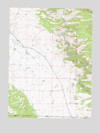
Elkhorn Point, WY USGS Topographic Map
Click on map above to begin viewing in our Map Viewer.

This topographic map contains these locations and features:
Feature Name Type Latitude Longitude GNIS ID View Map
Beaver Group MineMineN41.0955°W106.4600°1726167View Map
Big Creek RanchLocaleN41.0766°W106.4920°1585441View Map
Deerhorn PointSummitN41.1008°W106.4295°1587511View Map
Elkhorn PointCliffN41.0652°W106.4064°1588259View Map
Henry CreekStreamN41.0969°W106.4998°1600295View Map
Henry DitchCanalN41.0555°W106.4773°1600296View Map
Long LakeLakeN41.0560°W106.4731°1590991View Map
North Gate CanyonValleyN41.1247°W106.4217°1604440View Map
Parkview HillSummitN41.0219°W106.3984°1592592View Map
Platte River WildernessReserveN41.0854°W106.3765°169609View Map
Prospect MountainSummitN41.1200°W106.4364°1593044View Map
Rock SpringsSpringN41.0416°W106.4467°1593589View Map
Sixmile CreekStreamN41.0425°W106.3939°1602940View Map
Sixmile CreekStreamN41.0457°W106.4279°169983View Map
Sixmile GapGapN41.0439°W106.3939°1594408View Map
Sixmile Picnic GroundLocaleN41.0455°W106.4020°1594410View Map
Spring CreekStreamN41.0858°W106.4936°196559View Map
Spring LakeReservoirN41.0736°W106.4727°1606090View Map
Spring Lake DamDamN41.0766°W106.4756°1606089View Map
Stovepipe GulchValleyN41.0905°W106.4195°1595099View Map
Trail CreekStreamN41.1233°W106.4200°1595664View Map
Uranium King MineMineN41.1016°W106.4903°1726170View Map
Walbright CreekStreamN41.0569°W106.3811°1603956View Map

Note: Coordinates in the location and feature list above are referenced to NAD83 datum.


Copyright (C) 2008-2024 Ryan Niemi / Sunset Dynamics ... All Rights Reserved