TopoQuest Logo
Do you find TopoQuest useful?
Help keep TopoQuest running and adding new maps/features by donating!
Bitcoin:  19c7KJd3qBynnjoSw5npx9KScwjBe4ifkT
Litecoin:  LXs6TkuXGGXo1vDsWCkWVdjQX94eUKd6ui
Home View Maps Find Maps Find Places Resources & Links


Trevat, Texas Topographic Map

USGS Map Title: Trevat, TX
USGS Map MRC: 31094A8
DRG (GeoTIFF) Download: o31094a8.tif


Neighboring USGS Topographic Map Quads:


  Crecy, TX  
31095B1
 

  Apple Springs, TX  
31094B8
 

  Diboll, TX  
31094B7
 

  Groveton East, TX  
31095A1
 

  Trevat, TX  
31094A8
 

  Wakefield, TX  
31094A7
 

  Colita, TX  
30095H1
 

  Carmona, TX  
30094H8
 

  Corrigan, TX  
30094H7


Map MRC Location:

N32°
W95°
N32°
W94°
H8 H7 H6 H5 H4 H3 H2 H1
G8 G7 G6 G5 G4 G3 G2 G1
F8 F7 F6 F5 F4 F3 F2 F1
E8 E7 E6 E5 E4 E3 E2 E1
D8 D7 D6 D5 D4 D3 D2 D1
C8 C7 C6 C5 C4 C3 C2 C1
B8 B7 B6 B5 B4 B3 B2 B1
A8 A7 A6 A5 A4 A3 A2 A1
N31°
W95°
N31°
W94°

Trevat, TX USGS 1:24K Topographic Map Preview:
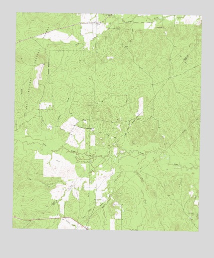
Trevat, TX USGS Topographic Map
Click on map above to begin viewing in our Map Viewer.

This topographic map contains these locations and features:
Feature Name Type Latitude Longitude GNIS ID View Map
Abbott Springs CemeteryCemeteryN31.0099°W94.8783°1350847View Map
Abbott Springs CemeteryCemeteryN31.0096°W94.8788°1383610View Map
Adams Spring BranchStreamN31.0507°W94.9983°1350880View Map
Brushy CreekStreamN31.0130°W94.9394°1383549View Map
Brushy CreekStreamN31.0130°W94.9391°1353049View Map
Bull CreekStreamN31.0419°W94.9388°1353234View Map
Dry CreekStreamN31.0291°W94.9577°1356324View Map
Dry LakeReservoirN31.0277°W94.9482°1383614View Map
James CreekStreamN31.1224°W94.9313°1360142View Map
James CreekStreamN31.1221°W94.9324°1383571View Map
Little Caney CreekStreamN31.0455°W94.9241°1361300View Map
Little Caney CreekStreamN31.0457°W94.9247°1383611View Map
North CreekStreamN31.1246°W94.9372°1383756View Map
North CreekStreamN31.1244°W94.9360°1364025View Map
Salt CreekStreamN31.0452°W94.9105°1367398View Map
Salt CreekStreamN31.0452°W94.9108°1383547View Map
SulphurPopulated PlaceN31.0591°W94.9774°1380624View Map
Sulphur CreekStreamN31.0474°W94.9674°1369353View Map
Sulphur Springs ChurchChurchN31.0588°W94.9513°1369371View Map
Sulphur Springs ChurchChurchN31.0585°W94.9516°1383615View Map
TrevatPopulated PlaceN31.1199°W94.9463°1380673View Map
Wagner Hill CemeteryCemeteryN31.0507°W94.9205°1370722View Map
Wagner Hill CemeteryCemeteryN31.0505°W94.9208°1383612View Map
White BranchStreamN31.1210°W94.9222°1383572View Map
White BranchStreamN31.1213°W94.9210°1371353View Map
White Oak CreekStreamN31.0438°W94.9163°1383550View Map
White Oak CreekStreamN31.0444°W94.9155°1371393View Map

Note: Coordinates in the location and feature list above are referenced to NAD83 datum.


Copyright (C) 2008-2024 Ryan Niemi / Sunset Dynamics ... All Rights Reserved