TopoQuest Logo
Do you find TopoQuest useful?
Help keep TopoQuest running and adding new maps/features by donating!
Bitcoin:  19c7KJd3qBynnjoSw5npx9KScwjBe4ifkT
Litecoin:  LXs6TkuXGGXo1vDsWCkWVdjQX94eUKd6ui
Home View Maps Find Maps Find Places Resources & Links


Tropic Canyon, Utah Topographic Map

USGS Map Title: Tropic Canyon, UT
USGS Map MRC: 37112F1
DRG (GeoTIFF) Download: o37112f1.tif


Neighboring USGS Topographic Map Quads:


  Flake Mountain West, UT  
37112G2
 

  Flake Mountain East, UT  
37112G1
 

  Sweetwater Creek, UT  
37111G8
 

  Bryce Canyon, UT  
37112F2
 

  Tropic Canyon, UT  
37112F1
 

  Pine Lake, UT  
37111F8
 

  Bryce Point, UT  
37112E2
 

  Cannonville, UT  
37112E1
 

  Henrieville, UT  
37111E8


Map MRC Location:

N38°
W113°
N38°
W112°
H8 H7 H6 H5 H4 H3 H2 H1
G8 G7 G6 G5 G4 G3 G2 G1
F8 F7 F6 F5 F4 F3 F2 F1
E8 E7 E6 E5 E4 E3 E2 E1
D8 D7 D6 D5 D4 D3 D2 D1
C8 C7 C6 C5 C4 C3 C2 C1
B8 B7 B6 B5 B4 B3 B2 B1
A8 A7 A6 A5 A4 A3 A2 A1
N37°
W113°
N37°
W112°

Tropic Canyon, UT USGS 1:24K Topographic Map Preview:
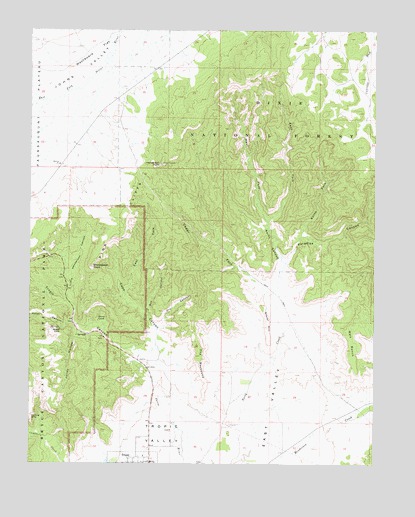
Tropic Canyon, UT USGS Topographic Map
Click on map above to begin viewing in our Map Viewer.

This topographic map contains these locations and features:
Feature Name Type Latitude Longitude GNIS ID View Map
Box CanyonValleyN37.6676°W112.0823°1439057View Map
Bryce Valley TranslatorTowerN37.7108°W112.0771°1455695View Map
Cedar ForkValleyN37.6514°W112.0319°1439565View Map
Cope CanyonValleyN37.6635°W112.0799°1439938View Map
Dry CanyonValleyN37.6636°W112.0794°1440564View Map
East Fork Cope CanyonValleyN37.6733°W112.0912°1440796View Map
East Fork North CanyonValleyN37.6950°W112.0395°1440814View Map
Fairyland CanyonValleyN37.6333°W112.1247°1440988View Map
Glory CoveValleyN37.6633°W112.0995°1441337View Map
Gravel HillSummitN37.6707°W112.0419°1428358View Map
Henderson PointSummitN37.7116°W112.0789°1441702View Map
Jolley HollowValleyN37.6625°W112.1082°1442198View Map
Little Henderson CanyonValleyN37.6715°W112.1108°1442724View Map
Loseeville CemeteryCemeteryN37.6253°W112.0466°2769409View Map
North CanyonValleyN37.6828°W112.0337°1443857View Map
North Fork Paradise CanyonValleyN37.6906°W112.0276°1443923View Map
Paradise CanyonValleyN37.6828°W112.0330°1444182View Map
Shakespear PointCliffN37.6819°W112.1035°1445463View Map
Sinking ShipSummitN37.6402°W112.1167°1445620View Map
The BackboneRidgeN37.6602°W112.0655°1446410View Map
Town of TropicCivilN37.6294°W112.0914°2413402View Map
TropicPopulated PlaceN37.6253°W112.0821°1446722View Map
Tropic CanyonValleyN37.6537°W112.0817°1446723View Map
Tropic CemeteryCemeteryN37.6294°W112.0824°1449112View Map
Tropic ValleyBasinN37.6300°W112.0819°1446726View Map
Walt BenchBenchN37.6580°W112.0096°1446971View Map
Washboard FlatFlatN37.7441°W112.1024°1447018View Map
Water CanyonValleyN37.6661°W112.1101°1447037View Map
West Fork North CanyonValleyN37.6949°W112.0397°1447150View Map

Note: Coordinates in the location and feature list above are referenced to NAD83 datum.


Copyright (C) 2008-2024 Ryan Niemi / Sunset Dynamics ... All Rights Reserved