TopoQuest Logo
Do you find TopoQuest useful?
Help keep TopoQuest running and adding new maps/features by donating!
Bitcoin:  19c7KJd3qBynnjoSw5npx9KScwjBe4ifkT
Litecoin:  LXs6TkuXGGXo1vDsWCkWVdjQX94eUKd6ui
Home View Maps Find Maps Find Places Resources & Links


Troup East, Texas Topographic Map

USGS Map Title: Troup East, TX
USGS Map MRC: 32095B1
DRG (GeoTIFF) Download: o32095b1.tif


Neighboring USGS Topographic Map Quads:


  Bascom, TX  
32095C2
 

  Hope Pond, TX  
32095C1
 

  Kilgore SW, TX  
32094C8
 

  Troup West, TX  
32095B2
 

  Troup East, TX  
32095B1
 

  Price, TX  
32094B8
 

  Tecula, TX  
32095A2
 

  Griffin, TX  
32095A1
 

  Gum Springs, TX  
32094A8


Map MRC Location:

N33°
W96°
N33°
W95°
H8 H7 H6 H5 H4 H3 H2 H1
G8 G7 G6 G5 G4 G3 G2 G1
F8 F7 F6 F5 F4 F3 F2 F1
E8 E7 E6 E5 E4 E3 E2 E1
D8 D7 D6 D5 D4 D3 D2 D1
C8 C7 C6 C5 C4 C3 C2 C1
B8 B7 B6 B5 B4 B3 B2 B1
A8 A7 A6 A5 A4 A3 A2 A1
N32°
W96°
N32°
W95°

Troup East, TX USGS 1:24K Topographic Map Preview:
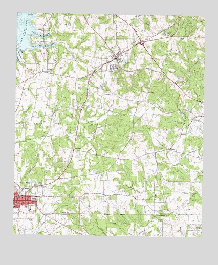
Troup East, TX USGS Topographic Map
Click on map above to begin viewing in our Map Viewer.

This topographic map contains these locations and features:
Feature Name Type Latitude Longitude GNIS ID View Map
ArpPopulated PlaceN32.2254°W95.0577°1329695View Map
Arp City HallBuildingN32.2248°W95.0598°2754002View Map
Arp High SchoolSchoolN32.2274°W95.0561°2008826View Map
Arp Junior High SchoolSchoolN32.2274°W95.0561°2008827View Map
Arp Police DepartmentBuildingN32.2248°W95.0599°2751186View Map
Arp Post OfficePost OfficeN32.2254°W95.0603°2731847View Map
Arp Volunteer Fire DepartmentBuildingN32.2249°W95.0596°2655276View Map
City of ArpCivilN32.2279°W95.0536°2409733View Map
City of TroupCivilN32.1450°W95.1224°2412097View Map
Ebenezer CemeteryCemeteryN32.2088°W95.0683°1335059View Map
Elkins CemeteryCemeteryN32.2193°W95.0955°1335316View Map
First Presbyterian ChurchChurchN32.1438°W95.1180°2023405View Map
Good Omen Oil FieldOilfieldN32.1893°W95.0899°1336698View Map
Grace Temple ChurchChurchN32.1735°W95.0849°1336774View Map
Grand View PointCapeN32.2265°W95.1224°1336805View Map
Hilltop Country ClubLocaleN32.1529°W95.1116°1384396View Map
Liberty ChurchChurchN32.1960°W95.0802°1339879View Map
Mary Memorial Church of God ChristChurchN32.1474°W95.1219°2023486View Map
Mason ChurchChurchN32.2410°W95.0405°1341049View Map
Mount Herman ChurchChurchN32.2404°W95.1072°1342040View Map
Mount Rose Baptist ChurchChurchN32.1415°W95.1202°2016662View Map
New Hope ChurchChurchN32.1874°W95.1199°1342466View Map
North Bridge CoveBayN32.2377°W95.1047°1342695View Map
OmenPopulated PlaceN32.2174°W95.1041°1343273View Map
Omen Road BayBayN32.2313°W95.1127°1343274View Map
SalemPopulated PlaceN32.1746°W95.0224°1379009View Map
Salem CemeteryCemeteryN32.1957°W95.0113°1346163View Map
Salem ChurchChurchN32.1468°W95.0997°1346168View Map
Shark BayBayN32.2285°W95.1222°1346974View Map
Shiloh CemeteryCemeteryN32.2179°W95.1136°1347042View Map
Sinclair ChurchChurchN32.1815°W95.0833°1347166View Map
Sinclair Church of ChristChurchN32.1843°W95.0824°2023480View Map
Sinclair CityPopulated PlaceN32.1985°W95.0799°1379081View Map
Smith County Constable's Office Precinct 3BuildingN32.1448°W95.1177°2751364View Map
South Bridge CoveBayN32.2324°W95.1016°1347413View Map
Spring ChapelChurchN32.2379°W95.0138°1347700View Map
Summer Hill Select SchoolSchoolN32.2179°W95.1030°2040756View Map
Swan BayBayN32.2496°W95.1141°1348111View Map
Swinney Road BayBayN32.2377°W95.1119°1348155View Map
TroupPopulated PlaceN32.1446°W95.1205°1348809View Map
Troup City HallBuildingN32.1441°W95.1199°2753972View Map
Troup Elementary SchoolSchoolN32.1471°W95.1199°2008763View Map
Troup High SchoolSchoolN32.1513°W95.1141°2008764View Map
Troup Middle SchoolSchoolN32.1507°W95.1147°2008765View Map
Troup Police DepartmentBuildingN32.1440°W95.1198°2751160View Map
Troup Post OfficePost OfficeN32.1441°W95.1199°2731973View Map
Troup Volunteer Fire Department Central StationBuildingN32.1378°W95.1203°2655287View Map
Troup-Arp DivisionCivilN32.2154°W95.0880°1939272View Map
Twin Bay PeninsulaCapeN32.2349°W95.1099°1348939View Map
Union Grove ChurchChurchN32.1474°W95.0649°1349063View Map

Note: Coordinates in the location and feature list above are referenced to NAD83 datum.


Copyright (C) 2008-2025 Ryan Niemi / Sunset Dynamics ... All Rights Reserved