TopoQuest Logo
Do you find TopoQuest useful?
Help keep TopoQuest running and adding new maps/features by donating!
Bitcoin:  19c7KJd3qBynnjoSw5npx9KScwjBe4ifkT
Litecoin:  LXs6TkuXGGXo1vDsWCkWVdjQX94eUKd6ui
Home View Maps Find Maps Find Places Resources & Links


Griffin, Texas Topographic Map

USGS Map Title: Griffin, TX
USGS Map MRC: 32095A1
DRG (GeoTIFF) Download: o32095a1.tif


Neighboring USGS Topographic Map Quads:


  Troup West, TX  
32095B2
 

  Troup East, TX  
32095B1
 

  Price, TX  
32094B8
 

  Tecula, TX  
32095A2
 

  Griffin, TX  
32095A1
 

  Gum Springs, TX  
32094A8
 

  Jacksonville East, TX  
31095H2
 

  New Summerfield, TX  
31095H1
 

  New Salem, TX  
31094H8


Map MRC Location:

N33°
W96°
N33°
W95°
H8 H7 H6 H5 H4 H3 H2 H1
G8 G7 G6 G5 G4 G3 G2 G1
F8 F7 F6 F5 F4 F3 F2 F1
E8 E7 E6 E5 E4 E3 E2 E1
D8 D7 D6 D5 D4 D3 D2 D1
C8 C7 C6 C5 C4 C3 C2 C1
B8 B7 B6 B5 B4 B3 B2 B1
A8 A7 A6 A5 A4 A3 A2 A1
N32°
W96°
N32°
W95°

Griffin, TX USGS 1:24K Topographic Map Preview:
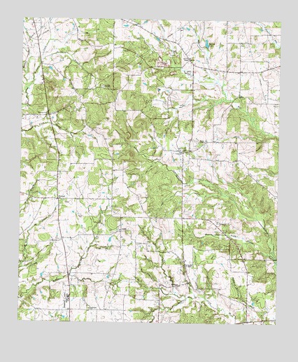
Griffin, TX USGS Topographic Map
Click on map above to begin viewing in our Map Viewer.

This topographic map contains these locations and features:
Feature Name Type Latitude Longitude GNIS ID View Map
Barker BranchStreamN32.1082°W95.1152°1330041View Map
Barrons LakeReservoirN32.1154°W95.0359°1330090View Map
BlackjackPopulated PlaceN32.0510°W95.1044°1378012View Map
Boggy BranchStreamN32.0274°W95.0008°1330996View Map
Campground CreekStreamN32.0435°W95.0102°1332043View Map
ConcordPopulated PlaceN32.0702°W95.0463°1378149View Map
EmmausPopulated PlaceN32.0152°W95.0488°1378262View Map
Emmaus ChurchChurchN32.0241°W95.0438°1335448View Map
Fitch CemeteryCemeteryN32.0438°W95.0966°1335842View Map
GriffinPopulated PlaceN32.0382°W95.0755°1378387View Map
Griffin CemeteryCemeteryN32.0373°W95.0802°2513168View Map
Grissom CreekStreamN32.0985°W95.0286°1337038View Map
Hampton CreekStreamN32.0985°W95.0286°1373988View Map
Harrison Farm AirportAirportN32.0371°W95.0808°2675970View Map
Henrys ChapelPopulated PlaceN32.1066°W95.0424°2034719View Map
Henrys ChapelLocaleN32.1088°W95.0436°1337625View Map
Knoxville CemeteryCemeteryN32.0974°W95.0858°1339201View Map
Martins ChapelChurchN32.0752°W95.0361°1341033View Map
New Summerfield DivisionCivilN32.0159°W95.0697°1939030View Map
Pleasant Plains ChurchChurchN32.0054°W95.0911°1344235View Map
Sanders CemeteryCemeteryN32.1118°W95.0499°1346559View Map
Willis DitchCanalN32.0304°W95.0022°1350164View Map

Note: Coordinates in the location and feature list above are referenced to NAD83 datum.


Copyright (C) 2008-2025 Ryan Niemi / Sunset Dynamics ... All Rights Reserved