TopoQuest Logo
Do you find TopoQuest useful?
Help keep TopoQuest running and adding new maps/features by donating!
Bitcoin:  19c7KJd3qBynnjoSw5npx9KScwjBe4ifkT
Litecoin:  LXs6TkuXGGXo1vDsWCkWVdjQX94eUKd6ui
Home View Maps Find Maps Find Places Resources & Links


Tubac, Arizona Topographic Map

USGS Map Title: Tubac, AZ
USGS Map MRC: 31111E1
DRG (GeoTIFF) Download: o31111e1.tif


Neighboring USGS Topographic Map Quads:


  Saucito Mountain, AZ  
31111F2
 

  Amado, AZ  
31111F1
 

  Mount Hopkins, AZ  
31110F8
 

  Murphy Peak, AZ  
31111E2
 

  Tubac, AZ  
31111E1
 

  San Cayetano Mountains, AZ  
31110E8
 

  Ruby, AZ  
31111D2
 

  Pena Blanca Lake, AZ  
31111D1
 

  Rio Rico, AZ  
31110D8


Map MRC Location:

N32°
W112°
N32°
W111°
H8 H7 H6 H5 H4 H3 H2 H1
G8 G7 G6 G5 G4 G3 G2 G1
F8 F7 F6 F5 F4 F3 F2 F1
E8 E7 E6 E5 E4 E3 E2 E1
D8 D7 D6 D5 D4 D3 D2 D1
C8 C7 C6 C5 C4 C3 C2 C1
B8 B7 B6 B5 B4 B3 B2 B1
A8 A7 A6 A5 A4 A3 A2 A1
N31°
W112°
N31°
W111°

Tubac, AZ USGS 1:24K Topographic Map Preview:
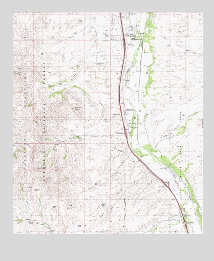
Tubac, AZ USGS Topographic Map
Click on map above to begin viewing in our Map Viewer.

This topographic map contains these locations and features:
Feature Name Type Latitude Longitude GNIS ID View Map
Aliso CanyonValleyN31.5966°W111.0498°36517View Map
Aliso SpringSpringN31.5832°W111.0999°25587View Map
Amole DamDamN31.5154°W111.0990°36521View Map
Anita WellWellN31.6018°W111.1048°36524View Map
Camp Loco (historical)LocaleN31.5251°W111.1143°36575View Map
CarmenPopulated PlaceN31.5873°W111.0529°27290View Map
CCC DamDamN31.6109°W111.0979°36567View Map
Cerro PelonSummitN31.6196°W111.0824°27474View Map
Edwards Ranch (historical)LocaleN31.5729°W111.0479°36621View Map
El Canto RanchLocaleN31.5670°W111.0431°28833View Map
Fresno SpringSpringN31.5070°W111.1143°29204View Map
Hidden TankReservoirN31.5167°W111.0640°36658View Map
Javelin CanyonValleyN31.5078°W111.1129°36668View Map
Josephine CanyonValleyN31.5581°W111.0184°30620View Map
Kenyon RanchLocaleN31.6131°W111.0637°30755View Map
Kenyon TankReservoirN31.6109°W111.0673°36680View Map
Mavis WashStreamN31.6098°W111.0368°31594View Map
Mesquite Gray WellWellN31.6040°W111.1054°36720View Map
Mesquite SeepSpringN31.5015°W111.1010°36721View Map
Mountain View Elementary SchoolSchoolN31.5059°W111.0147°2544802View Map
Negro CanyonValleyN31.5431°W111.0424°36741View Map
Negro TankReservoirN31.5045°W111.0827°36742View Map
OteroPopulated PlaceN31.5306°W111.0148°32577View Map
Palo Prado InterchangeCrossingN31.5279°W111.0243°36764View Map
Peck CanyonValleyN31.5108°W111.0131°32765View Map
Peck Canyon InterchangeCrossingN31.5062°W111.0087°36774View Map
Rancho Santa CruzLocaleN31.5434°W111.0415°33367View Map
Rio Rico High SchoolSchoolN31.5048°W111.0187°2544901View Map
Rio Rico LandfillLocaleN31.5175°W111.0241°2622365View Map
Rio Rico Northwest Census Designated Place (historical)CensusN31.5012°W111.0411°2409178View Map
Rock Corral CanyonValleyN31.5560°W111.0483°33697View Map
Rock Corral RanchLocaleN31.5473°W111.0523°36815View Map
Rock Corral SpringSpringN31.5448°W111.1045°42636View Map
Rock Corral SpringSpringN31.5542°W111.0821°36816View Map
San Cayetano de Tumacacori (historical)LocaleN31.5668°W111.0506°40492View Map
San Cayetano Elementary SchoolSchoolN31.5083°W111.0152°27171View Map
San Cayetano RanchLocaleN31.5598°W111.0443°34009View Map
Sardina PeakSummitN31.5907°W111.1222°34084View Map
Section Eleven WellWellN31.6131°W111.0848°36841View Map
The Church at TubacChurchN31.6130°W111.0540°2623315View Map
Tinaja CanyonValleyN31.5484°W111.0465°35340View Map
Tinaja DamDamN31.5279°W111.0695°36867View Map
TubacPopulated PlaceN31.6126°W111.0459°35489View Map
Tubac Census Designated PlaceCensusN31.6111°W111.0586°2409356View Map
Tubac CreekStreamN31.6095°W111.0406°35490View Map
Tubac Fire District Station 1BuildingN31.6154°W111.0519°2622576View Map
Tubac Fire District Station 2BuildingN31.5034°W111.0127°2657543View Map
Tubac InterchangeCrossingN31.6070°W111.0512°36877View Map
Tubac Presidio State Historical ParkParkN31.6115°W111.0459°36878View Map
Tubac Ultralight FlightparkAirportN31.6145°W111.0370°45531View Map
TumacacoriPopulated PlaceN31.5687°W111.0523°36879View Map
Tumacacori Carmen InterchangeCrossingN31.5565°W111.0506°36880View Map
Tumacacori MountainsRangeN31.5512°W111.1083°35518View Map
Tumacacori National Historical ParkParkN31.5728°W111.0478°35519View Map
Tumacacori PeakSummitN31.5710°W111.0846°35520View Map
Tumacacori Post OfficePost OfficeN31.5700°W111.0522°2622661View Map
Tumacacori Private Land GrantCivilN31.5148°W111.0131°36881View Map
Tumacacori-Carmen Census Designated PlaceCensusN31.5771°W111.0469°2409361View Map

Note: Coordinates in the location and feature list above are referenced to NAD83 datum.


Copyright (C) 2008-2025 Ryan Niemi / Sunset Dynamics ... All Rights Reserved