TopoQuest Logo
Do you find TopoQuest useful?
Help keep TopoQuest running and adding new maps/features by donating!
Bitcoin:  19c7KJd3qBynnjoSw5npx9KScwjBe4ifkT
Litecoin:  LXs6TkuXGGXo1vDsWCkWVdjQX94eUKd6ui
Home View Maps Find Maps Find Places Resources & Links


Tule Springs, California Topographic Map

USGS Map Title: Tule Springs, CA
USGS Map MRC: 32116H6
DRG (GeoTIFF) Download: o32116h6.tif


Neighboring USGS Topographic Map Quads:


  Ramona, CA  
33116A7
 

  Santa Ysabel, CA  
33116A6
 

  Julian, CA  
33116A5
 

  El Cajon Mountain, CA  
32116H7
 

  Tule Springs, CA  
32116H6
 

  Cuyamaca Peak, CA  
32116H5
 

  Alpine, CA  
32116G7
 

  Viejas Mountain, CA  
32116G6
 

  Descanso, CA  
32116G5


Map MRC Location:

N33°
W117°
N33°
W116°
H8 H7 H6 H5 H4 H3 H2 H1
G8 G7 G6 G5 G4 G3 G2 G1
F8 F7 F6 F5 F4 F3 F2 F1
E8 E7 E6 E5 E4 E3 E2 E1
D8 D7 D6 D5 D4 D3 D2 D1
C8 C7 C6 C5 C4 C3 C2 C1
B8 B7 B6 B5 B4 B3 B2 B1
A8 A7 A6 A5 A4 A3 A2 A1
N32°
W117°
N32°
W116°

Tule Springs, CA USGS 1:24K Topographic Map Preview:
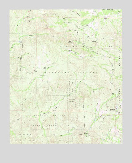
Tule Springs, CA USGS Topographic Map
Click on map above to begin viewing in our Map Viewer.

This topographic map contains these locations and features:
Feature Name Type Latitude Longitude GNIS ID View Map
Anahuac School (historical)SchoolN32.9842°W116.6639°1666232View Map
Anahuac SpringSpringN32.9845°W116.6628°238605View Map
Boulder CreekStreamN32.9745°W116.7389°239600View Map
Burney RanchLocaleN32.9214°W116.6339°239857View Map
Cedar CreekStreamN32.9875°W116.7403°240386View Map
Cedar Creek FallsFallsN32.9895°W116.7303°240388View Map
Coarse Gold ProspectMineN32.9917°W116.6920°1692978View Map
Conejos ValleyValleyN32.8964°W116.7467°240851View Map
Devils PunchbowlBasinN32.9692°W116.6828°254018View Map
Eagle PeakSummitN32.9842°W116.7092°241715View Map
Echo Dell RanchLocaleN32.9020°W116.6431°241818View Map
Echo ValleyValleyN32.8992°W116.6559°241824View Map
Gold Crown ProspectMineN32.9753°W116.6370°1692982View Map
Iron SpringSpringN32.9964°W116.6318°243895View Map
Johnson CreekStreamN32.9684°W116.6692°244106View Map
Kelly CreekStreamN32.9956°W116.7092°244227View Map
King CreekStreamN32.8981°W116.7189°244309View Map
Last Chance MineMineN32.9889°W116.6706°1692983View Map
Lillian HillSummitN32.9759°W116.6803°1660911View Map
Marston MeadowFlatN32.9923°W116.6442°245564View Map
Mineral HillSummitN32.9692°W116.6559°245962View Map
Mineral Hill MineMineN32.9698°W116.6692°1692985View Map
Nona ProspectMineN32.9906°W116.6939°1692986View Map
Penny MineMineN32.9723°W116.6461°1692989View Map
Pine GrovePopulated PlaceN32.9453°W116.7125°252956View Map
Poverty GulchValleyN32.8845°W116.6817°247749View Map
Prosperity ProspectMineN32.9909°W116.6667°1692990View Map
Rancho AlegriaLocaleN32.9623°W116.6853°247959View Map
Sheep Camp CreekStreamN32.9756°W116.6886°249359View Map
Sherilton Valley RanchLocaleN32.9067°W116.6334°249395View Map
Sill HillSummitN32.9648°W116.6384°1661446View Map
Spanish Bayonet MineMineN32.9092°W116.6481°1692991View Map
Sunshine MountainSummitN32.9953°W116.6764°250137View Map
Tule SpringsSpringN32.9388°W116.7140°250683View Map
West Fork King CreekStreamN32.9020°W116.6353°251345View Map
Wildcat SpringSpringN32.9437°W116.6374°251554View Map

Note: Coordinates in the location and feature list above are referenced to NAD83 datum.


Copyright (C) 2008-2025 Ryan Niemi / Sunset Dynamics ... All Rights Reserved