TopoQuest Logo
Do you find TopoQuest useful?
Help keep TopoQuest running and adding new maps/features by donating!
Bitcoin:  19c7KJd3qBynnjoSw5npx9KScwjBe4ifkT
Litecoin:  LXs6TkuXGGXo1vDsWCkWVdjQX94eUKd6ui
Home View Maps Find Maps Find Places Resources & Links


Turner Mountain, Oregon Topographic Map

USGS Map Title: Turner Mountain, OR
USGS Map MRC: 44119H5
DRG (GeoTIFF) Download: o44119h5.tif


Neighboring USGS Topographic Map Quads:


  Chapin Creek, OR  
45119A6
 

  Big Rock Flat, OR  
45119A5
 

  Madison Butte, OR  
45119A4
 

  Whitetail Butte, OR  
44119H6
 

  Turner Mountain, OR  
44119H5
 

  Johnny Cake Mountain, OR  
44119H4
 

  Kimberly, OR  
44119G6
 

  Bologna Basin, OR  
44119G5
 

  Monument, OR  
44119G4


Map MRC Location:

N45°
W120°
N45°
W119°
H8 H7 H6 H5 H4 H3 H2 H1
G8 G7 G6 G5 G4 G3 G2 G1
F8 F7 F6 F5 F4 F3 F2 F1
E8 E7 E6 E5 E4 E3 E2 E1
D8 D7 D6 D5 D4 D3 D2 D1
C8 C7 C6 C5 C4 C3 C2 C1
B8 B7 B6 B5 B4 B3 B2 B1
A8 A7 A6 A5 A4 A3 A2 A1
N44°
W120°
N44°
W119°

Turner Mountain, OR USGS 1:24K Topographic Map Preview:
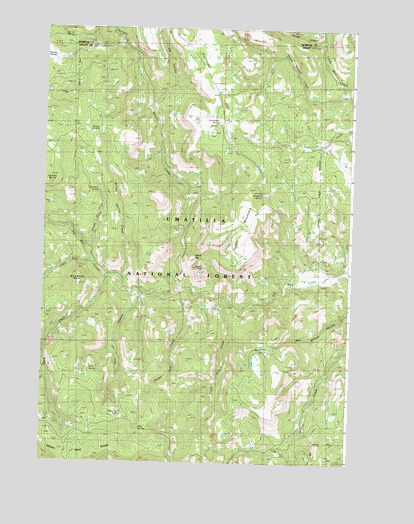
Turner Mountain, OR USGS Topographic Map
Click on map above to begin viewing in our Map Viewer.

This topographic map contains these locations and features:
Feature Name Type Latitude Longitude GNIS ID View Map
Bell SpringSpringN44.9013°W119.6053°1137900View Map
Big Burn SpringSpringN44.9533°W119.6031°1137983View Map
Big Cat SpringSpringN44.9977°W119.6182°1137995View Map
Big Willow SpringSpringN44.9081°W119.5333°1138098View Map
Big Willow Spring CreekStreamN44.9207°W119.5003°1138099View Map
Blue Spruce CampLocaleN44.9282°W119.5950°1138336View Map
Brown SpringSpringN44.9087°W119.6161°1638667View Map
Cat CanyonValleyN44.9788°W119.5825°1139452View Map
CCC SpringSpringN44.8847°W119.5847°1139488View Map
China CapSummitN44.9346°W119.5653°1139659View Map
Dark CanyonValleyN44.9268°W119.5989°1133780View Map
Eagle RockSummitN44.9293°W119.5633°1141496View Map
Grassy Butte CreekStreamN44.9368°W119.6081°1142968View Map
Happy Jack CreekStreamN44.9238°W119.5714°1143284View Map
Happy Jack RidgeRidgeN44.8776°W119.6122°1152931View Map
Happy Jack SpringSpringN44.8887°W119.5919°1143285View Map
Harrington CreekStreamN44.9946°W119.5975°1143326View Map
Kingbolt SpringSpringN44.9521°W119.5368°1144621View Map
Little Wilson CreekStreamN44.9226°W119.5531°1145287View Map
Lost CanyonValleyN44.9238°W119.5861°1145506View Map
Lovlett CorralLocaleN44.9579°W119.5150°1145583View Map
Rough CanyonValleyN44.9968°W119.5125°1148747View Map
Snowshoe SpringSpringN44.9985°W119.6095°1149837View Map
South Fork Big Wall CreekStreamN44.9335°W119.6075°1149935View Map
Sunflower SpringSpringN44.9732°W119.5550°1150665View Map
Three SpringSpringN44.8832°W119.6058°1638666View Map
Three Trough CreekStreamN44.9818°W119.5039°1151181View Map
Turner MountainSummitN44.9463°W119.5406°1151534View Map
Wild Horse ButteSummitN44.9254°W119.6122°1152328View Map
Willow SpringSpringN44.9705°W119.6070°1152441View Map
Willow Spring CreekStreamN44.9282°W119.5953°1129172View Map
Wilson CreekStreamN44.9246°W119.5719°1152457View Map

Note: Coordinates in the location and feature list above are referenced to NAD83 datum.


Copyright (C) 2008-2024 Ryan Niemi / Sunset Dynamics ... All Rights Reserved