TopoQuest Logo
Do you find TopoQuest useful?
Help keep TopoQuest running and adding new maps/features by donating!
Bitcoin:  19c7KJd3qBynnjoSw5npx9KScwjBe4ifkT
Litecoin:  LXs6TkuXGGXo1vDsWCkWVdjQX94eUKd6ui
Home View Maps Find Maps Find Places Resources & Links


Bologna Basin, Oregon Topographic Map

USGS Map Title: Bologna Basin, OR
USGS Map MRC: 44119G5
DRG (GeoTIFF) Download: o44119g5.tif


Neighboring USGS Topographic Map Quads:


  Whitetail Butte, OR  
44119H6
 

  Turner Mountain, OR  
44119H5
 

  Johnny Cake Mountain, OR  
44119H4
 

  Kimberly, OR  
44119G6
 

  Bologna Basin, OR  
44119G5
 

  Monument, OR  
44119G4
 

  Mount Misery, OR  
44119F6
 

  Miller Flat, OR  
44119F5
 

  Courthouse Rock, OR  
44119F4


Map MRC Location:

N45°
W120°
N45°
W119°
H8 H7 H6 H5 H4 H3 H2 H1
G8 G7 G6 G5 G4 G3 G2 G1
F8 F7 F6 F5 F4 F3 F2 F1
E8 E7 E6 E5 E4 E3 E2 E1
D8 D7 D6 D5 D4 D3 D2 D1
C8 C7 C6 C5 C4 C3 C2 C1
B8 B7 B6 B5 B4 B3 B2 B1
A8 A7 A6 A5 A4 A3 A2 A1
N44°
W120°
N44°
W119°

Bologna Basin, OR USGS 1:24K Topographic Map Preview:
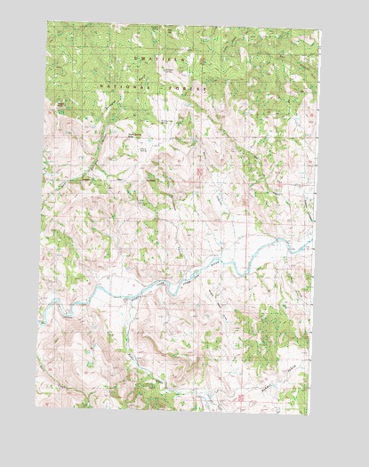
Bologna Basin, OR USGS Topographic Map
Click on map above to begin viewing in our Map Viewer.

This topographic map contains these locations and features:
Feature Name Type Latitude Longitude GNIS ID View Map
Alkali FlatsFlatN44.7613°W119.5108°1137134View Map
Ant HillSummitN44.8726°W119.5689°1137230View Map
Big BendBendN44.7763°W119.6233°1153775View Map
Birch CreekStreamN44.7765°W119.6242°1138151View Map
Bologna BasinBasinN44.8479°W119.5900°1138397View Map
Bologna SpringSpringN44.8601°W119.5706°1138399View Map
Cochran CreekStreamN44.8040°W119.5122°1152929View Map
Cupper CanyonValleyN44.8085°W119.5011°1140558View Map
Dry CreekStreamN44.8082°W119.5011°1141285View Map
Gilmore CreekStreamN44.7557°W119.5503°1142741View Map
Neal DamDamN44.8064°W119.5168°1153774View Map
Negro KnobSummitN44.8468°W119.6200°1146833View Map
Negro Knob Trail (historical)TrailN44.8596°W119.6153°1146834View Map
Portuguese CanyonValleyN44.7943°W119.5550°1147917View Map
Putnam SpringSpringN44.8739°W119.5735°1148057View Map
Rail CanyonValleyN44.8613°W119.5006°1148145View Map
Rains CanyonValleyN44.8129°W119.5380°1148181View Map
Rudio CreekStreamN44.7868°W119.5819°1148836View Map
Thorn SpringSpringN44.8345°W119.5808°1151133View Map
Thorn Spring ButteSummitN44.8376°W119.5872°1151134View Map
Tommy Cork SpringSpringN44.8435°W119.5717°1151327View Map
Wagon Road GulchValleyN44.7946°W119.5525°1151804View Map
Waller Reservoir Number FourReservoirN44.7568°W119.5428°1153772View Map
West Fork Cochran CreekStreamN44.7804°W119.5011°1152920View Map

Note: Coordinates in the location and feature list above are referenced to NAD83 datum.


Copyright (C) 2008-2025 Ryan Niemi / Sunset Dynamics ... All Rights Reserved