TopoQuest Logo
Do you find TopoQuest useful?
Help keep TopoQuest running and adding new maps/features by donating!
Bitcoin:  19c7KJd3qBynnjoSw5npx9KScwjBe4ifkT
Litecoin:  LXs6TkuXGGXo1vDsWCkWVdjQX94eUKd6ui
Home View Maps Find Maps Find Places Resources & Links


Twin Lakes Mountain, Oregon Topographic Map

USGS Map Title: Twin Lakes Mountain, OR
USGS Map MRC: 43122B5
DRG (GeoTIFF) Download: o43122b5.tif


Neighboring USGS Topographic Map Quads:


  Steamboat, OR  
43122C6
 

  Illahee Rock, OR  
43122C5
 

  Toketee Falls, OR  
43122C4
 

  Quartz Mountain, OR  
43122B6
 

  Twin Lakes Mountain, OR  
43122B5
 

  Fish Creek Desert, OR  
43122B4
 

  Acker Rock, OR  
43122A6
 

  Buckeye Lake, OR  
43122A5
 

  Fish Mountain, OR  
43122A4


Map MRC Location:

N44°
W123°
N44°
W122°
H8 H7 H6 H5 H4 H3 H2 H1
G8 G7 G6 G5 G4 G3 G2 G1
F8 F7 F6 F5 F4 F3 F2 F1
E8 E7 E6 E5 E4 E3 E2 E1
D8 D7 D6 D5 D4 D3 D2 D1
C8 C7 C6 C5 C4 C3 C2 C1
B8 B7 B6 B5 B4 B3 B2 B1
A8 A7 A6 A5 A4 A3 A2 A1
N43°
W123°
N43°
W122°

Twin Lakes Mountain, OR USGS 1:24K Topographic Map Preview:
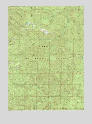
Twin Lakes Mountain, OR USGS Topographic Map
Click on map above to begin viewing in our Map Viewer.

This topographic map contains these locations and features:
Feature Name Type Latitude Longitude GNIS ID View Map
Alligator LakeLakeN43.1250°W122.6029°1155283View Map
Bear WallowBasinN43.1771°W122.6106°1137764View Map
Big Twin Lakes CampgroundLocaleN43.2318°W122.5928°1155287View Map
Birdseye CampLocaleN43.1568°W122.5123°1155284View Map
Bow CreekStreamN43.1526°W122.5870°1138512View Map
Boze CreekStreamN43.1429°W122.5453°1138550View Map
Boze ShelterLocaleN43.1415°W122.5495°1138551View Map
Buckhead MountainSummitN43.1811°W122.6246°1138850View Map
BVD TrailTrailN43.2218°W122.5656°1137367View Map
Copeland Creek TrailTrailN43.2010°W122.5589°1140095View Map
Cow PrairieFlatN43.2076°W122.6245°1140290View Map
Deer Lick FallsFallsN43.1276°W122.5840°1140855View Map
Doehead MountainSummitN43.2039°W122.6184°1141123View Map
Emile TrailTrailN43.1835°W122.5709°1141869View Map
French CreekStreamN43.1465°W122.5356°1142461View Map
Little Black RockPillarN43.1268°W122.5338°1145100View Map
Mud LakeLakeN43.1874°W122.5042°1146573View Map
Prong CreekStreamN43.1376°W122.5673°1148012View Map
Raven RockSummitN43.1919°W122.5834°1155286View Map
Sheep PrairieFlatN43.2118°W122.6206°1149342View Map
Stroubs MineMineN43.2126°W122.5431°1150497View Map
Twin LakesLakeN43.2289°W122.5919°1151564View Map
Twin Lakes MountainSummitN43.2212°W122.5988°1151567View Map
Twin Lakes Recreation SiteLocaleN43.2204°W122.6000°1156410View Map
Twin Lakes TrailTrailN43.2185°W122.6012°1151568View Map
Umpqua National ForestForestN43.2167°W122.5855°1154329View Map

Note: Coordinates in the location and feature list above are referenced to NAD83 datum.


Copyright (C) 2008-2024 Ryan Niemi / Sunset Dynamics ... All Rights Reserved