TopoQuest Logo
Do you find TopoQuest useful?
Help keep TopoQuest running and adding new maps/features by donating!
Bitcoin:  19c7KJd3qBynnjoSw5npx9KScwjBe4ifkT
Litecoin:  LXs6TkuXGGXo1vDsWCkWVdjQX94eUKd6ui
Home View Maps Find Maps Find Places Resources & Links


Steamboat, Oregon Topographic Map

USGS Map Title: Steamboat, OR
USGS Map MRC: 43122C6
DRG (GeoTIFF) Download: o43122c6.tif


Neighboring USGS Topographic Map Quads:


  Scaredman Creek, OR  
43122D7
 

  Chilcoot Mountain, OR  
43122D6
 

  Reynolds Ridge, OR  
43122D5
 

  Mace Mountain, OR  
43122C7
 

  Steamboat, OR  
43122C6
 

  Illahee Rock, OR  
43122C5
 

  Taft Mountain, OR  
43122B7
 

  Quartz Mountain, OR  
43122B6
 

  Twin Lakes Mountain, OR  
43122B5


Map MRC Location:

N44°
W123°
N44°
W122°
H8 H7 H6 H5 H4 H3 H2 H1
G8 G7 G6 G5 G4 G3 G2 G1
F8 F7 F6 F5 F4 F3 F2 F1
E8 E7 E6 E5 E4 E3 E2 E1
D8 D7 D6 D5 D4 D3 D2 D1
C8 C7 C6 C5 C4 C3 C2 C1
B8 B7 B6 B5 B4 B3 B2 B1
A8 A7 A6 A5 A4 A3 A2 A1
N43°
W123°
N43°
W122°

Steamboat, OR USGS 1:24K Topographic Map Preview:
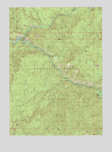
Steamboat, OR USGS Topographic Map
Click on map above to begin viewing in our Map Viewer.

This topographic map contains these locations and features:
Feature Name Type Latitude Longitude GNIS ID View Map
Apple CreekStreamN43.3065°W122.6773°1137271View Map
Apple Creek Recreation SiteLocaleN43.3051°W122.6745°1137272View Map
Bachelor ButteSummitN43.2558°W122.6833°1137376View Map
Bachelor CreekStreamN43.2826°W122.6731°1137380View Map
Black CreekStreamN43.3662°W122.6814°1138197View Map
Black GorgeValleyN43.3635°W122.6909°1138200View Map
Bloody PointCapeN43.3615°W122.7389°1138271View Map
Calf RidgeRidgeN43.2710°W122.6517°1139154View Map
Canton CreekStreamN43.3498°W122.7287°1139312View Map
Canton Creek Recreation SiteLocaleN43.3498°W122.7289°1155275View Map
Deep CreekStreamN43.3737°W122.6423°1140793View Map
Dog CreekStreamN43.2979°W122.6378°1141132View Map
Dog MountainSummitN43.3317°W122.6490°1141139View Map
Elkhorn CampLocaleN43.3712°W122.7470°1141808View Map
Fairy CreekStreamN43.2957°W122.6814°1141955View Map
Fairy ShelterLocaleN43.2532°W122.7251°1141956View Map
Grass CreekStreamN43.3579°W122.7092°1142950View Map
Horseshoe BendBendN43.2898°W122.6303°1143799View Map
Horseshoe Bend Recreation SiteLocaleN43.2887°W122.6275°1155274View Map
Island Recreation SiteLocaleN43.3390°W122.7220°1144134View Map
Jack CreekStreamN43.3165°W122.6892°1144160View Map
Jack FallsSpringN43.3180°W122.6891°1155268View Map
Jack PointSummitN43.3226°W122.6674°1144171View Map
Limpy CreekStreamN43.3021°W122.6806°1145029View Map
Limpy RockPillarN43.3181°W122.6331°1145031View Map
Little FallsFallsN43.3553°W122.7144°1145166View Map
Lookout MountainSummitN43.2602°W122.7387°1145468View Map
Loughs MineMineN43.3065°W122.6484°1145572View Map
Panther CreekStreamN43.3046°W122.6764°1147392View Map
Panther RidgeRidgeN43.2868°W122.7492°1147403View Map
Panther TrailTrailN43.3221°W122.7276°1147404View Map
Part CreekStreamN43.3557°W122.7189°1147472View Map
Ragged RidgeRidgeN43.3332°W122.6320°1148135View Map
Redman CreekStreamN43.3290°W122.7009°1135786View Map
Redmans ToothSummitN43.3443°W122.6795°1148346View Map
Siwash CreekStreamN43.3685°W122.6717°1149559View Map
Spring CreekStreamN43.3560°W122.6981°1150174View Map
Station CreekStreamN43.3429°W122.7373°1155269View Map
SteamboatPopulated PlaceN43.3454°W122.7356°1150372View Map
Steamboat CreekStreamN43.3451°W122.7356°1150374View Map
Steamboat FallsFallsN43.3737°W122.6407°1150375View Map
Steamboat Falls Recreation SiteLocaleN43.3748°W122.6428°1132929View Map
Steamboat PointSummitN43.3460°W122.7256°1158507View Map
Steelhead CreekStreamN43.3748°W122.6553°1150389View Map
United States Forest Service North Umpqua Ranger District Steamboat WorkstationBuildingN43.3438°W122.7379°2577058View Map
Winslow Cabin SpringSpringN43.3146°W122.7278°1152541View Map

Note: Coordinates in the location and feature list above are referenced to NAD83 datum.


Copyright (C) 2008-2025 Ryan Niemi / Sunset Dynamics ... All Rights Reserved